1980s Maps of DeKalb County, Missouri
Explore 17 historic maps of DeKalb County from the 1980s. These maps offer a rare glimpse into what life looked like during the 1980s — showing old roads, neighborhoods, homes, and landmarks that have changed or disappeared over time.
Whether you're researching your family's past, planning a metal detecting trip, or studying how DeKalb County's landscape evolved across the 1980s, these high-resolution maps are a powerful tool for exploring the history of this region.
- Focus on a specific era: All maps on this page are from the 1980s, giving you a focused view of this time period.
- See what’s changed: Compare century-old streets, trails, and buildings to today's modern landscape using overlays and satellite layers.
- Research with precision: Use these maps for genealogy, historical research, land use analysis, or educational projects.
- View, download, or print: Maps are fully viewable online in high resolution, and can be downloaded or printed for your own records.
Start exploring DeKalb County's history through authentic maps from the 1980s. This is your window into the past.
DeKalb County, MO maps
(17)- 1983 Map of Maysville, 1984 Print
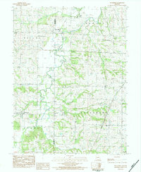
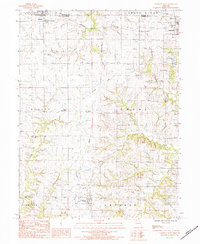
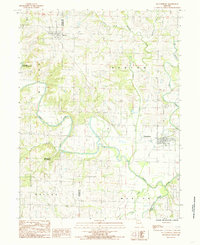
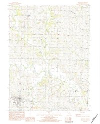 1983 Maysville1984 Print · USGSDeKalb County farmland is captured here in the early 1980s, centered on the county seat and the surrounding rural townships. Genealogists can trace family footprints across numerous rural burial sites like Norwegian Cem, Schambaugh-Cope Cem, and Oak Lawn Cem.
 - 1983 Map of Amity, 1984 Print
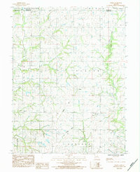
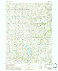
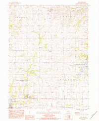 1983 Amity1984 Print · USGSDeKalb County comes into focus in the early 1980s, showcasing a rural landscape where active rail lines and abandoned grades meet. Researchers can trace the Burlington Northern corridor, locate local burials at Amity Cem, and explore the shoreline of Pony Express Lake.
 - 1983 Map of Fordham, 1984 Print
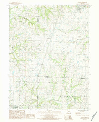
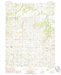
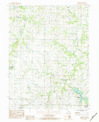 1983 Fordham1984 Print · USGSDeKalb County enters the early 1980s as a landscape of agricultural tradition and emerging wildlife conservation. Researchers can trace the path of an old railroad grade near Fordham or locate quiet burial grounds like Redman Cem and Mt Pleasant Cem.
 - 1983 Map of Union Star, 1984 Print
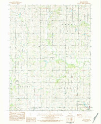
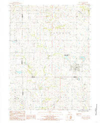
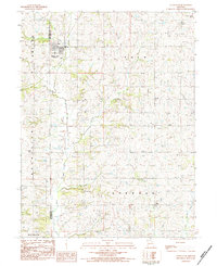 1983 Union Star1984 Print · USGSUnion Star and the surrounding Missouri countryside are captured in the early 1980s as a landscape of established family farms and quiet crossroads. Genealogists can trace local roots through several rural sites like Union Chapel Cem, Sharp Cem, and Mt Moriah Ch.
 - 1983 Map of Weatherby, 1984 Print
 1983 Weatherby1984 Print · USGSNorthwestern Missouri's rolling farm country comes to life in the 1980s, centering on the rural community of Weatherby and the DeKalb and Daviess county line. Researchers can trace family sites like Muddy Cemetery and the Old Railroad Grade winding through the hills.
 - 1983 Map of Clarksdale, 1984 Print
 1983 Clarksdale1984 Print · USGSThe rural borders of DeKalb, Buchanan, and Andrew Counties come into focus during the early 1980s. Local historians can trace the Old Railroad Grade and locate numerous family-named burial sites like Todd Cem and DeKalb Cem.
 - 1983 Map of Wood, 1984 Print
 1983 Wood1984 Print · USGSDeKalb County’s rural townships are captured here in the early 1980s, revealing a landscape of family farms and small communities. Genealogists can locate several family burial sites like Botts Cem and Smith Cem or trace the early community of Wood.
 - 1984 Map of Cameron East
 1984 Cameron East1984 Print · USGSCaldwell and Clinton counties are captured here in the early 1980s, documenting a landscape of rural cemeteries and creek-side settlements. Researchers can trace family history at Hill Cem or Packard Cem and locate the historic site of Far West.
 - 1984 Map of Cameron West
 1984 Cameron West1984 Print · USGSClinton and De Kalb counties are documented in the early 1980s, showing a landscape of traditional farming towns and evolving rail infrastructure. Genealogists and local historians can trace family locations near Osborn-Evergreen Cem, Smith Fork Ch, or the rural junction at West Keystone.
 - 1984 Map of Perrin
 1984 Perrin1984 Print · USGSClinton and De Kalb counties in the mid-1980s reveal a landscape shaped by shifting transportation and quiet rural life. Genealogists and historians can trace defunct routes along the Old Railroad Grade and locate family sites near Old Presbyterian Cem and Perrin.
 - 1984 Map of Winston
 1984 Winston1984 Print · USGSDaviess and Caldwell counties are captured in the early 1980s as the regional landscape transitions between the Grand River and northern prairie. Trace family history through numerous rural burial sites like Christian Chapel Cem, Delano Cem, and Jones Cem.
 - 1984 Map of King City, 1985 Print
 1984 King City1985 Print · USGSKing City and the surrounding three-county border region are detailed in the mid-eighties before modern development expanded. Genealogists and researchers can trace rural cemeteries, the Old Railroad Grade, and family-named landmarks like Limpp-Community State Lake.
 - 1984 Map of Pattonsburg, 1985 Print
 1984 Pattonsburg1985 Print · USGSNorthwest Missouri's river-bottom landscapes and rural rail history come alive in this mid-eighties survey of the Daviess County region. Researchers can trace the path of the Old Railroad Grade and explore the winding banks of the Grand River near Pattonsburg.
 - 1985 Map of Ford City
 1985 Ford City1985 Print · USGSGentry and De Kalb Counties are shown in the mid-1980s, documenting a landscape of rural townships and winding creek valleys. Genealogists and local historians can trace the Railroad Grade near Ford City and locate local landmarks like the QUARRY and Cem.
 - 1985 Map of Berlin
 1985 Berlin1985 Print · USGSGentry and De Kalb Counties in the mid-1980s are defined by the winding course of the Grand River and its many wooded tributaries. Researchers can locate the small community of Berlin, the riverside Andy Denton Public Access, and the winding North Fork Lost Creek.
 - 1986 Map of Maryville
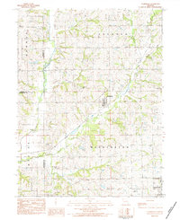
 1986 Maryville1986 Print · USGSNorthwest Missouri's agricultural heartland is documented here in the mid-1980s, from the campus at Northwest Missouri State University to the Grand River valley. Genealogists can trace family footprints across dozens of local burial grounds like Alanthus Grove Cem and Brooklyn Cem.2 unique versions available
 - 1986 Map of Saint Joseph
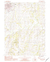
 1986 Saint Joseph1986 Print · USGSNorthwest Missouri thrived as a regional transportation and educational hub during the mid-eighties, centered on the historic river city of Saint Joseph. Researchers can locate specific local landmarks like Burlington Cemetery, Pigeon Hill Church, and the winding Pony Express Trail.2 unique versions available
End of results
Showing maps 1-17 of 17
Frequently asked questions
- What are the different types of historical maps available for DeKalb County?
- What is the oldest map of DeKalb County?
- Where can I purchase historical maps of DeKalb County for my home or office?
- Where can I download high-res historical maps of DeKalb County?
- Are there historical topographic maps available for DeKalb County?
- Is there historical aerial imagery available for DeKalb County?
- Where are historical maps of DeKalb County sourced from?