2000s (21st Century) Maps of Silverton, Missouri
Explore 5 historic maps of Silverton from the 2000s (21st Century). These maps offer a rare glimpse into what life looked like during the 2000s — showing old roads, neighborhoods, homes, and landmarks that have changed or disappeared over time.
Whether you're researching your family's past, planning a metal detecting trip, or studying how Silverton's landscape evolved across the 2000s, these high-resolution maps are a powerful tool for exploring the history of this region.
- Focus on a specific era: All maps on this page are from the 2000s, giving you a focused view of this time period.
- See what’s changed: Compare century-old streets, trails, and buildings to today's modern landscape using overlays and satellite layers.
- Research with precision: Use these maps for genealogy, historical research, land use analysis, or educational projects.
- View, download, or print: Maps are fully viewable online in high resolution, and can be downloaded or printed for your own records.
Start exploring Silverton's history through authentic maps from the 2000s. This is your window into the past.
Silverton, MO maps
(5)- 2004 Map of Wasola, 2006 Print
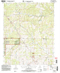 2004 Wasola2006 Print · USGSThe Missouri Ozarks are captured here during the early 2000s, showing the ridge-top roads and deep hollows of the Douglas and Ozark county line. Researchers can locate several rural landmarks including Murray Ch, Loflin Cem, and the village of Wasola.
 - 2012 Map of Wasola, 2012 Print
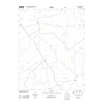 2012 Wasola2012 Print · USGSCovers Silverton, including Almartha, Girdner, and other nearby areas
 - 2015 Map of Wasola, 2015 Print
 2015 Wasola2015 Print · USGSCovers Silverton, including Almartha, Girdner, and other nearby areas
 - 2017 Map of Wasola, 2017 Print
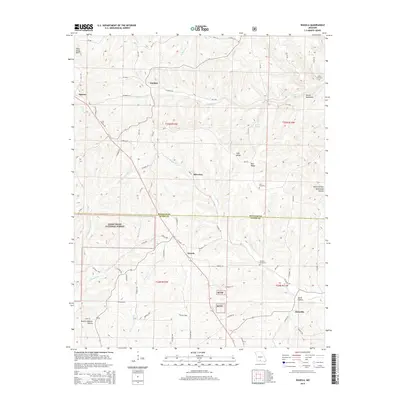
 2017 Wasola2017 Print · USGSCovers Silverton, including Almartha, Girdner, and other nearby areas
 - 2021 Map of Wasola, 2021 Print
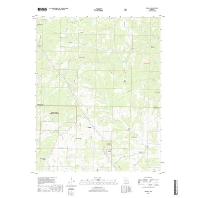
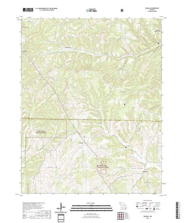 2021 Wasola2021 Print · USGSThe Douglas and Ozark county line in the early twenty-first century reveals a landscape of protected forest and high-ridge settlements. Researchers can trace rural lineages at Loftin Cem and Noble Cem or locate the Sweden Fork Natural Bridge near Girdner.
End of results
Showing maps 1-5 of 5
Top cities near Silverton
Frequently asked questions
- What are the different types of historical maps available for Silverton?
- What is the oldest map of Silverton?
- Where can I purchase historical maps of Silverton for my home or office?
- Where can I download high-res historical maps of Silverton?
- Are there historical topographic maps available for Silverton?
- Is there historical aerial imagery available for Silverton?
- Where are historical maps of Silverton sourced from?