2020s Maps of Kendricktown, Missouri
Explore 1 historic maps of Kendricktown from the 2020s. These maps offer a rare glimpse into what life looked like during the 2020s — showing old roads, neighborhoods, homes, and landmarks that have changed or disappeared over time.
Whether you're researching your family's past, planning a metal detecting trip, or studying how Kendricktown's landscape evolved across the 2020s, these high-resolution maps are a powerful tool for exploring the history of this region.
- Focus on a specific era: All maps on this page are from the 2020s, giving you a focused view of this time period.
- See what’s changed: Compare century-old streets, trails, and buildings to today's modern landscape using overlays and satellite layers.
- Research with precision: Use these maps for genealogy, historical research, land use analysis, or educational projects.
- View, download, or print: Maps are fully viewable online in high resolution, and can be downloaded or printed for your own records.
Start exploring Kendricktown's history through authentic maps from the 2020s. This is your window into the past.
Kendricktown, MO maps
(1)- 2021 Map of Carthage, 2021 Print
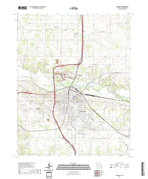 2021 Carthage2021 Print · USGSCarthage and its surrounding Jasper County settlements are shown here in the early twenty-first century as the area balances its civic history with modern growth. Genealogists and local historians can locate several burial grounds like Oak Hill Cem or trace landmarks such as the Jasper County Courthouse and Lee's Flying Park.
End of results
Showing maps 1-1 of 1
Top cities near Kendricktown
- Joplin historical maps
- Carthage historical maps
- Webb City historical maps
- Carl Junction historical maps
- Oronogo historical maps
- Carterville historical maps
See more
Frequently asked questions
- What are the different types of historical maps available for Kendricktown?
- What is the oldest map of Kendricktown?
- Where can I purchase historical maps of Kendricktown for my home or office?
- Where can I download high-res historical maps of Kendricktown?
- Are there historical topographic maps available for Kendricktown?
- Is there historical aerial imagery available for Kendricktown?
- Where are historical maps of Kendricktown sourced from?