Old Maps of Danby, Plattin Township for Hiking & Exploration
Hike through history with 13 historic maps of Danby. Explore old trails, ghost towns, and forgotten backroads — perfect for outdoor adventurers and local explorers.
- Rediscover forgotten places: Map out old mining camps, roads, and footpaths that no longer exist on modern maps.
- Layer with modern tools: Combine with LiDAR or satellite views to plan hikes through historical terrain.
- Made for exploration: Popular among hikers, overlanders, and local history lovers.
Use these maps to find adventure and explore the hidden past of Danby.
Danby, Plattin Township maps
(13)- 1915 Map of Crystal City
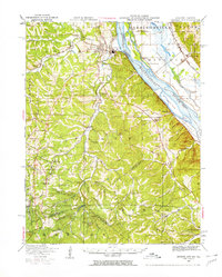
 1915 Crystal City1915 Print · USGSThe Missouri-Illinois riverfront comes alive in this early 1900s survey of the industrial corridor between Crystal City and VALLES MINES. Researchers can trace the path of the St Louis and San Francisco railroad and locate old community centers like Rush Tower or the Telegraph School.4 unique versions available
 - 1949 Map of Saint Louis
 1949 Saint Louis1949 Print · USGSGreater St. Louis and its surrounding river valleys are captured here just after the war, showing the metropolitan core and the rural Ozark fringe. Researchers can trace the sprawling rail network of the Wabash RR or locate landmarks like Meramec Caverns Airport and Scott Air Force Base.2 unique versions available
 - 1949 Map of Crystal City, 1959 Print
 1949 Crystal City1959 Print · USGSThe Mississippi River valley comes alive in the late 1940s, showing the industrial pulse of Festus and the rural reaches of Jefferson County. Genealogists can locate numerous vanished landmarks like the Telegraph School, Valle Mines, and the Rush Tower river landing.2 unique versions available
 - 1962 Map of St. Louis
 1962 St. Louis1962 Print · USGSThe mid-century gateway to the west shows the metropolitan expansion of St Louis alongside its critical river confluences. Genealogists and historians can trace the rail corridors of the Missouri Pacific RR and settlements from Fulton to De Soto.
 - 1963 Map of St. Louis, 1970 Print
 1963 St. Louis1970 Print · USGSSt. Louis and its surrounding river valleys are captured here during the peak of mid-century suburban expansion and industrial activity. Trace the historic rail routes of the Norfolk and Western Ry or locate the St Louis Ordnance Plant and early stretches of US Highway 66.4 unique versions available
 - 1964 Map of Danby, 1965 Print
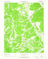 1964 Danby1965 Print · USGSSte. Genevieve County in the mid-sixties remained a landscape of remote family cemeteries and wooded hollows. Genealogists can trace family names at Bockenkamp Cem and Moehler Cem, or follow the rail corridor of the St Louis San Francisco.2 unique versions available
 - 1966 Map of St. Louis
 1966 St. Louis1966 Print · USGSThe St. Louis metropolitan area and its surrounding river valleys are captured here during the mid-sixties era of suburban growth and industrial strength. Genealogists and historians can trace the foundations of local communities through sites like Old Pioneer Cem, Parks College, and the Jefferson Barracks Military Reservation.
 - 1985 Map of Festus, 1987 Print
 1985 Festus1987 Print · USGSThe Mississippi River corridor and Ozark foothills appear here in the mid-1980s, documenting a landscape of industrial river towns and forest preserves. Trace the development of Festus, Crystal City, and De Soto or locate sites like Mastodon State Park.
 - 1993 Map of Danby, 1996 Print
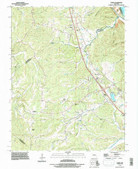 1993 Danby1996 Print · USGSThe Missouri borderlands of Ste. Genevieve and Jefferson counties come into focus in the 1990s as a land of deep hollows and family homesteads. Genealogists can trace local history through sites like Baker Cemetery, Danby, and the Bockenkamp Cemetery.
 - 2012 Map of Danby, 2012 Print
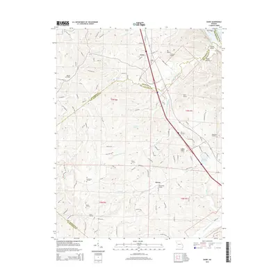
 2012 Danby2012 Print · USGSCovers Danby, including Kinsey, Valley View, and other nearby areas
 - 2015 Map of Danby, 2015 Print
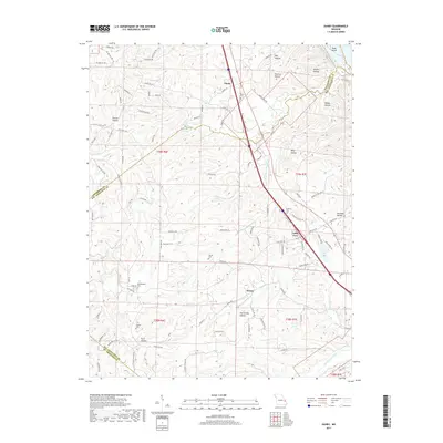
 2015 Danby2015 Print · USGSCovers Danby, including Kinsey, Valley View, and other nearby areas
 - 2017 Map of Danby, 2017 Print
 2017 Danby2017 Print · USGSCovers Danby, including Kinsey, Valley View, and other nearby areas
 - 2021 Map of Danby, 2021 Print
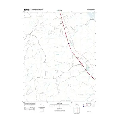
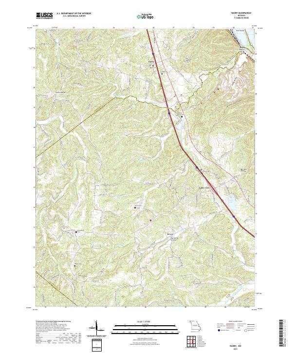 2021 Danby2021 Print · USGSThe eastern Ozark foothills come into focus in the early 2020s, revealing a landscape of winding hollows and rural crossroad communities. Researchers can trace family history through a network of local sites like Lebanon Baptist Cem, Danby Cem, and Skaggs Spring.
End of results
Showing maps 1-13 of 13
Top cities near Danby
- Festus historical maps
- Waterloo historical maps
- Bonne Terre historical maps
- De Soto historical maps
- Pevely historical maps
- Desloge historical maps
See more
Frequently asked questions
- What are the different types of historical maps available for Danby?
- What is the oldest map of Danby?
- Where can I purchase historical maps of Danby for my home or office?
- Where can I download high-res historical maps of Danby?
- Are there historical topographic maps available for Danby?
- Is there historical aerial imagery available for Danby?
- Where are historical maps of Danby sourced from?