Old Maps of Lebanon, Missouri
Explore 18 old maps of Lebanon, spanning from 1941 to today. These high-resolution historic maps reveal how streets, neighborhoods, landmarks, and natural features evolved over time — perfect for genealogy, metal detecting, research, and local history exploration.
What you can do with these maps:
- See how Lebanon changed over time: Compare historical maps to modern-day views to trace roads, homesites, rail lines & more.
- View detailed metadata: Each map includes creators, publishers, year, scale, and archive source.
- Overlay maps with satellite & LiDAR: Visualize the past alongside modern tools to explore terrain & human change.
- Trusted historical sources: Maps sourced from the USGS, Library of Congress, and other archives.
- Access maps your way: View online, download high-res files, or order prints for personal or research use.
Start exploring old maps of Lebanon to uncover forgotten places, hidden landmarks, and the deep history beneath your feet.
Lebanon, MO maps
(18)- 1941 Map of Lebanon, 1968 Print
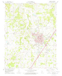
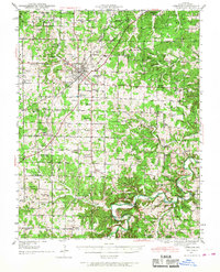 1941 Lebanon1968 Print · USGSLebanon and the surrounding Laclede County uplands are captured here in the early 1940s, just as the region was defined by Route 66 and a network of one-room schools. Genealogists can locate family landmarks like Atchley Cem and Santiago Cem, or trace vanished rural hubs such as Caffeyville and Orla.
 - 1943 Map of Lebanon
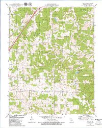
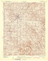 1943 Lebanon1943 Print · USGSLaclede County at the start of the 1940s reveals a landscape where the St Louis San Francisco railway and early aviation at Lebanon Airport met deep-rooted Ozark settlements. Genealogists can trace family footprints across dozens of local landmarks like Roper Cem, Hough Chapel, and the Bear Thicket Sch.2 unique versions available
 - 1954 Map of Springfield
 1954 Springfield1954 Print · USGSThe Missouri Ozarks are captured here during the post-war era, showing the expansion of Springfield and the surrounding river valleys. Genealogists and historians can trace local landmarks like Mount Comfort Cemetery and the Fort Leonard Wood military grounds.6 unique versions available
 - 1958 Map of Springfield
 1958 Springfield1958 Print · USGSThe Missouri Ozarks are captured during the mid-century era of growth, centered on the bustling hub of Springfield. Genealogists and historians can trace family roots through numerous landmarks like Ebenezer Church, Stockton Cem, and the various county courthouses.
 - 1959 Map of Springfield
 1959 Springfield1959 Print · USGSThe Missouri Ozarks are captured here during a decade of postwar growth and increasing highway connectivity. Researchers can trace the legacy of the St Louis-San Francisco RR and locate early sites in Springfield, Lebanon, and Mountain Grove.
 - 1975 Map of Lebanon NE, 1976 Print
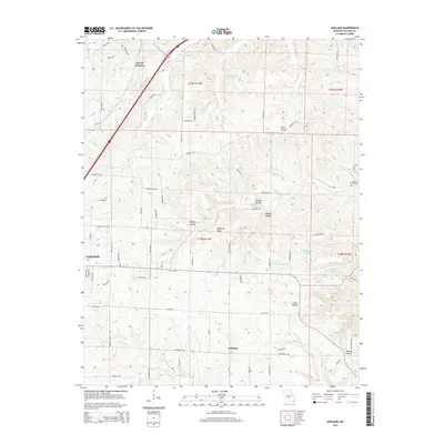
 1975 Lebanon NE1976 Print · USGSLaclede County farmland and the Missouri interior are captured in this mid-seventies aerial study. Genealogists and local historians can trace the rural landscape surrounding Oakland and the wooded drainage of Mill Creek exactly as they appeared decades ago.
 - 1975 Map of Lebanon NW, 1976 Print
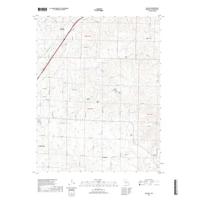
 1975 Lebanon NW1976 Print · USGSMid-century Missouri development is frozen in time on this 1975 aerial survey of the Laclede County area. Researchers can trace the exact footprint of Lebanon and the rural agricultural patterns along Goodwin Hollow as they appeared fifty years ago.
 - 1978 Map of Lebanon
 1978 Lebanon1978 Print · USGSLebanon and the surrounding Laclede County landscape are captured here in the late seventies as the town expanded along the rail corridor. Genealogists can trace family names through landmarks like Atchley Cem, Emmanuel Chapel, and the Joel E Barber Sch.
 - 1979 Map of Oakland, 1980 Print
 1979 Oakland1980 Print · USGSLaclede County in the late seventies is a landscape of established state forests and traditional country churches. Genealogists can trace family names through landmarks like Jarrell Cem and Thomas Chapel or follow the route of the St Louis-San Francisco Railroad.
 - 1982 Map of Lebanon, 1983 Print
 1982 Lebanon1983 Print · USGSThe Missouri Ozarks are captured in the early eighties as Interstate 44 and the St Louis-San Francisco rail line link growing towns with the Fort Leonard Wood Military Reservation. Genealogists and historians can trace family-named sites like Flatwood Church and old post offices at Sleeper and Nebo.
 - 2011 Map of Lebanon, 2011 Print
 2011 Lebanon2011 Print · USGSCovers Lebanon, including West Lebanon, Russell, and other nearby areas
 - 2011 Map of Oakland, 2011 Print
 2011 Oakland2011 Print · USGSCovers Lebanon, including Carrol Junction, Oakland, and other nearby areas
 - 2015 Map of Oakland, 2015 Print
 2015 Oakland2015 Print · USGSCovers Lebanon, including Carrol Junction, Oakland, and other nearby areas
 - 2015 Map of Lebanon, 2015 Print
 2015 Lebanon2015 Print · USGSCovers Lebanon, including West Lebanon, Russell, and other nearby areas
 - 2017 Map of Lebanon, 2017 Print
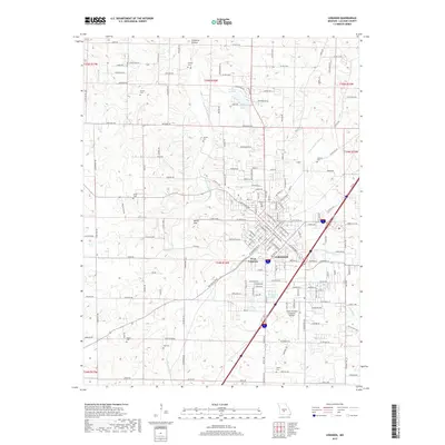 2017 Lebanon2017 Print · USGSCovers Lebanon, including West Lebanon, Russell, and other nearby areas
 - 2017 Map of Oakland, 2017 Print
 2017 Oakland2017 Print · USGSCovers Lebanon, including Carrol Junction, Oakland, and other nearby areas
 - 2021 Map of Lebanon, 2021 Print
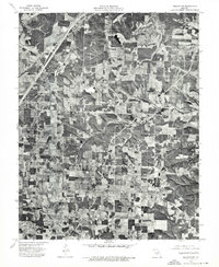
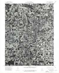
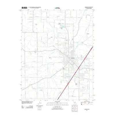
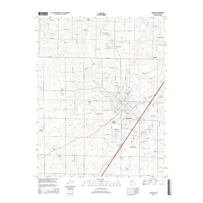
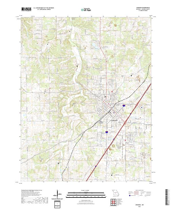 2021 Lebanon2021 Print · USGSLaclede County in the early 2020s shows the expansion of LEBANON alongside its rural roots. Researchers can locate numerous family burial sites like Dotson Cem and Ivey Cem or trace terrain features like Adkins Sink and Goodwin Hollow.
 - 2021 Map of Oakland, 2021 Print
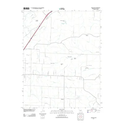
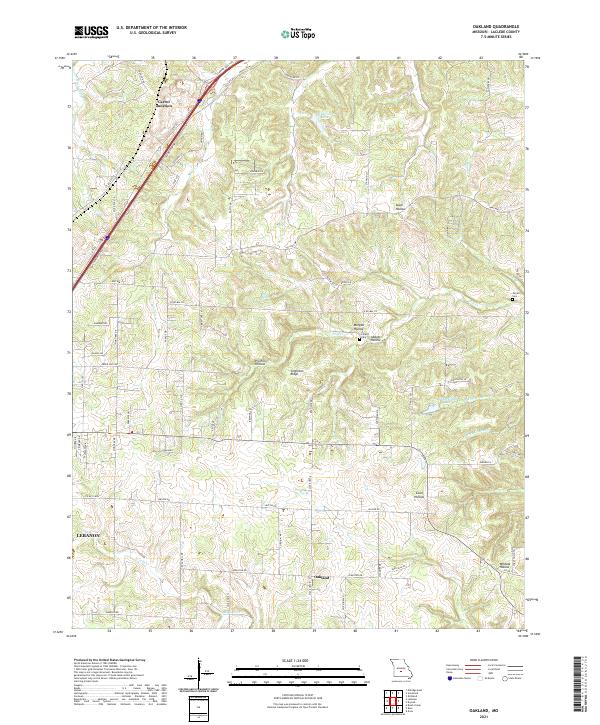 2021 Oakland2021 Print · USGSLaclede County as it appeared recently reveals a landscape of deep hollows and ridge-top settlements like Oakland. Genealogists and historians can trace family-named sites such as Jarrell Cem, Lillard Cem, and Singleton Ridge.
End of results
Showing maps 1-18 of 18
Top cities near Lebanon
- Conway historical maps
- Phillipsburg historical maps
- Evergreen historical maps
- Caffeyville historical maps
Top neighborhoods of Lebanon
Frequently asked questions
- What are the different types of historical maps available for Lebanon?
- What is the oldest map of Lebanon?
- Where can I purchase historical maps of Lebanon for my home or office?
- Where can I download high-res historical maps of Lebanon?
- Are there historical topographic maps available for Lebanon?
- Is there historical aerial imagery available for Lebanon?
- Where are historical maps of Lebanon sourced from?