2000s (21st Century) Maps of Saint Annie, Missouri
Explore 5 historic maps of Saint Annie from the 2000s (21st Century). These maps offer a rare glimpse into what life looked like during the 2000s — showing old roads, neighborhoods, homes, and landmarks that have changed or disappeared over time.
Whether you're researching your family's past, planning a metal detecting trip, or studying how Saint Annie's landscape evolved across the 2000s, these high-resolution maps are a powerful tool for exploring the history of this region.
- Focus on a specific era: All maps on this page are from the 2000s, giving you a focused view of this time period.
- See what’s changed: Compare century-old streets, trails, and buildings to today's modern landscape using overlays and satellite layers.
- Research with precision: Use these maps for genealogy, historical research, land use analysis, or educational projects.
- View, download, or print: Maps are fully viewable online in high resolution, and can be downloaded or printed for your own records.
Start exploring Saint Annie's history through authentic maps from the 2000s. This is your window into the past.
Saint Annie, MO maps
(5)- 2004 Map of Winnipeg, 2006 Print
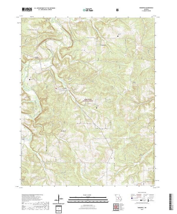
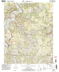 2004 Winnipeg2006 Print · USGSLaclede County at the turn of the millennium shows a landscape shaped by the Gasconade River and the sprawling Mark Twain National Forest. Genealogists and local historians can trace former community hubs through sites like Nebo Sch (Site) and the Winnipeg Cem.
 - 2012 Map of Winnipeg, 2012 Print
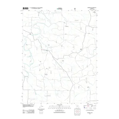 2012 Winnipeg2012 Print · USGSCovers Saint Annie, including Winnipeg, Casey Ford, and other nearby areas
 - 2015 Map of Winnipeg, 2015 Print
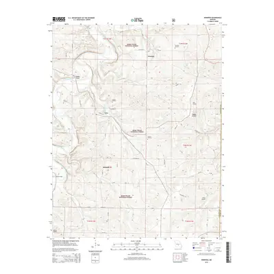 2015 Winnipeg2015 Print · USGSCovers Saint Annie, including Winnipeg, Casey Ford, and other nearby areas
 - 2017 Map of Winnipeg, 2017 Print
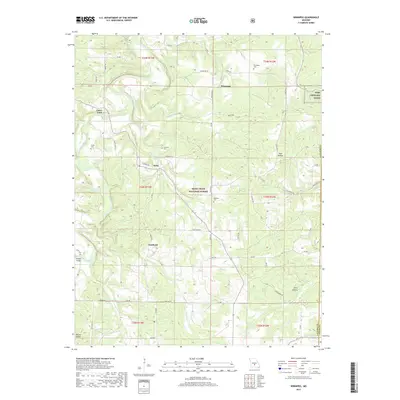 2017 Winnipeg2017 Print · USGSCovers Saint Annie, including Winnipeg, Casey Ford, and other nearby areas
 - 2021 Map of Winnipeg, 2021 Print
 2021 Winnipeg2021 Print · USGSThe Gasconade River valley in southern Missouri remained a landscape of isolated hill settlements and clear Ozark creeks into the early 2020s. Researchers can trace family history at Winnipeg Cem or locate the historic river crossings at Casey Ford and Dougan Bridge.
End of results
Showing maps 1-5 of 5
Top cities near Saint Annie
- Saint Robert historical maps
- Waynesville historical maps
- Roubidoux historical maps
- Upton historical maps
- Plato historical maps
Frequently asked questions
- What are the different types of historical maps available for Saint Annie?
- What is the oldest map of Saint Annie?
- Where can I purchase historical maps of Saint Annie for my home or office?
- Where can I download high-res historical maps of Saint Annie?
- Are there historical topographic maps available for Saint Annie?
- Is there historical aerial imagery available for Saint Annie?
- Where are historical maps of Saint Annie sourced from?