Old Maps of Elsberry, Missouri for Academic Research
Study the evolution of Elsberry with 10 high-resolution historic maps. Whether you're teaching, researching, or modeling changes in land use, these maps provide essential visual documentation of urban, environmental, and geographic change.
- Analyze long-term change: Track patterns in development, transportation, and natural features.
- Ideal for environmental or urban studies: Support academic projects with primary historical map data.
- Use in the classroom or lab: Educators and researchers rely on these maps to bring historical context to life.
These maps are a powerful tool for teaching, research, and visualizing how Elsberry has changed over the decades.
Elsberry, MO maps
(10)- 1934 Map of Elsberry
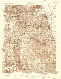 1934 Elsberry1934 Print · USGSLincoln County in the mid-1930s shows a landscape of ridge-top farms and river valley settlements along the Chicago Burlington and Quincy rail line. Genealogists can trace early rural life through numerous sites like Old Alexandria, Ashbury Chapel, and the Boyles Cem.2 unique versions available
 - 1942 Map of Elsberry
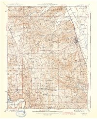 1942 Elsberry1942 Print · USGSNortheastern Missouri's river bluffs and rail corridors are captured here during the early 1940s. Genealogists and historians can locate vanished landmarks like Brussels Sch, Penn Cave, and the rural Old Alexandria Ch.2 unique versions available
 - 1948 Map of Quincy
 1948 Quincy1948 Print · USGSThe Mississippi and Illinois River valleys are captured at a post-war crossroads as rail and river travel met the expanding highway system. Genealogists can trace family settlements from Quincy to Hannibal and smaller towns like Vandalia and Jerseyville.2 unique versions available
 - 1956 Map of Quincy, 1967 Print
 1956 Quincy1967 Print · USGSThe river and rail corridors of the Illinois-Missouri border are documented here during the mid-1950s. Researchers can trace historic river landings and regional transit hubs from Quincy and Hannibal to smaller settlements like Meredosia and Roodhouse.3 unique versions available
 - 1975 Map of Elsberry, 1978 Print
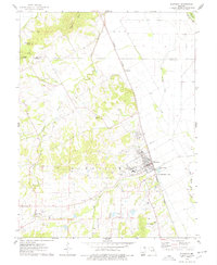 1975 Elsberry1978 Print · USGSThe Missouri river bluffs and the Burlington Northern line define the landscape around Elsberry in the mid-seventies. Local historians can trace old homesteads and family roots through the Vance-Seaman Cem, the U S Experimental Farm, and the hilltop Oak Ridge Cem.
 - 1985 Map of Jerseyville
 1985 Jerseyville1985 Print · USGSThe confluence of the Illinois and Mississippi rivers defines this 1980s landscape of fertile bottomlands and rail-hub towns. Genealogists and historians can trace the foundations of communities like Jerseyville and White Hall alongside the Oak Grove Cem and St Mary Church.2 unique versions available
 - 2011 Map of Elsberry, 2011 Print
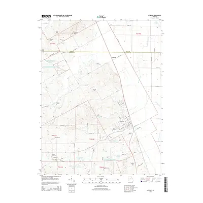
 2011 Elsberry2011 Print · USGSCovers Elsberry, including New Hope, Dameron, and other nearby areas
 - 2014 Map of Elsberry, 2014 Print
 2014 Elsberry2014 Print · USGSCovers Elsberry, including New Hope, Dameron, and other nearby areas
 - 2017 Map of Elsberry, 2017 Print
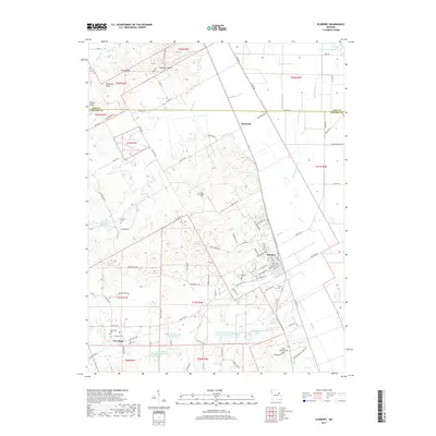 2017 Elsberry2017 Print · USGSCovers Elsberry, including New Hope, Dameron, and other nearby areas
 - 2021 Map of Elsberry, 2021 Print
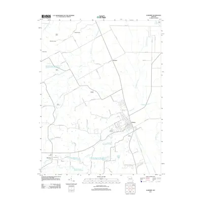
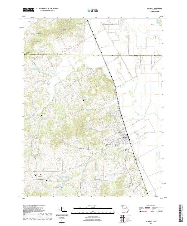 2021 Elsberry2021 Print · USGSThe bluffs above the Mississippi River valley are well-defined in this recent survey of the Elsberry area. Genealogists and local historians can trace family roots through numerous burial grounds like New Hope Cem, Palmer Cem, and Cox Cem.
End of results
Showing maps 1-10 of 10
Top cities near Elsberry
- Troy historical maps
- Moscow Mills historical maps
- Hardin historical maps
- Winfield historical maps
- Clarksville historical maps
- Eolia historical maps
See more
Frequently asked questions
- What are the different types of historical maps available for Elsberry?
- What is the oldest map of Elsberry?
- Where can I purchase historical maps of Elsberry for my home or office?
- Where can I download high-res historical maps of Elsberry?
- Are there historical topographic maps available for Elsberry?
- Is there historical aerial imagery available for Elsberry?
- Where are historical maps of Elsberry sourced from?