Old Maps of Dodge City, Palmyra
Explore 10 old maps of Dodge City, spanning from 1903 to today. These high-resolution historic maps reveal how streets, neighborhoods, landmarks, and natural features evolved over time — perfect for genealogy, metal detecting, research, and local history exploration.
What you can do with these maps:
- See how Dodge City changed over time: Compare historical maps to modern-day views to trace roads, homesites, rail lines & more.
- View detailed metadata: Each map includes creators, publishers, year, scale, and archive source.
- Overlay maps with satellite & LiDAR: Visualize the past alongside modern tools to explore terrain & human change.
- Trusted historical sources: Maps sourced from the USGS, Library of Congress, and other archives.
- Access maps your way: View online, download high-res files, or order prints for personal or research use.
Start exploring old maps of Dodge City to uncover forgotten places, hidden landmarks, and the deep history beneath your feet.
Dodge City, Palmyra maps
(10)- 1903 Map of Palmyra
 1903 Palmyra1903 Print · USGSNortheast Missouri at the start of the twentieth century was a landscape of river-valley farming and critical rail junctions. Researchers can trace early rural life through features like Sharp Mills, St. Pauls Ch., and the crossing of the Hannibal and St. Joseph R. R.2 unique versions available
 - 1948 Map of Quincy
 1948 Quincy1948 Print · USGSThe Mississippi and Illinois River valleys are captured at a post-war crossroads as rail and river travel met the expanding highway system. Genealogists can trace family settlements from Quincy to Hannibal and smaller towns like Vandalia and Jerseyville.2 unique versions available
 - 1949 Map of Palmyra, 1960 Print
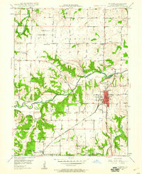 1949 Palmyra1960 Print · USGSMid-century Marion County comes alive in this survey of the river country surrounding the local county seat. Researchers can locate long-standing rural landmarks like Greenwood Cem, several schoolhouses, and the Marion County Infirmary.2 unique versions available
 - 1950 Map of Palmyra
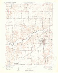 1950 Palmyra1950 Print · USGSMid-century Marion County centers on the rail hub of Palmyra during a period of thriving rural communities and small-town industry. Researchers can find precise locations for the Marion County Infirmary, Smileyville, and numerous country schools like Peddicord Sch.2 unique versions available
 - 1956 Map of Quincy, 1967 Print
 1956 Quincy1967 Print · USGSThe river and rail corridors of the Illinois-Missouri border are documented here during the mid-1950s. Researchers can trace historic river landings and regional transit hubs from Quincy and Hannibal to smaller settlements like Meredosia and Roodhouse.3 unique versions available
 - 1986 Map of Quincy
 1986 Quincy1986 Print · USGSThe tri-state border region along the Mississippi River comes into focus during the mid-1980s. Researchers can trace the legacy of river towns and rail hubs like Quincy and Monroe City or locate landmarks such as Mount Olive Cem.2 unique versions available
 - 2012 Map of Palmyra, 2012 Print
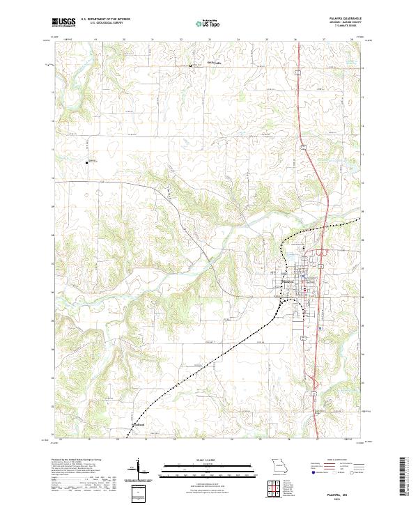
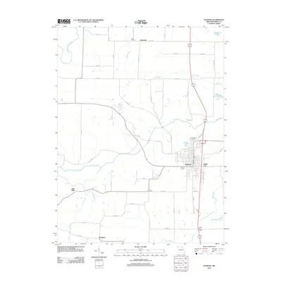 2012 Palmyra2012 Print · USGSCovers Dodge City, including Palmyra, Woodland, and other nearby areas
 - 2015 Map of Palmyra, 2015 Print
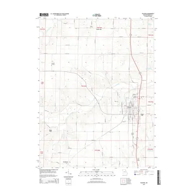 2015 Palmyra2015 Print · USGSCovers Dodge City, including Palmyra, Woodland, and other nearby areas
 - 2017 Map of Palmyra, 2017 Print
 2017 Palmyra2017 Print · USGSCovers Dodge City, including Palmyra, Woodland, and other nearby areas
 - 2021 Map of Palmyra, 2021 Print
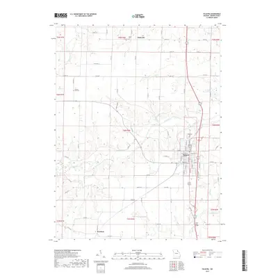
 2021 Palmyra2021 Print · USGSMarion County at the dawn of the 2020s shows a landscape of established town centers and a complex network of prairie rivers. Researchers can trace the layout of Palmyra near the Marion County District Courthouse or locate rural sites like Smileyville and Bethel Cem.
End of results
Showing maps 1-10 of 10
Top cities near Dodge City
- Quincy historical maps
- Hannibal historical maps
- Palmyra historical maps
- Monroe City historical maps
- New London historical maps
- Fall Creek historical maps
See more
Frequently asked questions
- What are the different types of historical maps available for Dodge City?
- What is the oldest map of Dodge City?
- Where can I purchase historical maps of Dodge City for my home or office?
- Where can I download high-res historical maps of Dodge City?
- Are there historical topographic maps available for Dodge City?
- Is there historical aerial imagery available for Dodge City?
- Where are historical maps of Dodge City sourced from?