
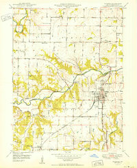
1950 Map of Palmyra
USGS Topo · Published 1950About this map
Palmyra serves as the focal point of this 1950 survey, showing the city's concentrated street grid and its position as a regional hub for the Chicago Burlington and Quincy railroad. The surrounding landscape of Marion County is defined by a dense network of rural infrastructure, including a notable number of small country schools such as Todd Sch and North River Sch. Social and community history is preserved in the location of the Marion County Infirmary and numerous religious centers like Bethel Ch and Salem Sch.
Find a feature on this map
28 named features on this map. Tap any name to fly to it.
Don’t see what you’re looking for? This feature index may not catch every label — zoom into the map to look around manually.
Map Details
Editions of this 1950 Palmyra Map
2 editions found
Other maps of this area

1903 · Palmyra
USGS Topo · 1:125,000

1925 · Quincy
USGS Topo · 1:62,500

1932 · Hannibal
USGS Topo · 1:62,500

1936 · Hannibal
USGS Topo · 1:48,000

1944 · Quincy
USGS Topo · 1:62,500

1945 · Hannibal
USGS Topo · 1:62,500

1945 · Quincy
USGS Topo · 1:62,500

1948 · Quincy
USGS Topo · 1:250,000

1949 · Durham
USGS Topo · 1:24,000

1949 · Maywood
USGS Topo · 1:24,000