Loading...
Loading map...1936 Map of Hannibal
USGS Topo · Published 1936About this map
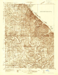
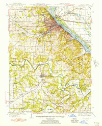
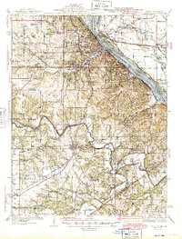
The Mississippi River defines the eastern edge of this mid-1930s landscape, where the Mark Twain Memorial Bridge connects Missouri to Illinois. The river is dotted with numerous islands, including Bay Island, Turtle Island, and Tower Island, reflecting a complex riparian environment before modern waterway controls. Further inland, the city of Hannibal serves as a hub for the Burlington, Wabash, and Quincy Omaha and Kansas City railroads, which converge near the riverfront.
Find a feature on this map
78 named features on this map. Tap any name to fly to it.
Don’t see what you’re looking for? This feature index may not catch every label — zoom into the map to look around manually.
Map Details
Date Portrayed1936
Date Published1936
PublisherU.S. Geological Survey
Map TypeTopographic
Scale1:48,000
Physical Dimensions21 x 26.9 inches
Editions of this 1936 Hannibal Map
2 editions found
Historical Maps of Hannibal Through Time
3 maps found

Featured Locations
Source Details
SourceU.S. Geological Survey
CopyrightPublic Domain