
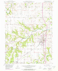
1949 Map of Palmyra
USGS Topo · Published 1960About this map
The county seat of Palmyra serves as the focal point of this mid-century survey, showcasing a grid of developed streets and public institutions like the Marion County Infirmary. The landscape is defined by the winding course of the North River and its various tributaries, including Lazy Branch and Lick Creek, which carve through the townships of Fabius and Liberty. The Chicago Burlington and Quincy railroad cuts a diagonal path across the southwest, anchoring smaller rural nodes like Woodland.
Find a feature on this map
29 named features on this map. Tap any name to fly to it.
Don’t see what you’re looking for? This feature index may not catch every label — zoom into the map to look around manually.
Map Details
Editions of this 1949 Palmyra Map
2 editions found
Other maps of this area

1903 · Palmyra
USGS Topo · 1:125,000

1925 · Quincy
USGS Topo · 1:62,500

1932 · Hannibal
USGS Topo · 1:62,500

1936 · Hannibal
USGS Topo · 1:48,000

1944 · Quincy
USGS Topo · 1:62,500

1945 · Hannibal
USGS Topo · 1:62,500

1945 · Quincy
USGS Topo · 1:62,500

1948 · Quincy
USGS Topo · 1:250,000

1949 · Durham
USGS Topo · 1:24,000

1949 · Maywood
USGS Topo · 1:24,000