Old Maps of Goshen, Missouri for Genealogy
Trace your family roots with 11 historic maps of Goshen. These high-res maps reveal old neighborhoods, homesites, landmarks, and streets — helping you uncover where your ancestors lived and how the area evolved over time.
- Explore historic neighborhoods: Identify where your relatives may have lived in the 1800s or 1900s.
- Compare maps over time: Trace the changes in streets, buildings, and landmarks for multi-generational research.
- Perfect for genealogy & ancestry research: Used by family historians and researchers to map out lineage and migration.
These maps are an incredible resource for exploring your personal connection to Goshen's past.
Goshen, MO maps
(11)- 1946 Map of Princeton, 1976 Print
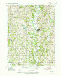 1946 Princeton1976 Print · USGSMercer County during the mid-forties reveals a rural landscape anchored by the Princeton rail corridor and the Weldon River valley. Researchers can trace family history through dozens of country schools and churches, such as Early Sch, Coon Ch, and the Mercer Cem.
 - 1948 Map of Princeton
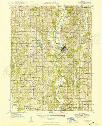 1948 Princeton1948 Print · USGSNorthern Missouri's agricultural heartland is documented here during the late 1940s, centered on the river valley and rail corridor. Researchers can trace the layout of Princeton and locate vanished rural landmarks like Modena, Hamblin School, and the Salem Cemetery.2 unique versions available
 - 1954 Map of Centerville, 1967 Print
 1954 Centerville1967 Print · USGSThe Iowa-Missouri borderlands at mid-century reveal a landscape shaped by river valleys and the height of the regional rail network. Genealogists and historians can trace the paths of the Wabash railroad and locate old townsites like Mystic, Moulton, and Greentop.3 unique versions available
 - 1957 Map of Centerville
 1957 Centerville1957 Print · USGSThe Iowa-Missouri borderlands in the mid-fifties reveal a landscape of river-valley agriculture and vital rail corridors. Genealogists and historians can trace family-named landmarks and small-town growth in Centerville, Kirksville, and along the Wabash railroad line.
 - 1958 Map of Centerville
 1958 Centerville1958 Print · USGSThe Iowa-Missouri borderlands come into focus during the mid-fifties, showing a landscape defined by river valleys and intersecting rail lines. Genealogists and local historians can trace family roots through dozens of rural hubs like Bloomfield, Unionville, and Corydon.
 - 1981 Map of Trenton
 1981 Trenton1981 Print · USGSNorthern Missouri in the early eighties remains a landscape defined by its river valleys and intersecting rail lines. Genealogists and local historians can trace the development of riverside towns like Trenton and Princeton or locate smaller rural junctions such as Humphreys and Brimson.
 - 1984 Map of Goshen, 1985 Print
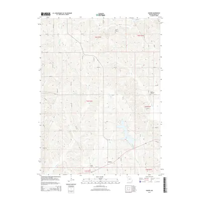
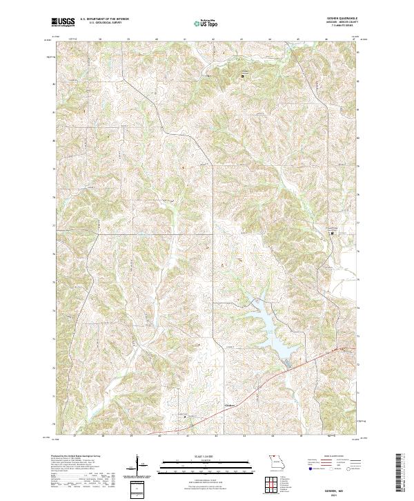
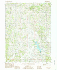 1984 Goshen1985 Print · USGSMercer and Harrison counties appear in the mid-1980s as a quiet patchwork of rural townships and winding creek beds. Researchers can trace family-named lands near Goshen or explore the drainage of Sandy Creek and the waters of Lake Paho.
 - 2012 Map of Goshen, 2012 Print
 2012 Goshen2012 Print · USGSCovers Goshen, including Mercer County, United States, and other nearby areas
 - 2014 Map of Goshen, 2014 Print
 2014 Goshen2014 Print · USGSCovers Goshen, including Mercer County, United States, and other nearby areas
 - 2017 Map of Goshen, 2017 Print
 2017 Goshen2017 Print · USGSCovers Goshen, including Mercer County, United States, and other nearby areas
 - 2021 Map of Goshen, 2021 Print
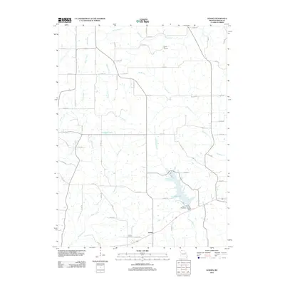
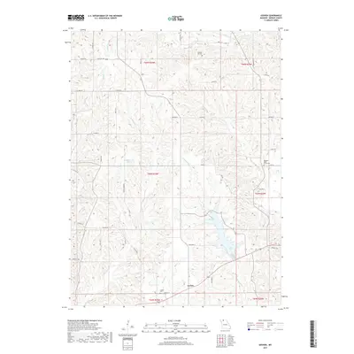
 2021 Goshen2021 Print · USGSThe rural landscape of Mercer County comes to life in this survey of the northern Missouri countryside. Genealogists can trace family roots at Goshen Cem, Pleasant Hill Cem, and the historic Pleasant Ridge Church Cem.
End of results
Showing maps 1-11 of 11
Top cities near Goshen
- Princeton historical maps
- Cainsville historical maps
- Mercer historical maps
- Spickard historical maps
- Ravanna historical maps
- Lineville historical maps
See more
Frequently asked questions
- What are the different types of historical maps available for Goshen?
- What is the oldest map of Goshen?
- Where can I purchase historical maps of Goshen for my home or office?
- Where can I download high-res historical maps of Goshen?
- Are there historical topographic maps available for Goshen?
- Is there historical aerial imagery available for Goshen?
- Where are historical maps of Goshen sourced from?