Old Maps of Syracuse, Missouri for Academic Research
Study the evolution of Syracuse with 17 high-resolution historic maps. Whether you're teaching, researching, or modeling changes in land use, these maps provide essential visual documentation of urban, environmental, and geographic change.
- Analyze long-term change: Track patterns in development, transportation, and natural features.
- Ideal for environmental or urban studies: Support academic projects with primary historical map data.
- Use in the classroom or lab: Educators and researchers rely on these maps to bring historical context to life.
These maps are a powerful tool for teaching, research, and visualizing how Syracuse has changed over the decades.
Syracuse, MO maps
(17)- 1888 Map of Boonville
 1888 Boonville1888 Print · USGSCentral Missouri comes to life in the late nineteenth century as the river economy of Boonville meets the iron rails of the Missouri Pacific Railroad. Genealogists and historians can trace old community centers like Latham Store, Chouteau Springs, and the townships of Richland and Saline.5 unique versions available
 - 1947 Map of Jefferson City, 1949 Print
 1947 Jefferson City1949 Print · USGSCentral Missouri and the northern Ozarks come into focus in this late 1940s survey of the river-and-rail landscape. Genealogists and historians can trace the growth of Jefferson City and Sedalia or locate family roots near Bagnell Dam and the Lake of the Ozarks.
 - 1952 Map of Tipton, 1953 Print
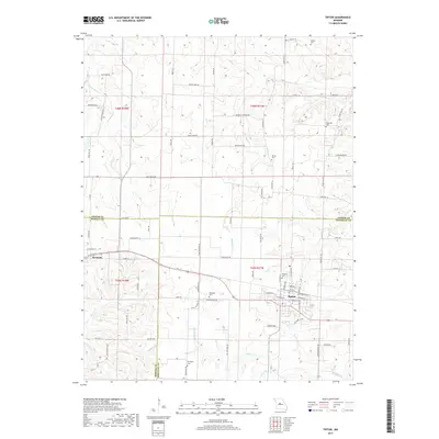
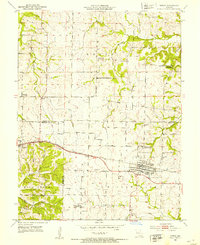 1952 Tipton1953 Print · USGSTipton and Syracuse sit at the junction of Cooper, Morgan, and Moniteau counties during the early fifties rail era. Researchers can trace the sprawling campus of the State Industrial Home for Girls or locate several decommissioned schools like Glendale Sch.3 unique versions available
 - 1953 Map of Otterville East, 1954 Print
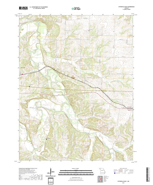
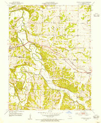 1953 Otterville East1954 Print · USGSMid-century Morgan and Cooper counties appear here as a landscape of rural townships and river valleys. Researchers can trace family history at Antioch Cem and Mt Olive Ch or follow the Missouri Pacific rail line through Otterville.3 unique versions available
 - 1954 Map of Jefferson City
 1954 Jefferson City1954 Print · USGSCentral Missouri in the early postwar years showcases a landscape defined by the winding Lake of the Ozarks and the state capital at Jefferson City. Researchers can trace the mid-century rail networks of the Missouri Pacific RR and locate rural communities like Tuscumbia, St Elizabeth, and St Anthony.2 unique versions available
 - 1955 Map of Jefferson City, 1967 Print
 1955 Jefferson City1967 Print · USGSCentral Missouri in the mid-fifties is defined by the winding Missouri River and the expanding reach of Lake of the Ozarks. Researchers can trace the rail corridors of the Missouri Pacific or locate the early footprint of Whiteman AFB and Jefferson City.4 unique versions available
 - 1958 Map of Jefferson City
 1958 Jefferson City1958 Print · USGSCentral Missouri in the late fifties shows a region transforming through the growth of Whiteman Air Force Base and the Lake of the Ozarks. Researchers can trace rail lines like the Missouri Pacific or find family roots at Enloe Cemetery and Mount Pleasant Cem.
 - 1959 Map of Jefferson City
 1959 Jefferson City1959 Print · USGSCentral Missouri is captured during the mid-fifties as the river economy and rail networks like the Missouri Pacific met the rise of the automobile. Local researchers can trace family landmarks and rural infrastructure from the Lake of the Ozarks up to Providence Cemetery and Knob Noster State Park.
 - 1982 Map of Jefferson City, 1983 Print
 1982 Jefferson City1983 Print · USGSMid-Missouri in the early eighties shows the corridor between Columbia and Jefferson City during a period of modern growth. Genealogists and historians can trace the Missouri Pacific Railroad route, family plots at Memorial Park Cem, and landmarks like Osage City and Lupus.
 - 2011 Map of Tipton, 2011 Print
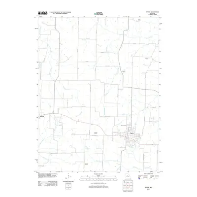 2011 Tipton2011 Print · USGSCovers Syracuse, including Tipton, Morgan County, and other nearby areas
 - 2011 Map of Otterville East, 2011 Print
 2011 Otterville East2011 Print · USGSCovers Syracuse, including Otterville, Morgan County, and other nearby areas
 - 2015 Map of Tipton, 2015 Print
 2015 Tipton2015 Print · USGSCovers Syracuse, including Tipton, Morgan County, and other nearby areas
 - 2015 Map of Otterville East, 2015 Print
 2015 Otterville East2015 Print · USGSCovers Syracuse, including Otterville, Morgan County, and other nearby areas
 - 2017 Map of Tipton, 2017 Print
 2017 Tipton2017 Print · USGSCovers Syracuse, including Tipton, Morgan County, and other nearby areas
 - 2017 Map of Otterville East, 2017 Print
 2017 Otterville East2017 Print · USGSCovers Syracuse, including Otterville, Morgan County, and other nearby areas
 - 2021 Map of Otterville East, 2021 Print
 2021 Otterville East2021 Print · USGSCentral Missouri's rural landscape at the start of the 2020s shows the enduring settlements along the Cooper and Morgan county line. Researchers can locate family landmarks like Finley-Dinwiddie Family Cem and the waters of Flat Creek.
 - 2021 Map of Tipton, 2021 Print
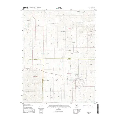
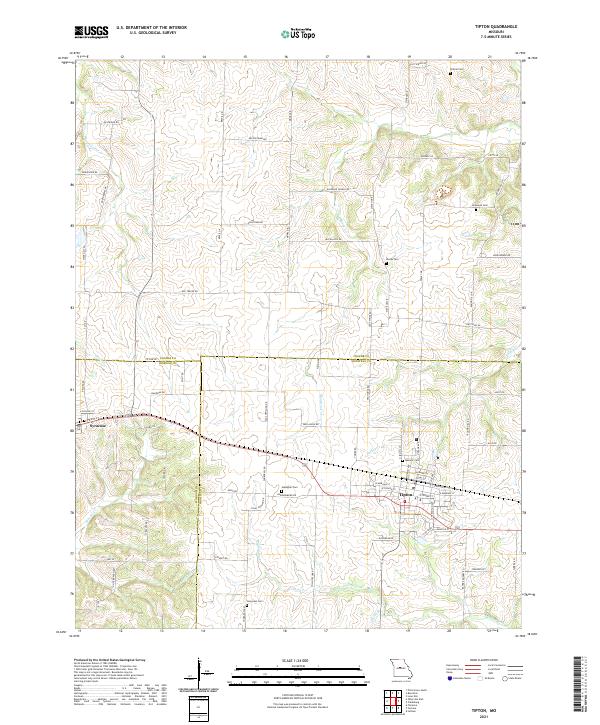 2021 Tipton2021 Print · USGSTipton and Syracuse are captured here in the early 2020s, showing a traditional Missouri landscape where three counties meet. Researchers can trace family ties through several rural burial grounds like Hopewell Cem and Gallagher Cem or follow the paths of Moniteau Cr and Smiley Cr.
End of results
Showing maps 1-17 of 17
Top cities near Syracuse
- Tipton historical maps
- Versailles historical maps
- Stover historical maps
- Pilot Grove historical maps
- Smithton historical maps
- Otterville historical maps
See more
Frequently asked questions
- What are the different types of historical maps available for Syracuse?
- What is the oldest map of Syracuse?
- Where can I purchase historical maps of Syracuse for my home or office?
- Where can I download high-res historical maps of Syracuse?
- Are there historical topographic maps available for Syracuse?
- Is there historical aerial imagery available for Syracuse?
- Where are historical maps of Syracuse sourced from?