Old Maps of Tallapoosa, Missouri
Explore 17 old maps of Tallapoosa, spanning from 1940 to today. These high-resolution historic maps reveal how streets, neighborhoods, landmarks, and natural features evolved over time — perfect for genealogy, metal detecting, research, and local history exploration.
What you can do with these maps:
- See how Tallapoosa changed over time: Compare historical maps to modern-day views to trace roads, homesites, rail lines & more.
- View detailed metadata: Each map includes creators, publishers, year, scale, and archive source.
- Overlay maps with satellite & LiDAR: Visualize the past alongside modern tools to explore terrain & human change.
- Trusted historical sources: Maps sourced from the USGS, Library of Congress, and other archives.
- Access maps your way: View online, download high-res files, or order prints for personal or research use.
Start exploring old maps of Tallapoosa to uncover forgotten places, hidden landmarks, and the deep history beneath your feet.
Tallapoosa, MO maps
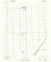
(17)- 1940 Map of Malden, 1942 Print
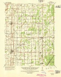 1940 Malden1942 Print · USGSIn the Missouri Bootheel during the early 1940s, a vast network of drainage ditches transformed the landscape for farming and rail commerce. Researchers can trace rural life through dozens of named landmarks like Sugar Tree Ch & Sch, Stephenson Cem, and Tallapoosa.
 - 1940 Map of Pascola, 1942 Print
 1940 Pascola1942 Print · USGSThe Missouri Bootheel is shown here during a period of massive land reclamation and rail-driven growth. Family historians can trace rural roots at Miller Sch, Mount Gilead Cem, and the timber-focused Lumber Yard in Gideon.
 - 1955 Map of Pascola
 1955 Pascola1955 Print · USGSThe Missouri Bootheel in the mid-fifties reveals a landscape defined by an extensive drainage system and the St Louis San Francisco rail line. Researchers can trace rural life through sites like the Delmore Labor Home, Sumach Ch & Cem, and the Gideon Memorial Airport.
 - 1956 Map of Malden
 1956 Malden1956 Print · USGSThe Missouri bootheel in the mid-1950s reveals a highly engineered landscape where drainage ditches and rail lines shaped every town and farm. Genealogists can locate family landmarks like Poplin Sch & Cem, Stones Chapel Cem, and the Malden Air Force Base.
 - 1956 Map of Dyersburg, 1960 Print
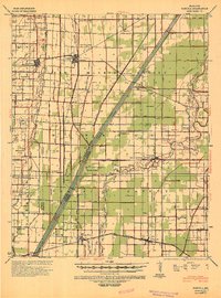
 1956 Dyersburg1960 Print · USGSThe Four Rivers region comes alive in the mid-fifties, capturing the intricate borderlands of Tennessee, Kentucky, and Missouri. Genealogists and historians can trace the rail-and-river networks connecting Dyersburg, Caruthersville, and the shoreline of Reelfoot Lake.4 unique versions available
 - 1978 Map of Parma, 1979 Print
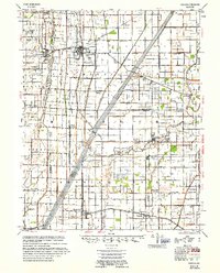
 1978 Parma1979 Print · USGSThe Missouri Bootheel is captured in the late seventies as a highly engineered agricultural landscape between Parma and Risco. Genealogists can trace rural communities along the St Louis Southwestern tracks, including Tallapoosa and Mt Zion Ch.
 - 1978 Map of Boekerton, 1979 Print
 1978 Boekerton1979 Print · USGSThe Missouri Bootheel at the end of the 1970s reveals a landscape of reclaimed wetlands and straight-line drainage engineering. Trace family roots and local history through small settlements like Boekerton, landmarks like Huie Ch, and the massive route of The Floodway.
 - 1983 Map of Dyersburg
 1983 Dyersburg1983 Print · USGSSpanning the Mississippi River at the start of the 1980s, this area shows the vital river-and-rail connections between Tennessee and Missouri. Researchers can trace family sites at Mount Pisgah Cemetery or study the evolving shoreline near Caruthersville and Reelfoot Lake.
 - 1985 Map of Sikeston, 1986 Print
 1985 Sikeston1986 Print · USGSThe Missouri Bootheel and the four-state river convergence are captured in the mid-eighties as the modern agricultural and rail networks matured. Researchers can locate regional landmarks like the Towosahgy State Historic Site, Oak Grove Cem, and towns along the St Louis Southwestern Railroad.2 unique versions available
 - 2012 Map of Parma, 2012 Print
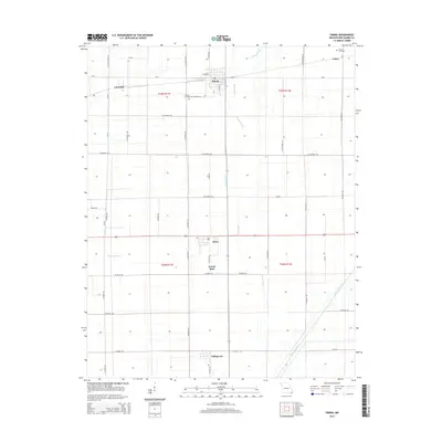
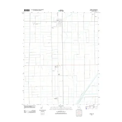 2012 Parma2012 Print · USGSCovers Tallapoosa, including Parma, Risco, and other nearby areas
 - 2012 Map of Boekerton, 2012 Print
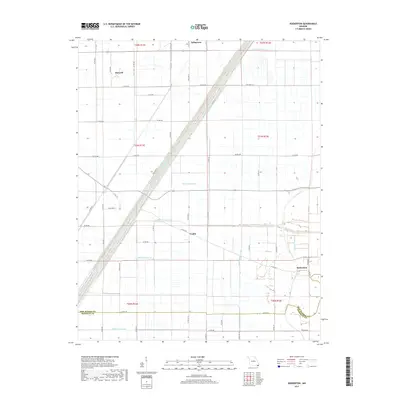
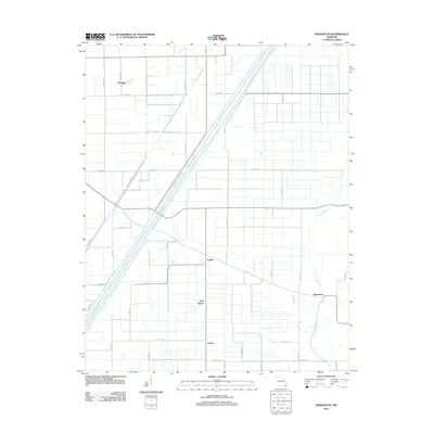 2012 Boekerton2012 Print · USGSCovers Tallapoosa, including New Garver, Garver, and other nearby areas
 - 2015 Map of Boekerton, 2015 Print
 2015 Boekerton2015 Print · USGSCovers Tallapoosa, including New Garver, Garver, and other nearby areas
 - 2015 Map of Parma, 2015 Print
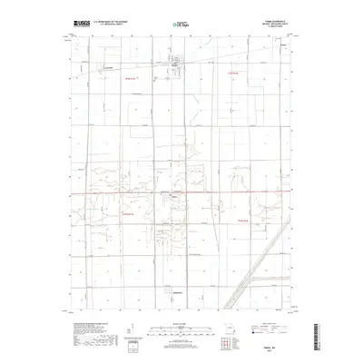
 2015 Parma2015 Print · USGSCovers Tallapoosa, including Parma, Risco, and other nearby areas
 - 2017 Map of Parma, 2017 Print
 2017 Parma2017 Print · USGSCovers Tallapoosa, including Parma, Risco, and other nearby areas
 - 2017 Map of Boekerton, 2017 Print
 2017 Boekerton2017 Print · USGSCovers Tallapoosa, including New Garver, Garver, and other nearby areas
 - 2021 Map of Boekerton, 2021 Print
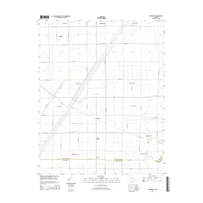
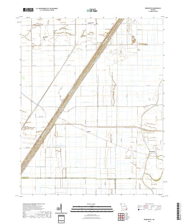 2021 Boekerton2021 Print · USGSThe Missouri Bootheel landscape appears here in its modern agricultural form, dominated by a vast network of drainage canals. Genealogists and local historians can trace the rural layout of Boekerton, Tallapoosa, and Hartzell, along with landmarks like Huie Grove.
 - 2021 Map of Parma, 2021 Print
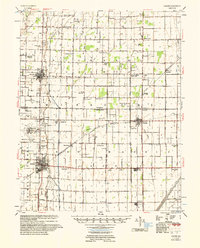
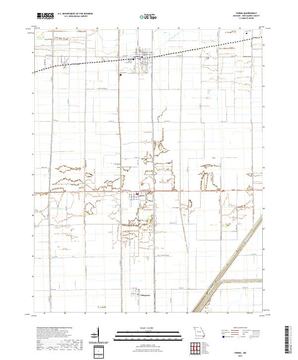 2021 Parma2021 Print · USGSThe northern reaches of the Missouri Bootheel are captured here in the early twenty-first century, showing a landscape of structured agriculture and small rail-side towns. Genealogists can locate family landmarks in Parma, Risco, and Tallapoosa, including the General Baptist Church and Parma Cemetery.
End of results
Showing maps 1-17 of 17
Top cities near Tallapoosa
- Malden historical maps
- Bernie historical maps
- Clarkton historical maps
- Lilbourn historical maps
- Gideon historical maps
- Parma historical maps
See more
Frequently asked questions
- What are the different types of historical maps available for Tallapoosa?
- What is the oldest map of Tallapoosa?
- Where can I purchase historical maps of Tallapoosa for my home or office?
- Where can I download high-res historical maps of Tallapoosa?
- Are there historical topographic maps available for Tallapoosa?
- Is there historical aerial imagery available for Tallapoosa?
- Where are historical maps of Tallapoosa sourced from?