2021 Map of Parma
USGS Topo · Published 2021About this map
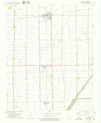
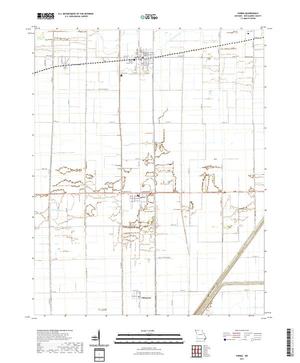
Parma serves as the primary hub of this Missouri landscape, anchored by the General Baptist Church and several community burial sites. The settlement pattern follows a rigid grid of rural roads and state highways, reflecting the agricultural character of New Madrid County. Smaller clusters like Risco, Tallapoosa, and Lorwood punctuate the flat terrain, which is defined by an extensive engineered drainage network including Ditch Number 6 and Ditch Number 1. These waterways, along with Caney Slough, indicate a landscape heavily modified for high-yield farming. Genealogists will find value in the specific locations of the Parma Cemetery, Church Cemetery, and Como Cemetery near the settlement of Como at the northeastern edge of the survey. The map details the local road infrastructure, from State Highway D to numerous numbered field roads, providing a precise record of contemporary property access and land use.
Find a feature on this map
62 named features on this map. Tap any name to fly to it.
Don’t see what you’re looking for? This feature index may not catch every label — zoom into the map to look around manually.
Map Details
Editions of this 2021 Parma Map
This is the sole edition of this map. No revisions or reprints were ever made.