Loading...
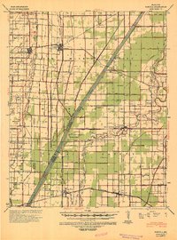
Loading map...1940 Map of Pascola
USGS Topo · Published 1942About this map
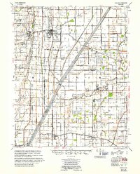
The St Louis Southwestern and San Francisco railroads anchor the landscape of this Bootheel region, where a dense network of drainage channels like Ditch No 60 and Ditch No 64 has transformed the low-lying terrain into productive land. The town of Gideon serves as a major hub, featuring a prominent Lumber Yard that speaks to the timber-clearing and agricultural development of the mid-20th century.
Find a feature on this map
101 named features on this map. Tap any name to fly to it.
Don’t see what you’re looking for? This feature index may not catch every label — zoom into the map to look around manually.
Map Details
Date Portrayed1940
Date Published1942
PublisherU.S. Geological Survey
Map TypeTopographic
Scale1:62,500
Physical Dimensions16.1 x 21.6 inches
Editions of this 1940 Pascola Map
This is the sole edition of this map. No revisions or reprints were ever made.
Historical Maps of Clarkton Through Time
Featured Locations
Source Details
SourceU.S. Geological Survey
CopyrightPublic Domain