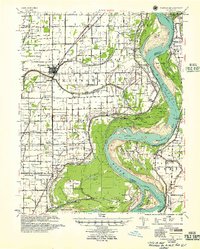
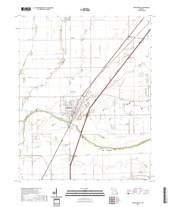
1955 Map of Portageville
USGS Topo · Published 1955About this map
The Mississippi River dominates this mid-century landscape, carving deep loops through the alluvial plains of Missouri and Tennessee. The meandering channel has created a complex geography of river features, including Stewart Bar, Linda Bar, and the massive Merriwether Bend. Away from the water, the land is meticulously organized into a grid of drainage ditches and farm roads, reflecting a highly engineered agricultural environment. The St Louis San Francisco railroad serves as the primary inland corridor, passing through the established town of Portageville. This area is dense with small, family-named landmarks and rural institutions, from the Beech Grove Sch and O'Bannon Sch to the Griffith Cem and Branham Cem. The presence of numerous tiny settlements like Conran, De Lisle, and Gayoso illustrates the intensive rural settlement pattern before the consolidation of farming operations altered the Missouri Bootheel.
Find a feature on this map
83 named features on this map. Tap any name to fly to it.
Don’t see what you’re looking for? This feature index may not catch every label — zoom into the map to look around manually.
Map Details
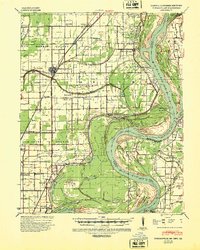
Editions of this 1955 Portageville Map
This is the sole edition of this map. No revisions or reprints were ever made.
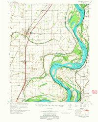
Historical Maps of Tiptonville Through Time
8 maps found
1939 Portageville
New Madrid County, MO
1955 Portageville
New Madrid County, MO
1971 Portageville
New Madrid County, MO
1973 Portageville
New Madrid County, MO
2012 Portageville
New Madrid County, MO
2015 Portageville
New Madrid County, MO
2017 Portageville
New Madrid County, MO
2021 Portageville
New Madrid County, MO