2020s Maps of Jefferson Township, Missouri
Explore 5 historic maps of Jefferson Township from the 2020s. These maps offer a rare glimpse into what life looked like during the 2020s — showing old roads, neighborhoods, homes, and landmarks that have changed or disappeared over time.
Whether you're researching your family's past, planning a metal detecting trip, or studying how Jefferson Township's landscape evolved across the 2020s, these high-resolution maps are a powerful tool for exploring the history of this region.
- Focus on a specific era: All maps on this page are from the 2020s, giving you a focused view of this time period.
- See what’s changed: Compare century-old streets, trails, and buildings to today's modern landscape using overlays and satellite layers.
- Research with precision: Use these maps for genealogy, historical research, land use analysis, or educational projects.
- View, download, or print: Maps are fully viewable online in high resolution, and can be downloaded or printed for your own records.
Start exploring Jefferson Township's history through authentic maps from the 2020s. This is your window into the past.
Jefferson Township, MO maps
(5)- 2021 Map of Stanberry, 2021 Print
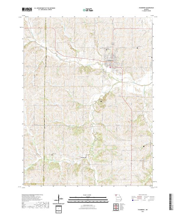 2021 Stanberry2021 Print · USGSGentry County farmland and the community of Stanberry are detailed here in the early 2020s. Researchers can locate numerous family burial grounds and small settlements, including Island City, High Ridge Cem, and Meeker Cem.
 - 2021 Map of Alanthus Grove, 2021 Print
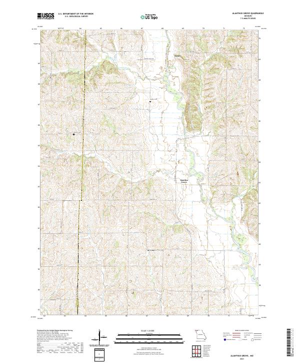 2021 Alanthus Grove2021 Print · USGSGentry and Nodaway Counties are captured here in the early twenty-first century as a landscape of structured farmland and winding river bottoms. Genealogists and local historians can trace the exact locations of Monroe Cem, Finders Cem, and the small settlement of Alanthus Grove.
 - 2021 Map of Guilford, 2021 Print
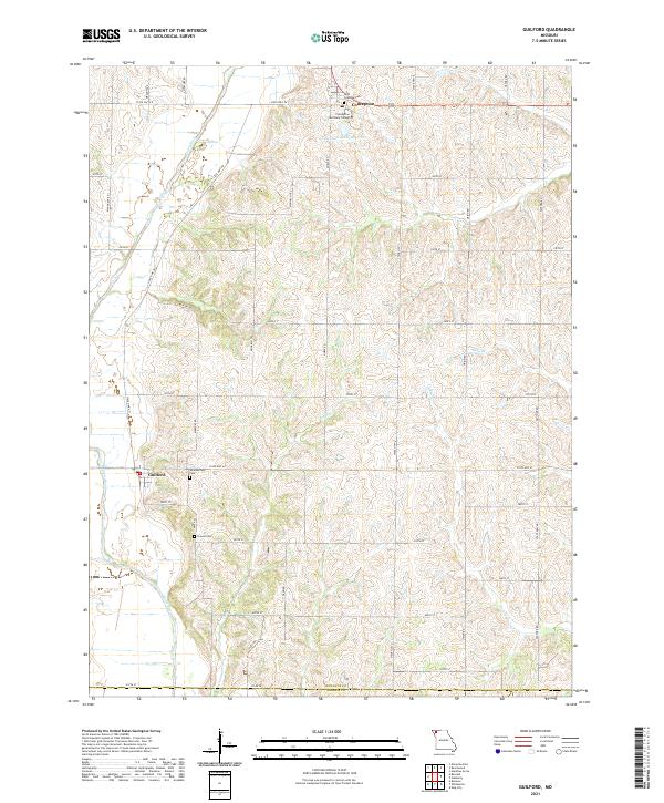 2021 Guilford2021 Print · USGSNodaway County agricultural life and religious centers are captured here in the early twenty-first century. Researchers can locate family heritage sites at Saint Columba Cem or trace the lands surrounding Conception Seminary College and Guilford.
 - 2021 Map of Ravenwood, 2021 Print
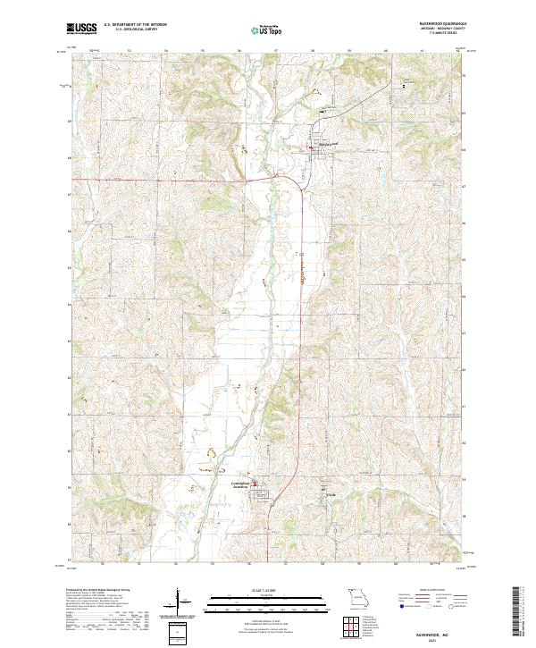 2021 Ravenwood2021 Print · USGSNodaway County's rural heartland is documented here in the early twenty-first century, centered on the community of Ravenwood. Genealogists and researchers can trace local family landmarks and burial sites like Oak Lawn Cem and Sweet Home Cem along the Platte River valley.
 - 2021 Map of Maryville East, 2021 Print
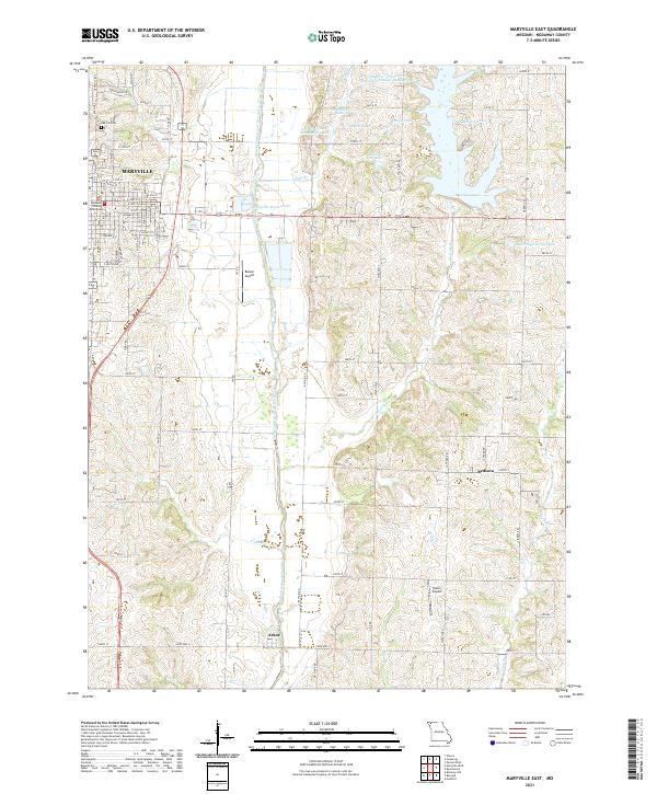 2021 Maryville East2021 Print · USGSThe area east of Maryville during the early 2020s shows a balance of civic life and water management. Researchers can locate the Nodaway County Courthouse, the small community of Arkoe, and family-named water bodies like Hiley Lake.
End of results
Showing maps 1-5 of 5
Top cities near Jefferson Township
- Maryville historical maps
- Stanberry historical maps
- King City historical maps
- Ravenwood historical maps
- Barnard historical maps
- Bolckow historical maps
See more
Top neighborhoods of Jefferson Township
- Monastery historical maps
- Conception historical maps
- Conception Junction historical maps
- Clyde historical maps
Frequently asked questions
- What are the different types of historical maps available for Jefferson Township?
- What is the oldest map of Jefferson Township?
- Where can I purchase historical maps of Jefferson Township for my home or office?
- Where can I download high-res historical maps of Jefferson Township?
- Are there historical topographic maps available for Jefferson Township?
- Is there historical aerial imagery available for Jefferson Township?
- Where are historical maps of Jefferson Township sourced from?