2020s Maps of Union Township, Missouri
Explore 6 historic maps of Union Township from the 2020s. These maps offer a rare glimpse into what life looked like during the 2020s — showing old roads, neighborhoods, homes, and landmarks that have changed or disappeared over time.
Whether you're researching your family's past, planning a metal detecting trip, or studying how Union Township's landscape evolved across the 2020s, these high-resolution maps are a powerful tool for exploring the history of this region.
- Focus on a specific era: All maps on this page are from the 2020s, giving you a focused view of this time period.
- See what’s changed: Compare century-old streets, trails, and buildings to today's modern landscape using overlays and satellite layers.
- Research with precision: Use these maps for genealogy, historical research, land use analysis, or educational projects.
- View, download, or print: Maps are fully viewable online in high resolution, and can be downloaded or printed for your own records.
Start exploring Union Township's history through authentic maps from the 2020s. This is your window into the past.
Union Township, MO maps
(6)- 2021 Map of Hopkins, 2021 Print
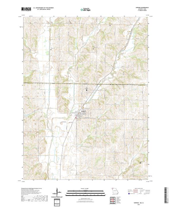 2021 Hopkins2021 Print · USGSThe northern edge of Nodaway County at the turn of the 2020s is defined by the three forks of the One Hundred and Two River converging near the town of Hopkins. Researchers can trace rural cemetery sites such as Williams Cem and Washburn Cem or locate the distinctive local rise of The Mound.
 - 2021 Map of Hopkins SW, 2021 Print
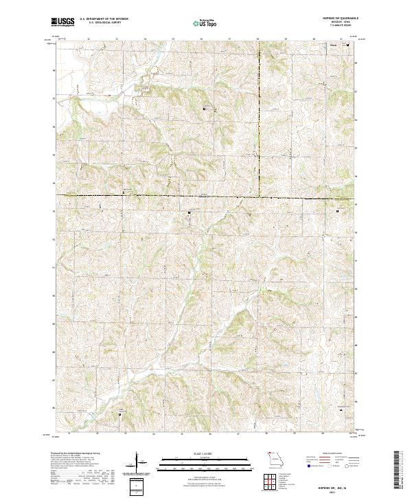 2021 Hopkins SW2021 Print · USGSThe Iowa-Missouri borderlands come into focus in this recent survey of the rural landscape where Page, Taylor, and Nodaway counties meet. Genealogists can locate several family burial sites including Siam Cemetery, Johnson Cemetery, and Morehouse Cemetery.
 - 2021 Map of Wilcox, 2021 Print
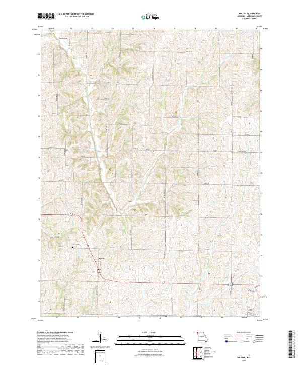 2021 Wilcox2021 Print · USGSNodaway County agricultural lands and rural crossroads are captured here in the early 2020s. Researchers can pinpoint family sites near the Wilcox Cem, trace the drainages of Big Slough, and explore the area around Toad Hollow and Wilcox.
 - 2021 Map of Parnell West, 2021 Print
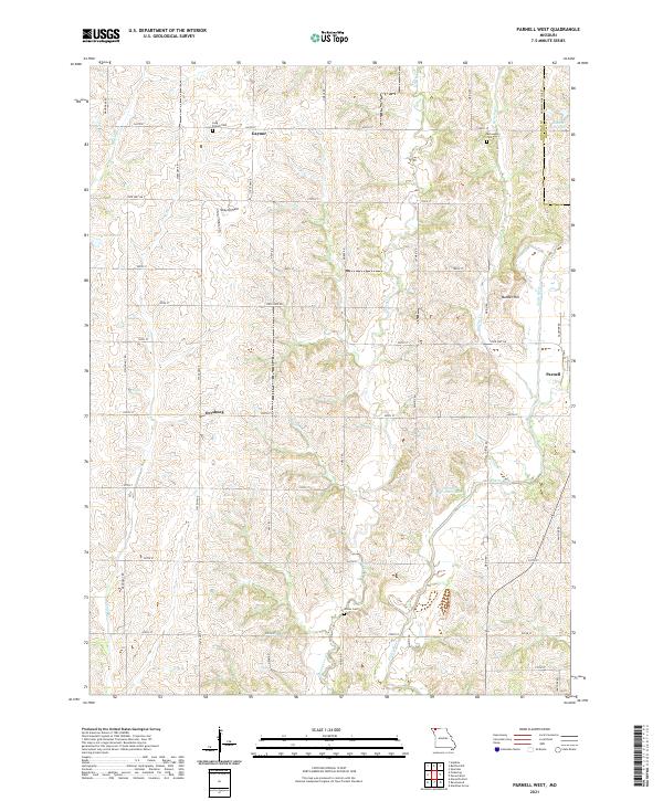 2021 Parnell West2021 Print · USGSNodaway County agricultural life continues its steady rhythm along the Platte River in the early twenty-first century. Genealogists and local historians can trace family land and landmarks like Gaynor, Orrsburg, and the well-placed Long Branch Cem.
 - 2021 Map of Bedford SW, 2021 Print
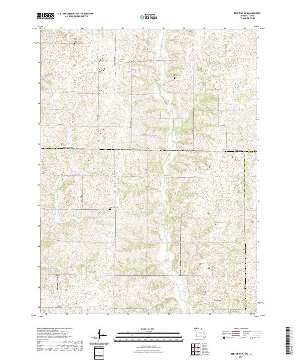 2021 Bedford SW2021 Print · USGSThe borderlands of Nodaway County and Taylor County are captured here in the early twenty-first century as a landscape of grid roads and family burial grounds. Researchers can locate several rural cemeteries including Brethren Cem, New Hope Cem, and Ross Township Cem.
 - 2021 Map of Pickering, 2021 Print
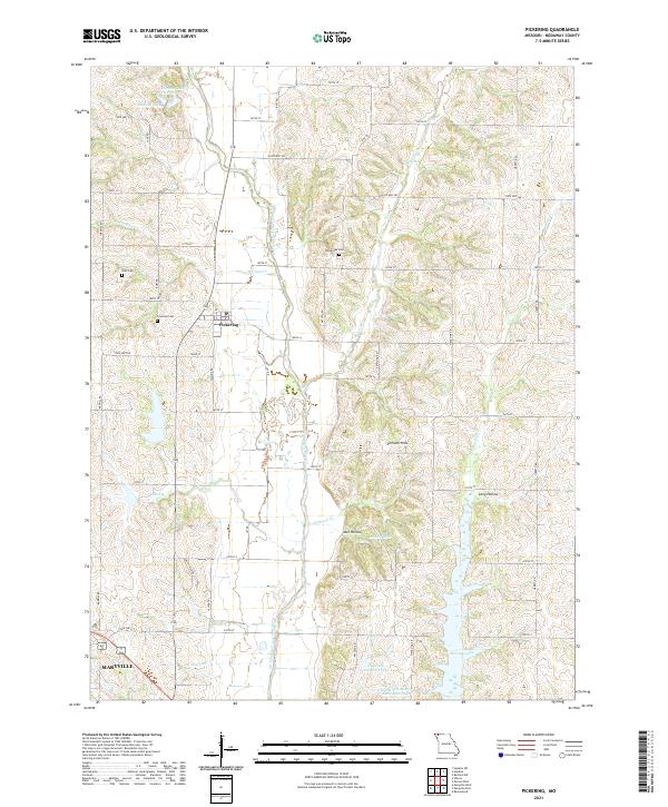 2021 Pickering2021 Print · USGSNodaway County agriculture and rural life are documented here in the early twenty-first century, centered on the settlement of Pickering. Genealogists can locate family sites near White Oak Cem and Coleman Cem or trace the winding path of the One Hundred and Two River.
End of results
Showing maps 1-6 of 6
Top cities near Union Township
- Maryville historical maps
- Bedford historical maps
- Burlington Junction historical maps
- Hopkins historical maps
- Ravenwood historical maps
- Conception Junction historical maps
See more
Top neighborhoods of Union Township
Frequently asked questions
- What are the different types of historical maps available for Union Township?
- What is the oldest map of Union Township?
- Where can I purchase historical maps of Union Township for my home or office?
- Where can I download high-res historical maps of Union Township?
- Are there historical topographic maps available for Union Township?
- Is there historical aerial imagery available for Union Township?
- Where are historical maps of Union Township sourced from?