Old Maps of Dora, Missouri for Hiking & Exploration
Hike through history with 15 historic maps of Dora. Explore old trails, ghost towns, and forgotten backroads — perfect for outdoor adventurers and local explorers.
- Rediscover forgotten places: Map out old mining camps, roads, and footpaths that no longer exist on modern maps.
- Layer with modern tools: Combine with LiDAR or satellite views to plan hikes through historical terrain.
- Made for exploration: Popular among hikers, overlanders, and local history lovers.
Use these maps to find adventure and explore the hidden past of Dora.
Dora, MO maps
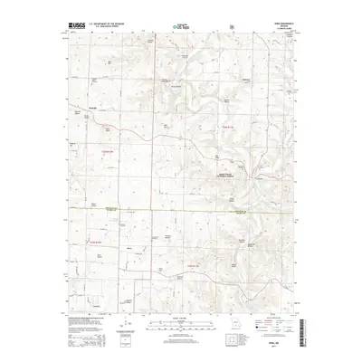
(15)- 1939 Map of Topaz
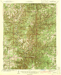 1939 Topaz1939 Print · USGSThe North Fork River valley in Douglas and Ozark counties is captured here in the late 1930s, showing a landscape defined by riverside mills and rural schools. Genealogists can trace family landmarks across Richville, Siloam Springs, and Hammonds Mill, or find remote sites like Mitts Cem and Little Zion Sch.3 unique versions available
 - 1941 Map of Topaz
 1941 Topaz1941 Print · USGSThe Ozark plateau of the late thirties and early forties comes alive here, showing the river-bound communities of Douglas and Howell Counties. Researchers can locate vanished rural landmarks like Omba Store, Hammonds Mill, and numerous country schools such as New Jail Sch.
 - 1945 Map of Harrison
 1945 Harrison1945 Print · USGSThe Ozark and Boston Mountains straddle the Missouri-Arkansas border during the mid-forties, showing a landscape of forest ridges and river valleys. Genealogists and historians can trace rail-connected towns like Monett and West Plains or early lake developments at Bull Shoals Res and Norfork Lake.
 - 1949 Map of Harrison
 1949 Harrison1949 Print · USGSThe Ozark highlands of northern Arkansas and southern Missouri are shown just after the war, when the White River still followed its original course. Genealogists and historians can trace rail lines like the Missouri & Arkansas RR and locate rural hubs like Harrison, Eureka Springs, and Mountain Home.
 - 1954 Map of Harrison
 1954 Harrison1954 Print · USGSThe Ozarks and Boston Mountains meet during a period of massive river engineering in the mid-fifties. Researchers can trace the early shorelines of Bull Shoals Lake and Table Rock Reservoir or locate inland towns like Berryville and Harrison.
 - 1958 Map of Harrison, 1973 Print
 1958 Harrison1973 Print · USGSThe Ozark and Boston Mountains appear in this mid-century survey as the great White River impoundments were reshaping the region. Researchers can trace the rail lines of the St Louis-San Francisco Ry and locate early settlements like Berryville and Gainesville.
 - 1964 Map of Harrison
 1964 Harrison1964 Print · USGSThe Ozark and Boston Mountains of Arkansas and Missouri are captured here in the mid-sixties, showing the rugged highlands before extensive modern development. Genealogists and historians can trace family-named peaks like Gaither Mountain and follow the St Louis-San Francisco RR through Monett and Purdy.
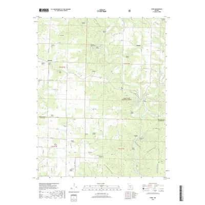
 - 1973 Map of Dora, 1976 Print
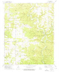 1973 Dora1976 Print · USGSDora and the North Fork White River corridor appear here in the early seventies, spanning the border of Douglas and Ozark counties. Researchers can trace rural cemeteries like Fish and Cudworth Cem, or locate landmarks like Twin Bridges and Hammonds Mill Camp.3 unique versions available
 - 1985 Map of Ava
 1985 Ava1985 Print · USGSThe Missouri Ozarks are captured here in the mid-1980s, showcasing a landscape of high ridges and deep river hollows. Genealogists and historians can trace family roots through numerous rural settlements like Vera Cruz, Rockbridge, and Almartha, or locate landmarks such as Hercules Tower.
 - 1985 Map of Harrison
 1985 Harrison1985 Print · USGSThe Ozark highlands and the White River valley are seen here in the mid-1980s, showcasing a region defined by its massive reservoirs and protected wilderness. You can trace the rugged corridors of the Missouri & North Arkansas RR or locate historic settlements like Eureka Springs and Jasper.
 - 2004 Map of Dora, 2006 Print
 2004 Dora2006 Print · USGSThe Ozark highlands of southern Missouri come alive in this survey of the river country bordering Douglas and Ozark counties. Researchers can trace the rural communities of Dora and Richville alongside scattered landmarks like Bethany Ch and Sweeton Cem.
 - 2012 Map of Dora, 2012 Print
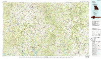
 2012 Dora2012 Print · USGSCovers Dora, including Hebron, Richville, and other nearby areas
 - 2015 Map of Dora, 2015 Print
 2015 Dora2015 Print · USGSCovers Dora, including Hebron, Richville, and other nearby areas
 - 2017 Map of Dora, 2017 Print
 2017 Dora2017 Print · USGSCovers Dora, including Hebron, Richville, and other nearby areas
 - 2021 Map of Dora, 2021 Print
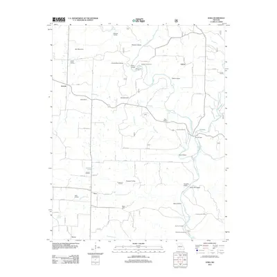
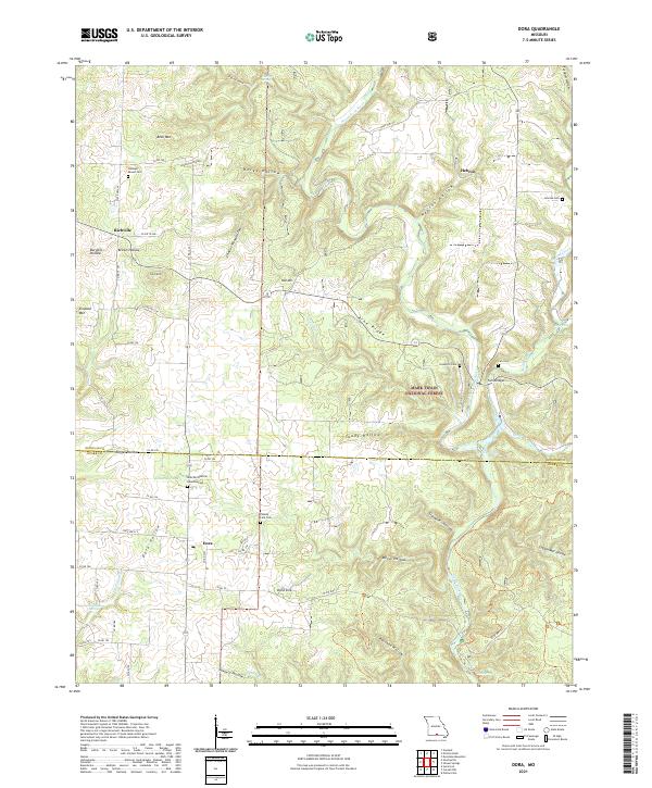 2021 Dora2021 Print · USGSThe Ozark plateau near the Douglas and Ozark County line is shown here in the early 2020s, centered on the community of Dora. Family historians can locate several local burial grounds, including Sweeton Cem, Fish Cem, and Cudworth Cem near Twin Bridges.
End of results
Showing maps 1-15 of 15
Top cities near Dora
Frequently asked questions
- What are the different types of historical maps available for Dora?
- What is the oldest map of Dora?
- Where can I purchase historical maps of Dora for my home or office?
- Where can I download high-res historical maps of Dora?
- Are there historical topographic maps available for Dora?
- Is there historical aerial imagery available for Dora?
- Where are historical maps of Dora sourced from?