Old Maps of Lutie, Missouri for Genealogy
Trace your family roots with 16 historic maps of Lutie. These high-res maps reveal old neighborhoods, homesites, landmarks, and streets — helping you uncover where your ancestors lived and how the area evolved over time.
- Explore historic neighborhoods: Identify where your relatives may have lived in the 1800s or 1900s.
- Compare maps over time: Trace the changes in streets, buildings, and landmarks for multi-generational research.
- Perfect for genealogy & ancestry research: Used by family historians and researchers to map out lineage and migration.
These maps are an incredible resource for exploring your personal connection to Lutie's past.
Lutie, MO maps
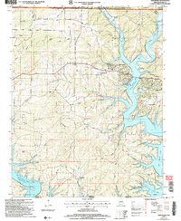
(16)- 1936 Map of Thornfield
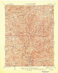
 1936 Thornfield1936 Print · USGSOzark County in the mid-1930s is a landscape of high ridges and deep river hollows where rural life centered on local schoolhouses and isolated post offices. Researchers can trace family history through sites like Franklin Grove Cem, Thornfield, and Igo School.
 - 1943 Map of Thornfield, 1959 Print
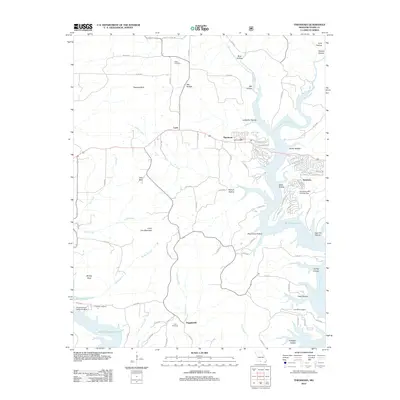
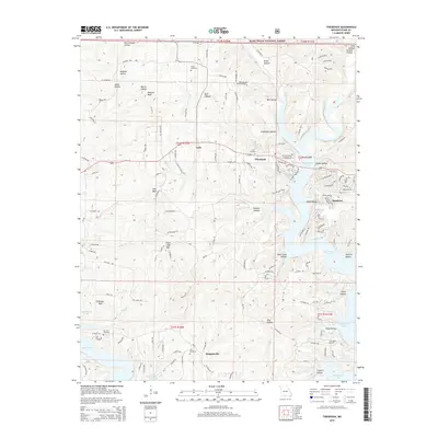
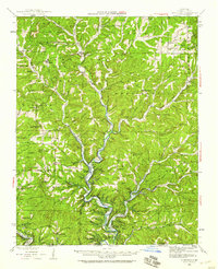 1943 Thornfield1959 Print · USGSOzark County and the Arkansas border are captured here in the 1940s, highlighting a landscape of river-valley settlements and rural hollows. Genealogists can trace family sites at Franklin Grove Cem, Turnbo Cem, and numerous country schools like Northview Sch.
 - 1945 Map of Harrison
 1945 Harrison1945 Print · USGSThe Ozark and Boston Mountains straddle the Missouri-Arkansas border during the mid-forties, showing a landscape of forest ridges and river valleys. Genealogists and historians can trace rail-connected towns like Monett and West Plains or early lake developments at Bull Shoals Res and Norfork Lake.
 - 1945 Map of Thornfield
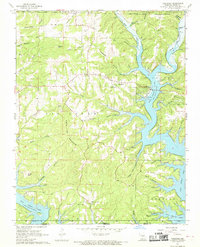
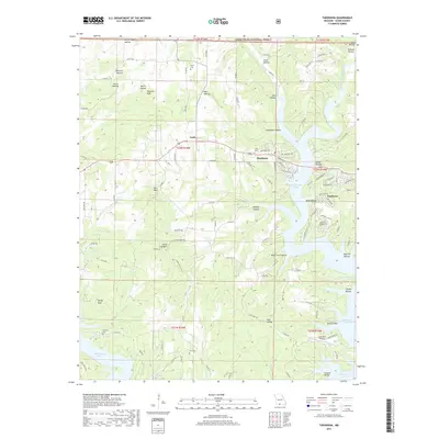
 1945 Thornfield1945 Print · USGSOzark County in the mid-1940s is captured here through its river-valley settlements and isolated upland schools. Genealogists and historians can trace family locations through named river crossings like Neasby Ford and local landmarks like Franklin Grove Ch or the settlement of Romance.2 unique versions available
 - 1949 Map of Harrison
 1949 Harrison1949 Print · USGSThe Ozark highlands of northern Arkansas and southern Missouri are shown just after the war, when the White River still followed its original course. Genealogists and historians can trace rail lines like the Missouri & Arkansas RR and locate rural hubs like Harrison, Eureka Springs, and Mountain Home.
 - 1954 Map of Harrison
 1954 Harrison1954 Print · USGSThe Ozarks and Boston Mountains meet during a period of massive river engineering in the mid-fifties. Researchers can trace the early shorelines of Bull Shoals Lake and Table Rock Reservoir or locate inland towns like Berryville and Harrison.
 - 1958 Map of Harrison, 1973 Print
 1958 Harrison1973 Print · USGSThe Ozark and Boston Mountains appear in this mid-century survey as the great White River impoundments were reshaping the region. Researchers can trace the rail lines of the St Louis-San Francisco Ry and locate early settlements like Berryville and Gainesville.
 - 1964 Map of Harrison
 1964 Harrison1964 Print · USGSThe Ozark and Boston Mountains of Arkansas and Missouri are captured here in the mid-sixties, showing the rugged highlands before extensive modern development. Genealogists and historians can trace family-named peaks like Gaither Mountain and follow the St Louis-San Francisco RR through Monett and Purdy.
 - 1968 Map of Theodosia, 1970 Print
 1968 Theodosia1970 Print · USGSThe Ozark hills and the rising waters of the White River watershed are captured here just as the modern reservoir landscape was maturing. Researchers can trace rural lineages through sites like Dugginsville, True Hope Ch, and family landmarks such as Lutie Cem.2 unique versions available
 - 1985 Map of Ava
 1985 Ava1985 Print · USGSThe Missouri Ozarks are captured here in the mid-1980s, showcasing a landscape of high ridges and deep river hollows. Genealogists and historians can trace family roots through numerous rural settlements like Vera Cruz, Rockbridge, and Almartha, or locate landmarks such as Hercules Tower.
 - 1985 Map of Harrison
 1985 Harrison1985 Print · USGSThe Ozark highlands and the White River valley are seen here in the mid-1980s, showcasing a region defined by its massive reservoirs and protected wilderness. You can trace the rugged corridors of the Missouri & North Arkansas RR or locate historic settlements like Eureka Springs and Jasper.
 - 2004 Map of Theodosia, 2006 Print
 2004 Theodosia2006 Print · USGSTheodosia and the northern reaches of Bull Shoals Lake are captured here during the early twenty-first century as part of the Ozark recreation landscape. Local historians can trace family sites like Hicks Cem, Dugginsville, and landmarks like True Hope Ch.
 - 2012 Map of Theodosia, 2012 Print
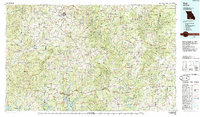
 2012 Theodosia2012 Print · USGSCovers Lutie, including Theodosia, Sundown, and other nearby areas
 - 2015 Map of Theodosia, 2015 Print
 2015 Theodosia2015 Print · USGSCovers Lutie, including Theodosia, Sundown, and other nearby areas
 - 2017 Map of Theodosia, 2017 Print
 2017 Theodosia2017 Print · USGSCovers Lutie, including Theodosia, Sundown, and other nearby areas
 - 2021 Map of Theodosia, 2021 Print
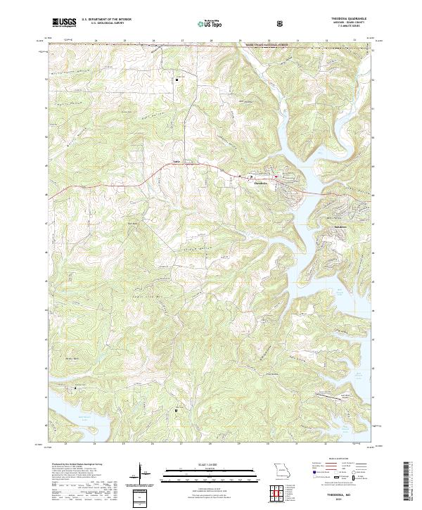 2021 Theodosia2021 Print · USGSTheodosia and the northern reaches of Bull Shoals Lake are captured here during the early twenty-first century. Genealogists and local historians can trace family locations near Lutie Cem, Hicks Cem, and the high points of McVey Bald or Chain Link Mountain.
End of results
Showing maps 1-16 of 16
Top cities near Lutie
- Bull Shoals historical maps
- Diamond City historical maps
- Lakeview historical maps
- Gainesville historical maps
- Lead Hill historical maps
- Theodosia historical maps
See more
Frequently asked questions
- What are the different types of historical maps available for Lutie?
- What is the oldest map of Lutie?
- Where can I purchase historical maps of Lutie for my home or office?
- Where can I download high-res historical maps of Lutie?
- Are there historical topographic maps available for Lutie?
- Is there historical aerial imagery available for Lutie?
- Where are historical maps of Lutie sourced from?