Old Maps of Livonia, Missouri
Explore 12 old maps of Livonia, spanning from 1911 to today. These high-resolution historic maps reveal how streets, neighborhoods, landmarks, and natural features evolved over time — perfect for genealogy, metal detecting, research, and local history exploration.
What you can do with these maps:
- See how Livonia changed over time: Compare historical maps to modern-day views to trace roads, homesites, rail lines & more.
- View detailed metadata: Each map includes creators, publishers, year, scale, and archive source.
- Overlay maps with satellite & LiDAR: Visualize the past alongside modern tools to explore terrain & human change.
- Trusted historical sources: Maps sourced from the USGS, Library of Congress, and other archives.
- Access maps your way: View online, download high-res files, or order prints for personal or research use.
Start exploring old maps of Livonia to uncover forgotten places, hidden landmarks, and the deep history beneath your feet.
Livonia, MO maps
(12)- 1911 Map of Queen City, 1971 Print
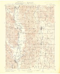
 1911 Queen City1971 Print · USGSSchuyler and Adair counties thrive as a rural railway crossroads during the early 1900s. Researchers can locate dozens of country schoolhouses like Patterson School and trace the paths of the Wabash RR through Queen City or the Iowa and St Louis RR near Connelsville.
 - 1913 Map of Queen City
 1913 Queen City1913 Print · USGSSchuyler and Adair counties appear in this pre-war survey as a bustling network of small farming townships and rural school districts. Researchers can trace family roots through dozens of local sites like Queen City, New Hope School, and the river crossing at Slate Ford.2 unique versions available
 - 1954 Map of Centerville, 1967 Print
 1954 Centerville1967 Print · USGSThe Iowa-Missouri borderlands at mid-century reveal a landscape shaped by river valleys and the height of the regional rail network. Genealogists and historians can trace the paths of the Wabash railroad and locate old townsites like Mystic, Moulton, and Greentop.3 unique versions available
 - 1957 Map of Centerville
 1957 Centerville1957 Print · USGSThe Iowa-Missouri borderlands in the mid-fifties reveal a landscape of river-valley agriculture and vital rail corridors. Genealogists and historians can trace family-named landmarks and small-town growth in Centerville, Kirksville, and along the Wabash railroad line.
 - 1958 Map of Centerville
 1958 Centerville1958 Print · USGSThe Iowa-Missouri borderlands come into focus during the mid-fifties, showing a landscape defined by river valleys and intersecting rail lines. Genealogists and local historians can trace family roots through dozens of rural hubs like Bloomfield, Unionville, and Corydon.
 - 1974 Map of Queen City NW, 1976 Print
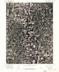 1974 Queen City NW1976 Print · USGSSchuyler County farmland is captured in remarkable aerial detail during the mid-seventies, showing the rural landscape just north of Queen City. Genealogists and local historians can pinpoint farmsteads near Livonia and trace the winding course of the Chariton River past Worthington.
 - 1979 Map of Livonia
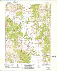 1979 Livonia1979 Print · USGSNortheastern Missouri farmland and river bottoms are captured here in the late seventies as the rural landscape transitioned between old rail eras and modern agriculture. Researchers can trace the Old RR Grade near Worthington or locate numerous historic burial sites like Jimtown Cem and Gillespie Cem.
 - 1981 Map of Kirksville, 1982 Print
 1981 Kirksville1982 Print · USGSNortheast Missouri in the early eighties was a landscape of rail-connected trade towns and significant river valleys. Researchers can trace the legacy of medical education at the Kirksville College of Osteopathic Med or locate family roots in Unionville, Edina, and Bible Grove.
 - 2012 Map of Livonia, 2012 Print
 2012 Livonia2012 Print · USGSCovers Livonia, including Worthington, Lickskillet, and other nearby areas
 - 2015 Map of Livonia, 2015 Print
 2015 Livonia2015 Print · USGSCovers Livonia, including Worthington, Lickskillet, and other nearby areas
 - 2017 Map of Livonia, 2017 Print
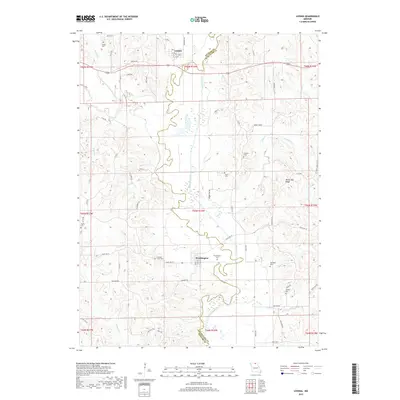 2017 Livonia2017 Print · USGSCovers Livonia, including Worthington, Lickskillet, and other nearby areas
 - 2021 Map of Livonia, 2021 Print
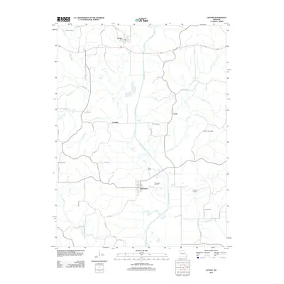
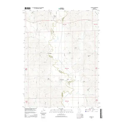
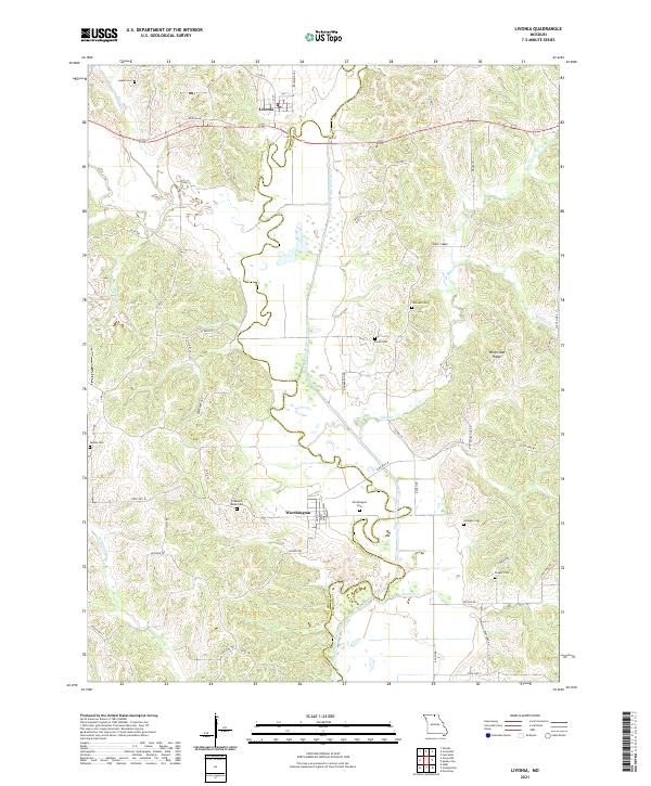 2021 Livonia2021 Print · USGSUpper Missouri's river hills are captured here in the early twenty-first century, centered on the historic settlements of Livonia and Worthington. Researchers can locate numerous local burial sites like Jimtown Cem and Gillespie Cem while tracing the winding path of the Chariton River.
End of results
Showing maps 1-12 of 12
Top cities near Livonia
- Centerville historical maps
- Lancaster historical maps
- Queen City historical maps
- Moulton historical maps
- Cincinnati historical maps
- Glenwood historical maps
See more
Frequently asked questions
- What are the different types of historical maps available for Livonia?
- What is the oldest map of Livonia?
- Where can I purchase historical maps of Livonia for my home or office?
- Where can I download high-res historical maps of Livonia?
- Are there historical topographic maps available for Livonia?
- Is there historical aerial imagery available for Livonia?
- Where are historical maps of Livonia sourced from?