1950s Maps of Randolph County, Missouri
Explore 13 historic maps of Randolph County from the 1950s. These maps offer a rare glimpse into what life looked like during the 1950s — showing old roads, neighborhoods, homes, and landmarks that have changed or disappeared over time.
Whether you're researching your family's past, planning a metal detecting trip, or studying how Randolph County's landscape evolved across the 1950s, these high-resolution maps are a powerful tool for exploring the history of this region.
- Focus on a specific era: All maps on this page are from the 1950s, giving you a focused view of this time period.
- See what’s changed: Compare century-old streets, trails, and buildings to today's modern landscape using overlays and satellite layers.
- Research with precision: Use these maps for genealogy, historical research, land use analysis, or educational projects.
- View, download, or print: Maps are fully viewable online in high resolution, and can be downloaded or printed for your own records.
Start exploring Randolph County's history through authentic maps from the 1950s. This is your window into the past.
Randolph County, MO maps
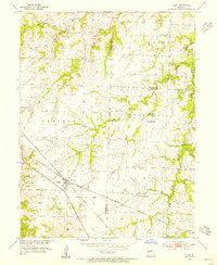
(13)- 1952 Map of Middle Grove, 1955 Print
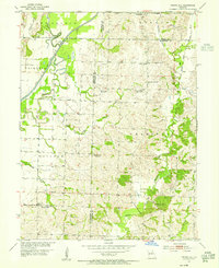
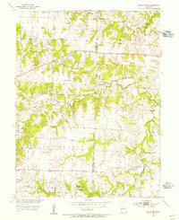 1952 Middle Grove1955 Print · USGSMid-century rural life in central Missouri is meticulously documented here just as the post-war era reshaped the countryside. Researchers can trace family history through numerous country landmarks like Number Six Sch, Enon Ch, and Meals Cem.
 - 1953 Map of Moberly
 1953 Moberly1953 Print · USGSMid-century north-central Missouri is documented here as a bustling intersection of river commerce and heavy rail. Researchers can trace historic family-named landmarks and transport hubs from the Missouri River corridor to the rail yards of Moberly, Chillicothe, and Macon.
 - 1953 Map of Renick, 1955 Print
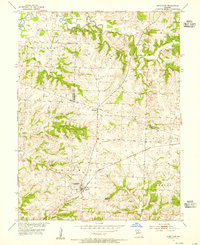
 1953 Renick1955 Print · USGSMid-Missouri prairie life and rail history are captured here in the early fifties, centered on the Renick area. Researchers can trace genealogical sites like Hamilton Cem and the Wilson Sch, or follow the Wabash rail line through Harkes.3 unique versions available
 - 1953 Map of Huntsville, 1955 Print
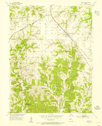
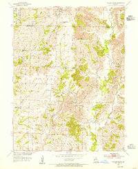
 1953 Huntsville1955 Print · USGSRandolph County in the early fifties shows a landscape balancing rail-based industry with deep-rooted rural communities. Genealogists can locate family-named landmarks like the Hannah Mine, Lincoln Sch, and several rural churches including New Hope Ch.2 unique versions available
 - 1953 Map of Higbee, 1955 Print
 1953 Higbee1955 Print · USGSHigbee served as a busy railroad junction in the 1950s where two major lines intersected amidst the coal-bearing hills of Randolph County. Researchers can trace the industrial landscape through the Strip Mine and Mine Dump or locate family roots at Mt Ararat Ch and Bagby Cem.2 unique versions available
 - 1953 Map of Clark, 1955 Print
 1953 Clark1955 Print · USGSNear the intersection of Randolph, Monroe, and Audrain counties in the 1950s, this area centers on the rail hub of Clark. Genealogists can trace rural family sites near Chapel Grove Cem, Macedonia Ch, and the Mt Pisgah Sch.3 unique versions available
 - 1953 Map of College Mound, 1955 Print
 1953 College Mound1955 Print · USGSRandolph and Macon Counties appear here during the mid-fifties, showing a landscape defined by coal mining and rural tradition. Researchers can trace the Bevier and Southern railroad through a massive strip mine and locate Barnhart Cem or the Crisman Sch.2 unique versions available
 - 1953 Map of Armstrong, 1955 Print
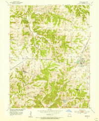
 1953 Armstrong1955 Print · USGSHoward and Randolph counties come alive in the mid-1950s as the rail-driven economy of the Missouri interior is captured in fine detail. Genealogists can trace family footprints at Wesley Chapel Cem, Sharon Sch, and the busy rail hub of Armstrong.2 unique versions available
 - 1953 Map of Clifton Hill, 1955 Print
 1953 Clifton Hill1955 Print · USGSRandolph and Chariton Counties come to life in the 1950s as the WABASH railroad connects the small community of Clifton Hill. Genealogists can trace family names through several rural burial grounds like Gross Cem and early school sites.2 unique versions available
 - 1953 Map of Moberly, 1955 Print
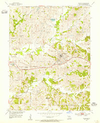
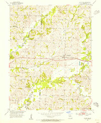
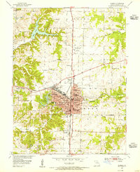 1953 Moberly1955 Print · USGSMoberly was a thriving mid-century railroad center at the crossroads of the Wabash and Missouri-Kansas-Texas lines. Researchers can trace numerous local institutions, from the Sisters of Loretto Sch to family landmarks like Daskin Cem and the Omar N Bradley Airport.3 unique versions available
 - 1953 Map of Prairie Hill, 1955 Print
 1953 Prairie Hill1955 Print · USGSNorth-central Missouri farming and mining communities come into focus in the mid-1950s. Genealogists and local historians can trace family locations near Prairie Hill, Cumberland Chapel, and the now-abandoned Old Grove Ch (Abandoned).2 unique versions available
 - 1954 Map of Moberly, 1969 Print
 1954 Moberly1969 Print · USGSMid-century Missouri is captured here during a period of transition for its river towns and rail hubs. Genealogists and historians can trace the paths of the Wabash railroad through Moberly or explore the riverside layout of Lexington and Brunswick.3 unique versions available
 - 1957 Map of Moberly
 1957 Moberly1957 Print · USGSNorth-central Missouri in the late nineteen-forties and fifties remains a landscape defined by its great rivers and a dense network of steam and diesel rail lines. Genealogists and historians can trace the paths of the Wabash RR and Santa Fe RR through historic junctions like Moberly, Brookfield, and Macon.
End of results
Showing maps 1-13 of 13
Top cities of Randolph County
- Moberly historical maps
- Huntsville historical maps
- Higbee historical maps
- Cairo historical maps
- Clark historical maps
- Renick historical maps
See more
Frequently asked questions
- What are the different types of historical maps available for Randolph County?
- What is the oldest map of Randolph County?
- Where can I purchase historical maps of Randolph County for my home or office?
- Where can I download high-res historical maps of Randolph County?
- Are there historical topographic maps available for Randolph County?
- Is there historical aerial imagery available for Randolph County?
- Where are historical maps of Randolph County sourced from?