Old Maps of Marcoot, Missouri
Explore 18 old maps of Marcoot, spanning from 1941 to today. These high-resolution historic maps reveal how streets, neighborhoods, landmarks, and natural features evolved over time — perfect for genealogy, metal detecting, research, and local history exploration.
What you can do with these maps:
- See how Marcoot changed over time: Compare historical maps to modern-day views to trace roads, homesites, rail lines & more.
- View detailed metadata: Each map includes creators, publishers, year, scale, and archive source.
- Overlay maps with satellite & LiDAR: Visualize the past alongside modern tools to explore terrain & human change.
- Trusted historical sources: Maps sourced from the USGS, Library of Congress, and other archives.
- Access maps your way: View online, download high-res files, or order prints for personal or research use.
Start exploring old maps of Marcoot to uncover forgotten places, hidden landmarks, and the deep history beneath your feet.
Marcoot, MO maps
(18)- 1941 Map of Stone Hill, 1958 Print
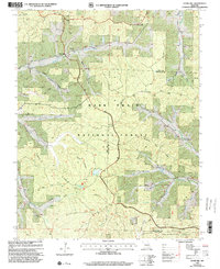
 1941 Stone Hill1958 Print · USGSDent County and the Ozark hills are captured here in the early 1940s, just as rural school districts and post-office hamlets still anchored local life. Genealogists and researchers can locate numerous family burial grounds and country schools, including Copeland Cem, Union Ch, and the remote Victory Sch.3 unique versions available
 - 1945 Map of Stone Hill
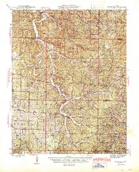 1945 Stone Hill1945 Print · USGSThe Ozark highlands of Dent County are shown here in the mid-1940s, a landscape defined by the upper Meramec River and deep forest preserves. Researchers can trace rural life through dozens of local landmarks, from the Indian Trail Fish Hatchery to remote settlements like Short Bend and Howes Mill PO.2 unique versions available
 - 1949 Map of Rolla, 1950 Print
 1949 Rolla1950 Print · USGSThe Missouri Ozarks are captured here just after the war, showing a landscape of deep river valleys and emerging reservoir projects. Genealogists and historians can trace the mining towns of Bonne Terre and Potosi or follow the early route of U.S. Highway 66.
 - 1953 Map of Rolla
 1953 Rolla1953 Print · USGSSoutheast Missouri’s mining towns and timberlands are seen here at the start of the 1950s. Genealogists and historians can trace the rail-and-river economy through local hubs like Fredericktown and the lead-mining heritage of Potosi and Desloge.
 - 1954 Map of Rolla, 1970 Print
 1954 Rolla1970 Print · USGSThe Missouri Ozarks and the historic Lead Belt are captured in the late sixties, showing a landscape of deep river hollows and industrial mines. Researchers can trace the routes of the Missouri Pacific RR to extraction sites like the Iron Mountain Mine or Pea Ridge Mine.2 unique versions available
 - 1958 Map of Rolla
 1958 Rolla1958 Print · USGSThe Missouri Ozarks and the lead-rich hills of the southeast are captured here in the late fifties as timber and mining shaped the local economy. Researchers can locate family landmarks like the Rolla Cemetery or trace old rail lines including the Missouri-Illinois RR and St Louis-San Francisco RR.
 - 1959 Map of Rolla
 1959 Rolla1959 Print · USGSMid-century Missouri is defined here by the deep forests of the Ozarks and the industrial peaks of the St Francois Mountains. Genealogists and historians can trace the development of towns like Potosi and Fredericktown or locate rural landmarks like Dry Fork Church and the Phelps County Courthouse.
 - 1960 Map of Rolla
 1960 Rolla1960 Print · USGSThe Ozark Highlands in the mid-twentieth century reveal a landscape of deep timber and heavy industry. Researchers can trace the rail-and-mine economy through the St Louis-San Francisco RR and the Iron Mountain Mine, alongside the growth of Fort Leonard Wood.
 - 1966 Map of Rolla
 1966 Rolla1966 Print · USGSThe Missouri Ozarks are revealed here in the mid-1960s, showing the intersection of heavy industry and sprawling national forests. Trace the development of the Lead Belt near Flat River or locate family roots in vanished hamlets like Enough and Howes Mill.
 - 1971 Map of Rolla
 1971 Rolla1971 Print · USGSThe Missouri Ozarks are captured here during the early seventies, showing a landscape of deep river valleys and industrial mining towns. Researchers can trace historic lead mining operations at St Joseph Mines and locate rural landmarks like Viburnum and the Galveston Trail.
 - 1981 Map of Stone Hill, 1982 Print
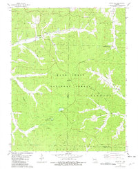 1981 Stone Hill1982 Print · USGSThe Dent County Ozarks come into focus in the early 1980s as the regional timber and mining legacy persists within the national forest. Researchers can trace family roots at Scotia Cem or locate the site of the Scotia Iron Mine and the historic Howes Mill.
 - 1986 Map of Rolla
 1986 Rolla1986 Print · USGSThe Missouri Ozarks are captured here in the mid-1980s, showcasing the intersection of deep forest wilderness and growing highway corridors. Genealogists and local historians can trace family roots through rural landmarks like Salem Memorial Cemetery or the rail-stop history of Cook Station and Steelville.2 unique versions available
 - 1989 Map of Rolla
 1989 Rolla1989 Print · USGSThe Missouri Ozarks are captured in the late eighties as a landscape of national forests and historic mining towns. Researchers can trace the rail lines of the Missouri Pacific RR or locate landmarks like Taum Sauk Mtn and Elephant Rocks State Park.
 - 1999 Map of Stone Hill, 2002 Print
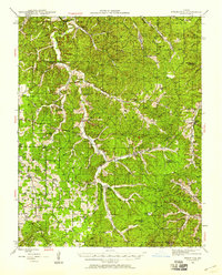
 1999 Stone Hill2002 Print · USGSThe Dent and Reynolds county line near the Meramec River is shown here at the turn of the millennium, following decades of forest management and rural change. Researchers can trace the heritage of small settlements and industries through the Scotia Iron Mine, the Stone Hill Ch, and Howes Mill.
 - 2012 Map of Stone Hill, 2012 Print
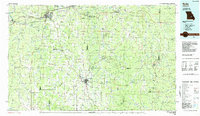
 2012 Stone Hill2012 Print · USGSCovers Marcoot, including Howes Mill, Stone Hill, and other nearby areas
 - 2015 Map of Stone Hill, 2015 Print
 2015 Stone Hill2015 Print · USGSCovers Marcoot, including Howes Mill, Stone Hill, and other nearby areas
 - 2017 Map of Stone Hill, 2017 Print
 2017 Stone Hill2017 Print · USGSCovers Marcoot, including Howes Mill, Stone Hill, and other nearby areas
 - 2021 Map of Stone Hill, 2021 Print
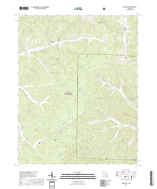 2021 Stone Hill2021 Print · USGSThe Ozark highlands of Dent and Reynolds Counties are documented here in recent years, showing a landscape shaped by narrow hollows and forest ridges. Genealogists can locate family landmarks like Nelson Schoolyard Graveyard and Parker Cem near Howes Mill.
End of results
Showing maps 1-18 of 18
Top cities near Marcoot
Frequently asked questions
- What are the different types of historical maps available for Marcoot?
- What is the oldest map of Marcoot?
- Where can I purchase historical maps of Marcoot for my home or office?
- Where can I download high-res historical maps of Marcoot?
- Are there historical topographic maps available for Marcoot?
- Is there historical aerial imagery available for Marcoot?
- Where are historical maps of Marcoot sourced from?