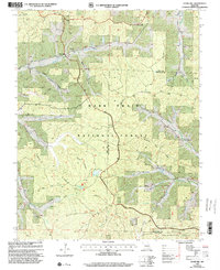
1999 Map of Stone Hill
USGS Topo · Published 2002About this map
Scotia Iron Mine and the surrounding valley floor document the industrial and social footprint of the Dent and Reynolds county border at the close of the twentieth century. The landscape is defined by the winding course of the Meramec River and the headwaters of the West Fork Huzzah Creek, where small settlements like Stone Hill and Howes Mill remain connected by rural routes such as Scenic Drive. The map provides a detailed view of the region's extractive and agrarian history through features like the Gravel Pit and several family burial grounds, including Scotia Cem and Brook Cem. The vast wooded expanse of the Mark Twain National Forest dominates the central topography, punctuated by high points like Marcoot Lookout and the long spine of Stooping Tree Ridge. To the south, the Sinkin Experimental Forest reflects specialized land management within the broader forest system.
Find a feature on this map
41 named features on this map. Tap any name to fly to it.
Don’t see what you’re looking for? This feature index may not catch every label — zoom into the map to look around manually.
Map Details
Editions of this 1999 Stone Hill Map
This is the sole edition of this map. No revisions or reprints were ever made.
Other maps of this area

1941 · Stone Hill
USGS Topo · 1:62,500

1943 · Boss
USGS Topo · 1:62,500

1944 · Corridon
USGS Topo · 1:62,500

1945 · Stone Hill
USGS Topo · 1:62,500

1945 · Round Spring
USGS Topo · 1:62,500

1946 · Boss
USGS Topo · 1:62,500

1947 · Sinkin
USGS Topo · 1:48,000

1947 · Corridon
USGS Topo · 1:62,500

1949 · Round Spring
USGS Topo · 1:62,500

1949 · Rolla
USGS Topo · 1:250,000