Old Maps of Iron Mountain Lake, Missouri
Explore 26 old maps of Iron Mountain Lake, spanning from 1937 to today. These high-resolution historic maps reveal how streets, neighborhoods, landmarks, and natural features evolved over time — perfect for genealogy, metal detecting, research, and local history exploration.
What you can do with these maps:
- See how Iron Mountain Lake changed over time: Compare historical maps to modern-day views to trace roads, homesites, rail lines & more.
- View detailed metadata: Each map includes creators, publishers, year, scale, and archive source.
- Overlay maps with satellite & LiDAR: Visualize the past alongside modern tools to explore terrain & human change.
- Trusted historical sources: Maps sourced from the USGS, Library of Congress, and other archives.
- Access maps your way: View online, download high-res files, or order prints for personal or research use.
Start exploring old maps of Iron Mountain Lake to uncover forgotten places, hidden landmarks, and the deep history beneath your feet.
Iron Mountain Lake, MO maps
(26)- 1937 Map of Ironton
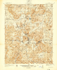 1937 Ironton1937 Print · USGSThe Arcadia Valley in the late 1930s is documented here during a period of established mining and rail activity. Researchers can trace family roots at Rebel Cem and Algire Cem, or locate rural landmarks like King Sch and the Devils Toll Gate.
 - 1945 Map of Ironton, 1955 Print
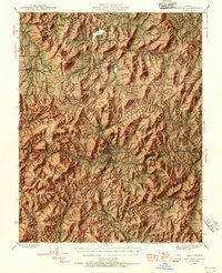 1945 Ironton1955 Print · USGSThe Arcadia Valley and the iron mining district of the St. Francois Mountains are captured here in the mid-1940s. Trace the path of the Missouri Pacific railroad through Pilot Knob and Ironton, or locate family sites like Schwab Cem and Flatwoods Sch.6 unique versions available
 - 1946 Map of Ironton
 1946 Ironton1946 Print · USGSThe Arcadia Valley and the high peaks of the St. Francois Mountains are captured here in the post-war era. Researchers can trace the Missouri Pacific rail line through historic Ironton or locate family sites like Rebel Cem and Hogan Sch.2 unique versions available
 - 1949 Map of Rolla, 1950 Print
 1949 Rolla1950 Print · USGSThe Missouri Ozarks are captured here just after the war, showing a landscape of deep river valleys and emerging reservoir projects. Genealogists and historians can trace the mining towns of Bonne Terre and Potosi or follow the early route of U.S. Highway 66.
 - 1953 Map of Ironton
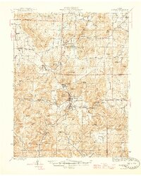
 1953 Ironton1953 Print · USGSThe St. Francois Mountains of the Missouri Ozarks are captured here during the mid-century industrial era. Genealogists and historians can trace rail-side settlements like Arcadia and Ironton or find family landmarks such as Rebel Cem and White Sch.
 - 1953 Map of Rolla
 1953 Rolla1953 Print · USGSSoutheast Missouri’s mining towns and timberlands are seen here at the start of the 1950s. Genealogists and historians can trace the rail-and-river economy through local hubs like Fredericktown and the lead-mining heritage of Potosi and Desloge.
 - 1954 Map of Rolla, 1970 Print
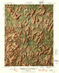
 1954 Rolla1970 Print · USGSThe Missouri Ozarks and the historic Lead Belt are captured in the late sixties, showing a landscape of deep river hollows and industrial mines. Researchers can trace the routes of the Missouri Pacific RR to extraction sites like the Iron Mountain Mine or Pea Ridge Mine.2 unique versions available
 - 1958 Map of Rolla
 1958 Rolla1958 Print · USGSThe Missouri Ozarks and the lead-rich hills of the southeast are captured here in the late fifties as timber and mining shaped the local economy. Researchers can locate family landmarks like the Rolla Cemetery or trace old rail lines including the Missouri-Illinois RR and St Louis-San Francisco RR.
 - 1959 Map of Rolla
 1959 Rolla1959 Print · USGSMid-century Missouri is defined here by the deep forests of the Ozarks and the industrial peaks of the St Francois Mountains. Genealogists and historians can trace the development of towns like Potosi and Fredericktown or locate rural landmarks like Dry Fork Church and the Phelps County Courthouse.
 - 1960 Map of Rolla
 1960 Rolla1960 Print · USGSThe Ozark Highlands in the mid-twentieth century reveal a landscape of deep timber and heavy industry. Researchers can trace the rail-and-mine economy through the St Louis-San Francisco RR and the Iron Mountain Mine, alongside the growth of Fort Leonard Wood.
 - 1966 Map of Rolla
 1966 Rolla1966 Print · USGSThe Missouri Ozarks are revealed here in the mid-1960s, showing the intersection of heavy industry and sprawling national forests. Trace the development of the Lead Belt near Flat River or locate family roots in vanished hamlets like Enough and Howes Mill.
 - 1968 Map of Graniteville, 1970 Print
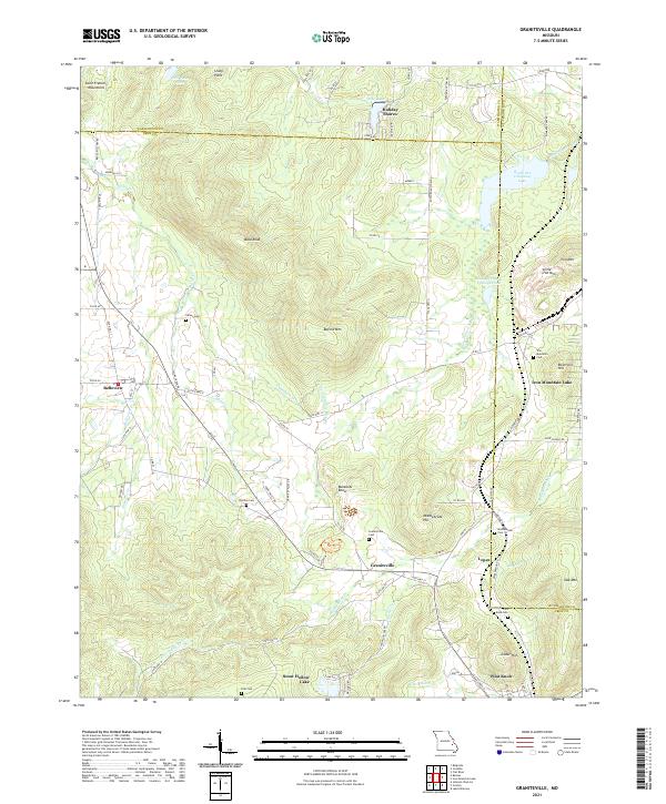
 1968 Graniteville1970 Print · USGSThe Missouri Ozarks are captured here in the late sixties as the region's quarrying and mining heritage remains clearly visible. Genealogists and historians can trace family locations through Belleview Sch and Thomas Cem, or follow the industrial legacy of the Missouri Pacific near Graniteville.2 unique versions available
 - 1968 Map of Iron Mountain Lake, 1970 Print
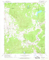
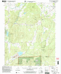
 1968 Iron Mountain Lake1970 Print · USGSIn the Missouri Ozarks during the late 1960s, the terrain south of the St Francis River was a mix of national forest and active mining communities. Local historians can trace old property lines and cemetery locations like German Cem, or explore the rail network through Iron Mountain Lake and Doe Run.2 unique versions available
 - 1971 Map of Rolla
 1971 Rolla1971 Print · USGSThe Missouri Ozarks are captured here during the early seventies, showing a landscape of deep river valleys and industrial mining towns. Researchers can trace historic lead mining operations at St Joseph Mines and locate rural landmarks like Viburnum and the Galveston Trail.
 - 1986 Map of Farmington
 1986 Farmington1986 Print · USGSThe Missouri Lead Belt and the eastern Ozarks are detailed here in the mid-1980s, showcasing a landscape of intensive mining and deep forest. Researchers can trace the Missouri Pacific RR line through industrial centers like Bonne Terre and Flat River, or locate remote landmarks like Elephant Rocks.
 - 1987 Map of Farmington
 1987 Farmington1987 Print · USGSThe St. Francois Mountains and Missouri Lead Belt are shown in the late eighties as industry and conservation converged. Researchers can trace the rail lines of the Missouri Pacific and locate historic mining sites like Mine La Motte and the Iron Mountain Mine.
 - 1989 Map of Rolla
 1989 Rolla1989 Print · USGSThe Missouri Ozarks are captured in the late eighties as a landscape of national forests and historic mining towns. Researchers can trace the rail lines of the Missouri Pacific RR or locate landmarks like Taum Sauk Mtn and Elephant Rocks State Park.
 - 2000 Map of Iron Mountain Lake, 2003 Print
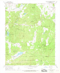
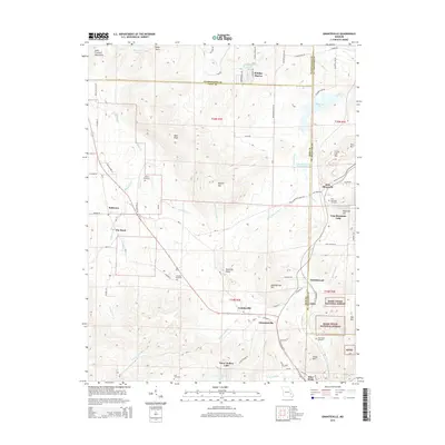
 2000 Iron Mountain Lake2003 Print · USGSThe St. Francois Mountains area of Missouri is captured here just as the new millennium began, showing a landscape defined by mining history and timbered heights. Researchers can trace family roots through several rural burial sites like the German Cem and landmarks such as Stone Union Ch or the settlement of Doe Run.
 - 2011 Map of Iron Mountain Lake, 2011 Print
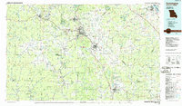
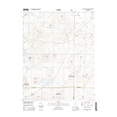
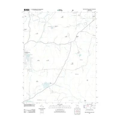 2011 Iron Mountain Lake2011 Print · USGSCovers Iron Mountain Lake, including Mineral City, Saint Francois County, and other nearby areas
 - 2011 Map of Graniteville, 2011 Print
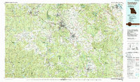
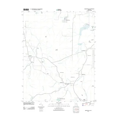 2011 Graniteville2011 Print · USGSCovers Iron Mountain Lake, including Pilot Knob, Belleview, and other nearby areas
 - 2015 Map of Iron Mountain Lake, 2015 Print
 2015 Iron Mountain Lake2015 Print · USGSCovers Iron Mountain Lake, including Mineral City, Saint Francois County, and other nearby areas
 - 2015 Map of Graniteville, 2015 Print
 2015 Graniteville2015 Print · USGSCovers Iron Mountain Lake, including Pilot Knob, Belleview, and other nearby areas
 - 2017 Map of Iron Mountain Lake, 2017 Print
 2017 Iron Mountain Lake2017 Print · USGSCovers Iron Mountain Lake, including Mineral City, Saint Francois County, and other nearby areas
 - 2017 Map of Graniteville, 2017 Print
 2017 Graniteville2017 Print · USGSCovers Iron Mountain Lake, including Pilot Knob, Belleview, and other nearby areas
 - 2021 Map of Graniteville, 2021 Print
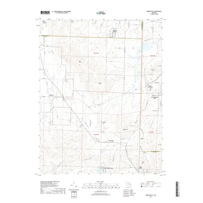
 2021 Graniteville2021 Print · USGSThe mining and mountain heritage of Iron County is preserved here in the early twenty-first century. Researchers can trace family roots through numerous sites like Graniteville Cem, Middlebrook Cem, and the old residential lanes of Belleview.
Showing maps 1-25 of 26
Top cities near Iron Mountain Lake
- Farmington historical maps
- Park Hills historical maps
- Bonne Terre historical maps
- Desloge historical maps
- Bismarck historical maps
- Ironton historical maps
See more
Frequently asked questions
- What are the different types of historical maps available for Iron Mountain Lake?
- What is the oldest map of Iron Mountain Lake?
- Where can I purchase historical maps of Iron Mountain Lake for my home or office?
- Where can I download high-res historical maps of Iron Mountain Lake?
- Are there historical topographic maps available for Iron Mountain Lake?
- Is there historical aerial imagery available for Iron Mountain Lake?
- Where are historical maps of Iron Mountain Lake sourced from?