Old Maps of Ninnescah Park, Missouri for Academic Research
Study the evolution of Ninnescah Park with 15 high-resolution historic maps. Whether you're teaching, researching, or modeling changes in land use, these maps provide essential visual documentation of urban, environmental, and geographic change.
- Analyze long-term change: Track patterns in development, transportation, and natural features.
- Ideal for environmental or urban studies: Support academic projects with primary historical map data.
- Use in the classroom or lab: Educators and researchers rely on these maps to bring historical context to life.
These maps are a powerful tool for teaching, research, and visualizing how Ninnescah Park has changed over the decades.
Ninnescah Park, MO maps
(15)- 1887 Map of Clinton
 1887 Clinton1887 Print · USGSWest-Central Missouri is captured during a period of rapid railroad expansion in the 1880s, centered on the growing junction at Clinton. Researchers can trace early township developments and find established settlements like Chalk Level, Iconium, and Brownington along the winding Osage River.
 - 1894 Map of Clinton
 1894 Clinton1894 Print · USGSHenry County and St. Clair County thrive during the peak of the railroad era in the 1890s. Genealogists and historians can trace the early rail stops at Clinton and Brownington, or locate vanished post offices like Chalk Level and Huntingdale.4 unique versions available
 - 1941 Map of Valhalla, 1963 Print
 1941 Valhalla1963 Print · USGSThe Osage River valley in the early 1940s was a landscape of sharp bends and small riverside outposts. Researchers can trace rural life through family-named landmarks like McGuiness Bend, local gathering spots like the Valhalla Store, and the Peaceful Home Cem.2 unique versions available
 - 1945 Map of Valhalla
 1945 Valhalla1945 Print · USGSThe Osage River valley in the mid-1940s is captured here just as rural life began to shift away from old river fords and camp settlements. Genealogists can locate Peaceful Home Cem, Valhalla P O, and family-named schools like Wright Creek Sch.
 - 1947 Map of Jefferson City, 1949 Print
 1947 Jefferson City1949 Print · USGSCentral Missouri and the northern Ozarks come into focus in this late 1940s survey of the river-and-rail landscape. Genealogists and historians can trace the growth of Jefferson City and Sedalia or locate family roots near Bagnell Dam and the Lake of the Ozarks.
 - 1954 Map of Jefferson City
 1954 Jefferson City1954 Print · USGSCentral Missouri in the early postwar years showcases a landscape defined by the winding Lake of the Ozarks and the state capital at Jefferson City. Researchers can trace the mid-century rail networks of the Missouri Pacific RR and locate rural communities like Tuscumbia, St Elizabeth, and St Anthony.2 unique versions available
 - 1955 Map of Jefferson City, 1967 Print
 1955 Jefferson City1967 Print · USGSCentral Missouri in the mid-fifties is defined by the winding Missouri River and the expanding reach of Lake of the Ozarks. Researchers can trace the rail corridors of the Missouri Pacific or locate the early footprint of Whiteman AFB and Jefferson City.4 unique versions available
 - 1958 Map of Jefferson City
 1958 Jefferson City1958 Print · USGSCentral Missouri in the late fifties shows a region transforming through the growth of Whiteman Air Force Base and the Lake of the Ozarks. Researchers can trace rail lines like the Missouri Pacific or find family roots at Enloe Cemetery and Mount Pleasant Cem.
 - 1959 Map of Jefferson City
 1959 Jefferson City1959 Print · USGSCentral Missouri is captured during the mid-fifties as the river economy and rail networks like the Missouri Pacific met the rise of the automobile. Local researchers can trace family landmarks and rural infrastructure from the Lake of the Ozarks up to Providence Cemetery and Knob Noster State Park.
 - 1983 Map of Harry S Truman Reservoir, 1984 Print
 1983 Harry S Truman Reservoir1984 Print · USGSBenton and Henry counties center on the vast Harry S Truman Reservoir in the early 1980s as the landscape adapted to its new shoreline. Genealogists and historians can trace old river crossings like Bledsoe Ferry, local landmarks like Mt Zion Ch, and unique settlements such as Tightwad.
 - 1991 Map of Ninnescah Park
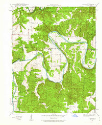
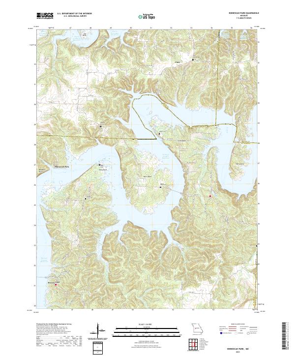
 1991 Ninnescah Park1991 Print · USGSThe Harry S Truman Reservoir reshaped the Missouri river valleys in the late twentieth century, creating a labyrinth of water and timber. Genealogists and local historians can locate early burial grounds like Peaceful Home Cem and settlements such as Leesville and Finey.
 - 2011 Map of Ninnescah Park, 2011 Print
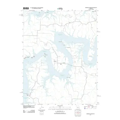 2011 Ninnescah Park2011 Print · USGSCovers Ninnescah Park, including Finey, Fox Run, and other nearby areas
 - 2014 Map of Ninnescah Park, 2014 Print
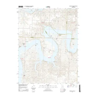 2014 Ninnescah Park2014 Print · USGSCovers Ninnescah Park, including Finey, Fox Run, and other nearby areas
 - 2017 Map of Ninnescah Park, 2017 Print
 2017 Ninnescah Park2017 Print · USGSCovers Ninnescah Park, including Finey, Fox Run, and other nearby areas
 - 2021 Map of Ninnescah Park, 2021 Print
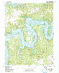
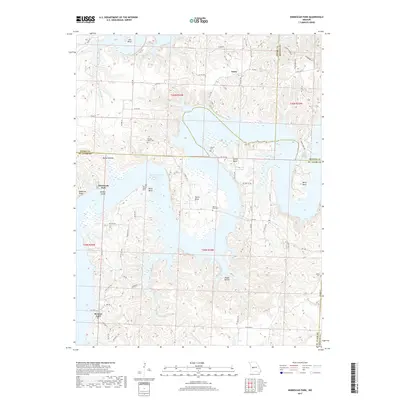
 2021 Ninnescah Park2021 Print · USGSThe meeting point of Henry, Benton, and St. Clair counties is shown here in the early twenty-first century as the reservoir reshaped the valley. Genealogists can trace family landmarks like Wright Creek Cem and old community centers such as Finey or Browns Ford.
End of results
Showing maps 1-15 of 15
Top cities near Ninnescah Park
- Clinton historical maps
- Leesville historical maps
- Osceola historical maps
- Lowry City historical maps
- Deepwater historical maps
- Brownington historical maps
See more
Frequently asked questions
- What are the different types of historical maps available for Ninnescah Park?
- What is the oldest map of Ninnescah Park?
- Where can I purchase historical maps of Ninnescah Park for my home or office?
- Where can I download high-res historical maps of Ninnescah Park?
- Are there historical topographic maps available for Ninnescah Park?
- Is there historical aerial imagery available for Ninnescah Park?
- Where are historical maps of Ninnescah Park sourced from?