Old Maps of Hi-Pointe, St. Louis for Genealogy
Trace your family roots with 13 historic maps of Hi-Pointe. These high-res maps reveal old neighborhoods, homesites, landmarks, and streets — helping you uncover where your ancestors lived and how the area evolved over time.
- Explore historic neighborhoods: Identify where your relatives may have lived in the 1800s or 1900s.
- Compare maps over time: Trace the changes in streets, buildings, and landmarks for multi-generational research.
- Perfect for genealogy & ancestry research: Used by family historians and researchers to map out lineage and migration.
These maps are an incredible resource for exploring your personal connection to Hi-Pointe's past.
Hi-Pointe, St. Louis maps
(13)- 1933 Map of Jefferson Barracks
 1933 Jefferson Barracks1933 Print · USGSCovers Hi-Pointe, including Mehlville, Webster Groves, and other nearby areas
 - 1933 Map of Clayton
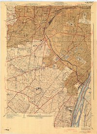
 1933 Clayton1933 Print · USGSCovers Hi-Pointe, including University City, Ferguson, and other nearby areas
 - 1941 Map of Clayton
 1941 Clayton1941 Print · USGSCovers Hi-Pointe, including University City, Ferguson, and other nearby areas2 unique versions available
 - 1941 Map of Jefferson Barracks
 1941 Jefferson Barracks1941 Print · USGSCovers Hi-Pointe, including Mehlville, Webster Groves, and other nearby areas3 unique versions available
 - 1949 Map of Saint Louis
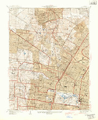
 1949 Saint Louis1949 Print · USGSCovers Hi-Pointe, including St. Louis, O'Fallon, and other nearby areas2 unique versions available
 - 1954 Map of Clayton, 1959 Print
 1954 Clayton1959 Print · USGSCovers Hi-Pointe, including University City, Ferguson, and other nearby areas6 unique versions available
 - 1954 Map of Webster Groves, 1959 Print
 1954 Webster Groves1959 Print · USGSCovers Hi-Pointe, including Mehlville, Webster Groves, and other nearby areas5 unique versions available
 - 1962 Map of St. Louis
 1962 St. Louis1962 Print · USGSCovers Hi-Pointe, including St. Louis, O'Fallon, and other nearby areas
 - 1963 Map of St. Louis, 1970 Print
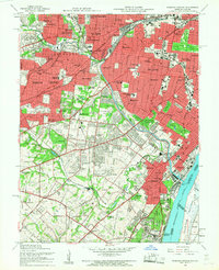
 1963 St. Louis1970 Print · USGSCovers Hi-Pointe, including St. Louis, O'Fallon, and other nearby areas4 unique versions available
 - 1966 Map of St. Louis
 1966 St. Louis1966 Print · USGSCovers Hi-Pointe, including St. Louis, O'Fallon, and other nearby areas
 - 1985 Map of St Louis
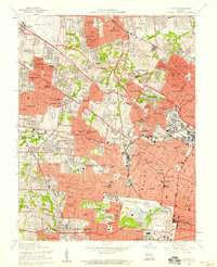
 1985 St Louis1985 Print · USGSCovers Hi-Pointe, including St. Louis, O'Fallon, and other nearby areas3 unique versions available
 - 1993 Map of Webster Groves, 1996 Print
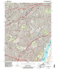 1993 Webster Groves1996 Print · USGSCovers Hi-Pointe, including Mehlville, Webster Groves, and other nearby areas
 - 1998 Map of Webster Groves, 1999 Print
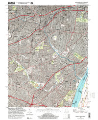 1998 Webster Groves1999 Print · USGSCovers Hi-Pointe, including Mehlville, Webster Groves, and other nearby areas2 unique versions available
End of results
Showing maps 1-13 of 13
Frequently asked questions
- What are the different types of historical maps available for Hi-Pointe?
- What is the oldest map of Hi-Pointe?
- Where can I purchase historical maps of Hi-Pointe for my home or office?
- Where can I download high-res historical maps of Hi-Pointe?
- Are there historical topographic maps available for Hi-Pointe?
- Is there historical aerial imagery available for Hi-Pointe?
- Where are historical maps of Hi-Pointe sourced from?