Old Maps of Hazleton, Missouri for Academic Research
Study the evolution of Hazleton with 13 high-resolution historic maps. Whether you're teaching, researching, or modeling changes in land use, these maps provide essential visual documentation of urban, environmental, and geographic change.
- Analyze long-term change: Track patterns in development, transportation, and natural features.
- Ideal for environmental or urban studies: Support academic projects with primary historical map data.
- Use in the classroom or lab: Educators and researchers rely on these maps to bring historical context to life.
These maps are a powerful tool for teaching, research, and visualizing how Hazleton has changed over the decades.
Hazleton, MO maps
(13)- 1941 Map of Big Piney
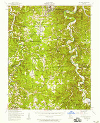
 1941 Big Piney1941 Print · USGSThe Ozarks at the dawn of the war years reveal a landscape of rural schoolhouses and river bends before military expansion. Genealogists can trace family roots through Lone Star Sch, Cook Cem, and the now-transformed settlement of Bloodland.
 - 1943 Map of Big Piney
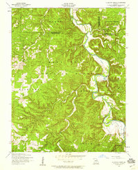
 1943 Big Piney1943 Print · USGSThe Missouri Ozarks are shown here during the early years of the Second World War as federal land expansion reshaped the region. Genealogists and local historians can trace family roots through numerous country schools like Lone Star Sch and churches including St Annie Ch and Dondas Ch.2 unique versions available
 - 1954 Map of Springfield
 1954 Springfield1954 Print · USGSThe Missouri Ozarks are captured here during the post-war era, showing the expansion of Springfield and the surrounding river valleys. Genealogists and historians can trace local landmarks like Mount Comfort Cemetery and the Fort Leonard Wood military grounds.6 unique versions available
 - 1954 Map of Big Piney, 1958 Print
 1954 Big Piney1958 Print · USGSThe mid-century Ozark highlands are captured here during a period of massive federal transition, as military expansion met traditional rural life. Researchers can trace family names and vanished sites through the Bloodland Cemetery, the Roby Lookout Tower, and several abandoned schoolhouses like Morman Valley School.3 unique versions available
 - 1954 Map of Slabtown Spring, 1959 Print
 1954 Slabtown Spring1959 Print · USGSTexas County and the surrounding Ozark river valleys are shown in the mid-fifties, just as rural school consolidation began leaving landmarks like the Harmon Valley School behind. Genealogists can trace family sites at Omalley Cem or locate the riverside settlements of Slabtown and Hazleton.3 unique versions available
 - 1958 Map of Springfield
 1958 Springfield1958 Print · USGSThe Missouri Ozarks are captured during the mid-century era of growth, centered on the bustling hub of Springfield. Genealogists and historians can trace family roots through numerous landmarks like Ebenezer Church, Stockton Cem, and the various county courthouses.
 - 1959 Map of Springfield
 1959 Springfield1959 Print · USGSThe Missouri Ozarks are captured here during a decade of postwar growth and increasing highway connectivity. Researchers can trace the legacy of the St Louis-San Francisco RR and locate early sites in Springfield, Lebanon, and Mountain Grove.
 - 1982 Map of Lebanon, 1983 Print
 1982 Lebanon1983 Print · USGSThe Missouri Ozarks are captured in the early eighties as Interstate 44 and the St Louis-San Francisco rail line link growing towns with the Fort Leonard Wood Military Reservation. Genealogists and historians can trace family-named sites like Flatwood Church and old post offices at Sleeper and Nebo.
 - 2004 Map of Slabtown Spring, 2006 Print
 2004 Slabtown Spring2006 Print · USGSThe Missouri Ozarks are captured here at the dawn of the new millennium, showcasing a landscape of dense forests and river hollows. Researchers can locate the Omalley Cem, trace the waters of Slabtown Spring, or explore the limits of the Paddy Creek Wilderness.
 - 2012 Map of Slabtown Spring, 2012 Print
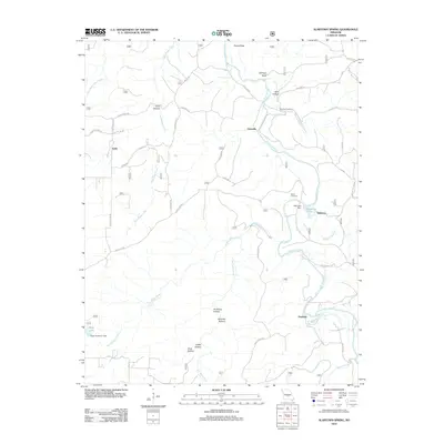 2012 Slabtown Spring2012 Print · USGSCovers Hazleton, including Edanville, Slabtown, and other nearby areas
 - 2015 Map of Slabtown Spring, 2015 Print
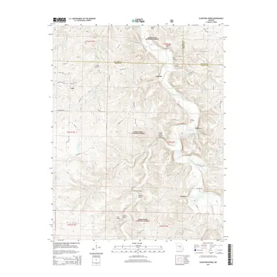 2015 Slabtown Spring2015 Print · USGSCovers Hazleton, including Edanville, Slabtown, and other nearby areas
 - 2017 Map of Slabtown Spring, 2017 Print
 2017 Slabtown Spring2017 Print · USGSCovers Hazleton, including Edanville, Slabtown, and other nearby areas
 - 2021 Map of Slabtown Spring, 2021 Print
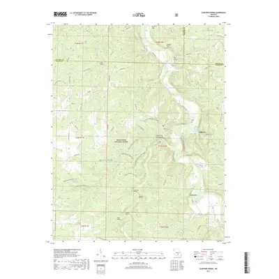
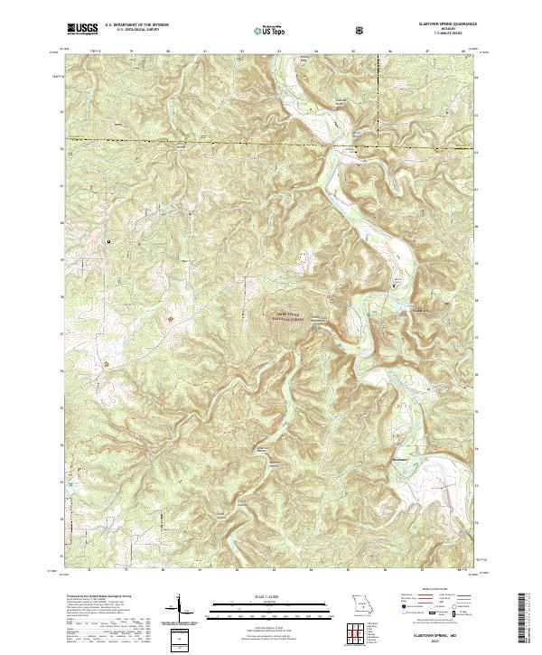 2021 Slabtown Spring2021 Print · USGSTexas County and the surrounding Ozark woodlands are shown here in the early 2020s, centered on the Big Piney River corridor. Genealogists and hikers can trace local landmarks like Omalley Cem, the site of Baldridge School, and the Paddy Creek Natural Arch.
End of results
Showing maps 1-13 of 13
Top cities near Hazleton
- Sherrill historical maps
- Houston historical maps
- Roubidoux historical maps
- Licking historical maps
- Upton historical maps
- Raymondville historical maps
See more
Frequently asked questions
- What are the different types of historical maps available for Hazleton?
- What is the oldest map of Hazleton?
- Where can I purchase historical maps of Hazleton for my home or office?
- Where can I download high-res historical maps of Hazleton?
- Are there historical topographic maps available for Hazleton?
- Is there historical aerial imagery available for Hazleton?
- Where are historical maps of Hazleton sourced from?