Old Maps of Licking, Missouri
Explore 31 old maps of Licking, spanning from 1937 to today. These high-resolution historic maps reveal how streets, neighborhoods, landmarks, and natural features evolved over time — perfect for genealogy, metal detecting, research, and local history exploration.
What you can do with these maps:
- See how Licking changed over time: Compare historical maps to modern-day views to trace roads, homesites, rail lines & more.
- View detailed metadata: Each map includes creators, publishers, year, scale, and archive source.
- Overlay maps with satellite & LiDAR: Visualize the past alongside modern tools to explore terrain & human change.
- Trusted historical sources: Maps sourced from the USGS, Library of Congress, and other archives.
- Access maps your way: View online, download high-res files, or order prints for personal or research use.
Start exploring old maps of Licking to uncover forgotten places, hidden landmarks, and the deep history beneath your feet.
Licking, MO maps
(31)- 1937 Map of Edgar Springs
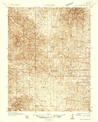 1937 Edgar Springs1937 Print · USGSThe Missouri Ozarks are captured here during the mid-1930s, showing the intersection of rural life and New Deal conservation efforts. Genealogists can locate family landmarks like Freemans Store, Mette Sch, and the Blooming Rose CCC Camp No 1732.
 - 1945 Map of Edgar Springs
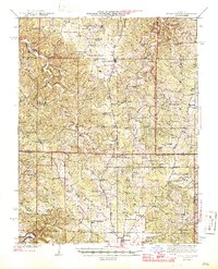 1945 Edgar Springs1945 Print · USGSThe Missouri Ozarks are captured here in the mid-1940s, showing a landscape of upland ridges and deep hollows at the borders of Phelps and Texas counties. Researchers can trace rural community life through the Blooming Rose CCC Camp and remote sites like Bethlehem Sch & Pray Cem.2 unique versions available
 - 1949 Map of Rolla, 1950 Print
 1949 Rolla1950 Print · USGSThe Missouri Ozarks are captured here just after the war, showing a landscape of deep river valleys and emerging reservoir projects. Genealogists and historians can trace the mining towns of Bonne Terre and Potosi or follow the early route of U.S. Highway 66.
 - 1951 Map of Licking, 1952 Print
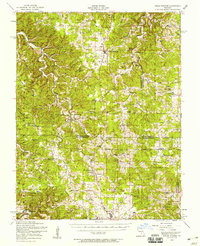
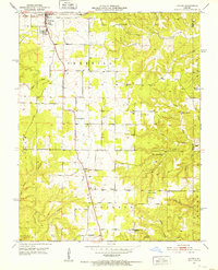 1951 Licking1952 Print · USGSMid-century Texas County Missouri comes alive in this survey, showing the rural landscape around Licking just after the war. Local historians can trace family ties at sites like Shipp Cem, Mahan Cem, and the old Wildwood Sch.3 unique versions available
 - 1951 Map of Raymondville, 1958 Print
 1951 Raymondville1958 Print · USGSTexas County, Missouri, is shown here in the early fifties, capturing a landscape of small upland farms and Ozark river bends. Genealogists and local historians can locate dozens of country schools and churches, such as the Whitlock School, Boone Creek Church, and the County Farm Cemetery.3 unique versions available
 - 1953 Map of Rolla
 1953 Rolla1953 Print · USGSSoutheast Missouri’s mining towns and timberlands are seen here at the start of the 1950s. Genealogists and historians can trace the rail-and-river economy through local hubs like Fredericktown and the lead-mining heritage of Potosi and Desloge.
 - 1954 Map of Edgar Springs, 1958 Print
 1954 Edgar Springs1958 Print · USGSThe northern Ozarks come alive in this mid-century survey of the Phelps, Dent, and Texas county borders. Trace the location of family landmarks and community centers like the Lady of Perpetual Help Church, West Point School, and Beulah Cemetery.2 unique versions available
 - 1954 Map of Maples, 1959 Print
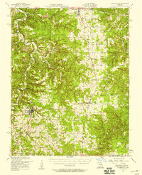
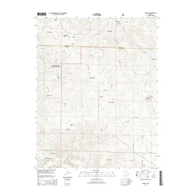
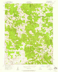 1954 Maples1959 Print · USGSThe rural borderlands of Texas and Dent counties are captured here in the mid-1950s. Researchers can trace dozens of family landmarks and local community centers, from Stoney Point School and Bethel Church to the early layout of Licking.2 unique versions available
 - 1954 Map of Beulah, 1959 Print
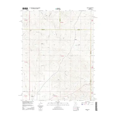
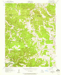 1954 Beulah1959 Print · USGSThe Ozark woodlands of Texas County were still dotted with one-room schools and family burial grounds in the mid-1950s. Trace the rural landscape through Beulah, find the Licking State Forest Nursery, or locate landmarks like Craddock School and Texas Lookout Tower.2 unique versions available
 - 1954 Map of Rolla, 1970 Print
 1954 Rolla1970 Print · USGSThe Missouri Ozarks and the historic Lead Belt are captured in the late sixties, showing a landscape of deep river hollows and industrial mines. Researchers can trace the routes of the Missouri Pacific RR to extraction sites like the Iron Mountain Mine or Pea Ridge Mine.2 unique versions available
 - 1958 Map of Rolla
 1958 Rolla1958 Print · USGSThe Missouri Ozarks and the lead-rich hills of the southeast are captured here in the late fifties as timber and mining shaped the local economy. Researchers can locate family landmarks like the Rolla Cemetery or trace old rail lines including the Missouri-Illinois RR and St Louis-San Francisco RR.
 - 1959 Map of Rolla
 1959 Rolla1959 Print · USGSMid-century Missouri is defined here by the deep forests of the Ozarks and the industrial peaks of the St Francois Mountains. Genealogists and historians can trace the development of towns like Potosi and Fredericktown or locate rural landmarks like Dry Fork Church and the Phelps County Courthouse.
 - 1960 Map of Rolla
 1960 Rolla1960 Print · USGSThe Ozark Highlands in the mid-twentieth century reveal a landscape of deep timber and heavy industry. Researchers can trace the rail-and-mine economy through the St Louis-San Francisco RR and the Iron Mountain Mine, alongside the growth of Fort Leonard Wood.
 - 1966 Map of Rolla
 1966 Rolla1966 Print · USGSThe Missouri Ozarks are revealed here in the mid-1960s, showing the intersection of heavy industry and sprawling national forests. Trace the development of the Lead Belt near Flat River or locate family roots in vanished hamlets like Enough and Howes Mill.
 - 1971 Map of Rolla
 1971 Rolla1971 Print · USGSThe Missouri Ozarks are captured here during the early seventies, showing a landscape of deep river valleys and industrial mining towns. Researchers can trace historic lead mining operations at St Joseph Mines and locate rural landmarks like Viburnum and the Galveston Trail.
 - 1986 Map of Spring Valley
 1986 Spring Valley1986 Print · USGSThe Missouri Ozarks are showcased in the mid-1980s, revealing a landscape defined by state forests and the protected waters of the Current River. Researchers can trace local heritage through landmarks like Oakside Ch, Fletcher Mine, and Summersville Cem.2 unique versions available
 - 1986 Map of Rolla
 1986 Rolla1986 Print · USGSThe Missouri Ozarks are captured here in the mid-1980s, showcasing the intersection of deep forest wilderness and growing highway corridors. Genealogists and local historians can trace family roots through rural landmarks like Salem Memorial Cemetery or the rail-stop history of Cook Station and Steelville.2 unique versions available
 - 1989 Map of Rolla
 1989 Rolla1989 Print · USGSThe Missouri Ozarks are captured in the late eighties as a landscape of national forests and historic mining towns. Researchers can trace the rail lines of the Missouri Pacific RR or locate landmarks like Taum Sauk Mtn and Elephant Rocks State Park.
 - 2004 Map of Beulah, 2006 Print
 2004 Beulah2006 Print · USGSThe Big Piney River valley and the Mark Twain National Forest define this part of the Ozarks in the early 2000s. Genealogists and local historians can locate several family cemeteries and former school sites like Beulah Cem, Walnut Ridge Sch, and the George O White State Forest Nursery.
 - 2011 Map of Licking, 2011 Print
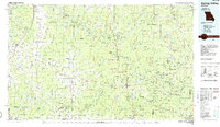
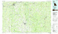
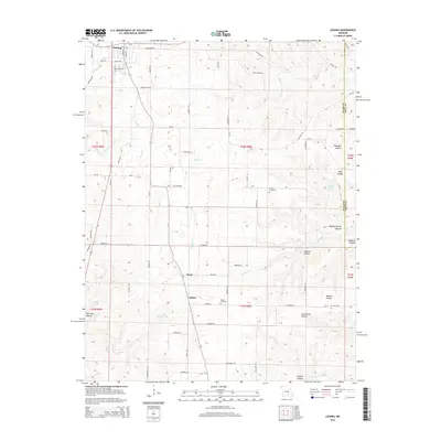
 2011 Licking2011 Print · USGSCovers Licking, including Oscar, Mahan, and other nearby areas
 - 2011 Map of Maples, 2011 Print
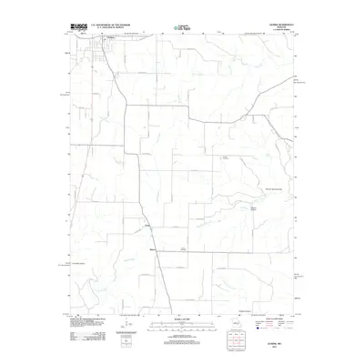
 2011 Maples2011 Print · USGSCovers Licking, including Coulstone, Kimble, and other nearby areas
 - 2011 Map of Beulah, 2011 Print
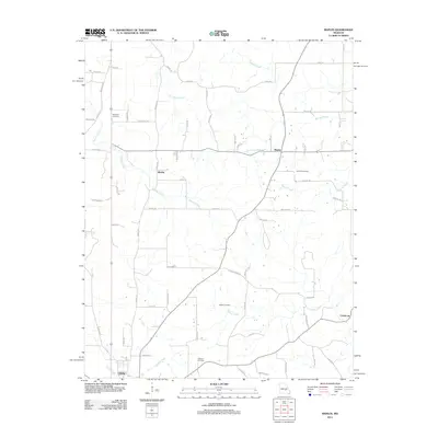
 2011 Beulah2011 Print · USGSCovers Licking, including Sherrill, Dent, and other nearby areas
 - 2015 Map of Beulah, 2015 Print
 2015 Beulah2015 Print · USGSCovers Licking, including Sherrill, Dent, and other nearby areas
 - 2015 Map of Maples, 2015 Print
 2015 Maples2015 Print · USGSCovers Licking, including Coulstone, Kimble, and other nearby areas
 - 2015 Map of Licking, 2015 Print
 2015 Licking2015 Print · USGSCovers Licking, including Oscar, Mahan, and other nearby areas
Showing maps 1-25 of 31
Top cities near Licking
- Sherrill historical maps
- Houston historical maps
- Raymondville historical maps
- Edgar Springs historical maps
Frequently asked questions
- What are the different types of historical maps available for Licking?
- What is the oldest map of Licking?
- Where can I purchase historical maps of Licking for my home or office?
- Where can I download high-res historical maps of Licking?
- Are there historical topographic maps available for Licking?
- Is there historical aerial imagery available for Licking?
- Where are historical maps of Licking sourced from?