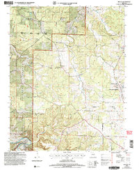
2004 Map of Beulah
USGS Topo · Published 2006About this map
The Big Piney River winds through the southwestern corner of this landscape, where the Masons Bridge River Access and Boat Launch provides a key point of entry for the waterway. Much of the terrain is defined by the Mark Twain National Forest, specifically the Rolla Houston Ranger District. This area is marked by numerous family-named burial grounds and historic community hubs, including the Beulah Cem, Mitchell Cem, and the Craddock School Site.
Find a feature on this map
44 named features on this map. Tap any name to fly to it.
Don’t see what you’re looking for? This feature index may not catch every label — zoom into the map to look around manually.
Map Details
Editions of this 2004 Beulah Map
This is the sole edition of this map. No revisions or reprints were ever made.
Other maps of this area

1937 · Edgar Springs
USGS Topo · 1:48,000

1941 · Big Piney
USGS Topo · 1:62,500

1941 · Bado
USGS Topo · 1:62,500

1943 · Big Piney
USGS Topo · 1:62,500

1943 · Bado
USGS Topo · 1:62,500

1945 · Edgar Springs
USGS Topo · 1:62,500

1949 · Rolla
USGS Topo · 1:250,000

1951 · Licking
USGS Topo · 1:24,000

1951 · Prescott
USGS Topo · 1:24,000

1951 · Raymondville
USGS Topo · 1:62,500