Old Maps of Lakeview, Montana for Hiking & Exploration
Hike through history with 7 historic maps of Lakeview. Explore old trails, ghost towns, and forgotten backroads — perfect for outdoor adventurers and local explorers.
- Rediscover forgotten places: Map out old mining camps, roads, and footpaths that no longer exist on modern maps.
- Layer with modern tools: Combine with LiDAR or satellite views to plan hikes through historical terrain.
- Made for exploration: Popular among hikers, overlanders, and local history lovers.
Use these maps to find adventure and explore the hidden past of Lakeview.
Lakeview, MT maps
(7)- 1950 Map of Lower Red Rock Lake, 1954 Print
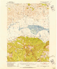 1950 Lower Red Rock Lake1954 Print · USGSThe high Centennial Valley comes to life in the early fifties, where ranching and conservation meet along the Continental Divide. Genealogists and historians can trace family locations like the Goble Ranch, the Doyle School, and the remote Landon Camp.5 unique versions available
 - 1955 Map of Ashton, 1967 Print
 1955 Ashton1967 Print · USGSThe Greater Yellowstone ecosystem is captured here during the mid-1950s, showing the high plateaus and remote gateway towns of Idaho and Montana. Researchers can trace the Union Pacific line to Ashton or locate small settlements like Squirrel and Grainville.4 unique versions available
 - 1958 Map of Ashton
 1958 Ashton1958 Print · USGSGreater Yellowstone and the eastern Idaho borderlands appear here in the mid-1950s as rail and road networks connected remote mountain basins. Trace the Union Pacific route through Ashton or locate early outposts like Last Chance, Squirrel, and West Yellowstone.
 - 1960 Map of Ashton
 1960 Ashton1960 Print · USGSThe Idaho-Montana-Wyoming borderlands at the dawn of the sixties show a landscape defined by the Continental Divide and early wilderness tourism. Genealogists and historians can trace rail-stop settlements like Trude Siding, old outposts like Warm River, and early lodging at Snowball Inn.
 - 1988 Map of Slide Mountain
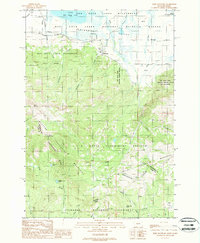 1988 Slide Mountain1988 Print · USGSThe Centennial Valley and the high peaks of the Continental Divide meet in this late 1980s study of the Montana-Idaho border. Researchers can trace the layout of the U S Sheep Experiment Station and the settlement at Lakeview near the Red Rock Lakes Refuge.
 - 1993 Map of Hebgen Lake
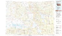 1993 Hebgen Lake1993 Print · USGSThe high mountain passes and vast river basins of the Montana-Idaho border come into focus in the early nineties. Genealogists and historians can trace the remote settlement of Lakeview and the development of West Yellowstone near the Red Rock Lakes National Wildlife Refuge.2 unique versions available
 - 2024 Map of Slide Mountain, 2024 Print
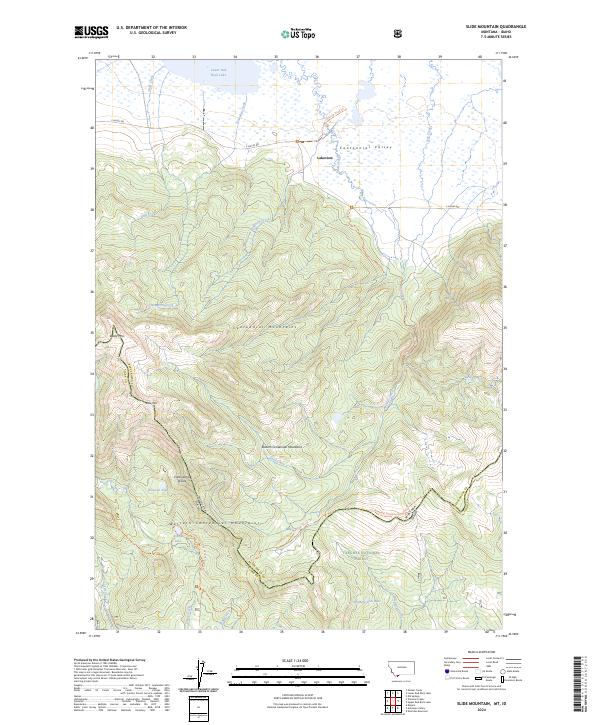 2024 Slide Mountain2024 Print · USGSThe Centennial Mountains and the Montana-Idaho border come alive in this contemporary survey of the high-divide country. Hikers and historians can trace the Continental Divide National Scenic Trail past Aldous Lake and the settlement at Lakeview.
End of results
Showing maps 1-7 of 7
Frequently asked questions
- What are the different types of historical maps available for Lakeview?
- What is the oldest map of Lakeview?
- Where can I purchase historical maps of Lakeview for my home or office?
- Where can I download high-res historical maps of Lakeview?
- Are there historical topographic maps available for Lakeview?
- Is there historical aerial imagery available for Lakeview?
- Where are historical maps of Lakeview sourced from?