Old Maps of Downtown, Great Falls for Metal Detecting
Plan your next treasure hunt with 12 historic maps of Downtown. Find old homesites, ghost towns, trails, and gathering spots that may be lost to time — perfect for identifying promising metal detecting locations.
- Locate forgotten sites: Uncover places like long-lost settlements, abandoned rail lines, or gathering spots.
- Plan better hunts: Use map overlays combined with LiDAR or satellite views to narrow in on historically rich areas.
- Made for detectorists: Thousands of hobbyists use these maps to discover relics, coins, and hidden history.
Use these historic maps to boost your research and find new opportunities beneath the surface of Downtown.
Downtown, Great Falls maps
(12)- 1886 Map of Great Falls
 1886 Great Falls1886 Print · USGSCentral Montana in the mid-1880s is defined by its great river systems and the early footprints of frontier outposts. Researchers can trace the early development of Great Falls, find the site of St. Peter's Mission, and locate river settlements like Truly and Fort Shaw.4 unique versions available
 - 1949 Map of Great Falls, 1966 Print
 1949 Great Falls1966 Print · USGSMid-century Great Falls and the Missouri River basin are shown here during a period of post-war industrial and educational expansion. Researchers can trace the heritage of the area via the Bootlegger Trail, the Black Eagle Dam, and schools like Ursuline Academy and McKinley Sch.
 - 1951 Map of Great Falls
 1951 Great Falls1951 Print · USGSGreat Falls and the surrounding Cascade County plains come alive in this mid-century survey of the Missouri River basin. Genealogists and local historians can trace the early layout of Black Eagle, locate the Ursuline Academy, and follow the historic Bootlegger Trail.2 unique versions available
 - 1954 Map of Great Falls
 1954 Great Falls1954 Print · USGSThe Missouri River valley in the mid-1950s is shown at a time of significant industrial and military growth. Genealogists and historians can locate early schools and rail stops like Tiger Butte Community Center, Fort Benton, and the Anaconda Wire Plant.4 unique versions available
 - 1957 Map of Great Falls
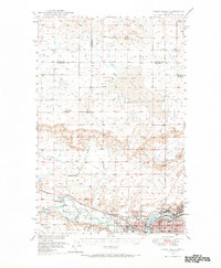
 1957 Great Falls1957 Print · USGSMontana's central plains and mountain foothills are captured here in the mid-fifties, showing the hub of Great Falls and the surrounding grain-shipping towns. Genealogists can trace family roots through the rail sidings of the Great Northern and small rural communities like Sand Coulee or Fort Benton.
 - 1965 Map of Northwest Great Falls, 1968 Print
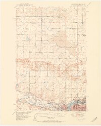
 1965 Northwest Great Falls1968 Print · USGSMid-century Great Falls is a hub of industry and transport at the confluence of the Missouri and Sun rivers. Trace the rail lines of the Great Northern and local landmarks like the Black Eagle Dam or the Ursuline Academy.3 unique versions available
 - 1976 Map of Great Falls North, 1990 Print
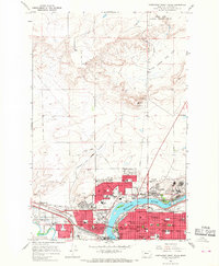
 1976 Great Falls North1990 Print · USGSNorth of the Missouri River in the mid-seventies, this survey shows a region defined by extensive irrigation projects and the growing footprint of Great Falls. Researchers can trace the Burlington Northern rail lines through Dutton or locate the sprawling Benton Lake National Wildlife Refuge.
 - 2011 Map of Northwest Great Falls, 2011 Print
 2011 Northwest Great Falls2011 Print · USGSCovers Downtown, including Great Falls, Cascade County, and other nearby areas
 - 2014 Map of Northwest Great Falls, 2014 Print
 2014 Northwest Great Falls2014 Print · USGSCovers Downtown, including Great Falls, Cascade County, and other nearby areas
 - 2017 Map of Northwest Great Falls, 2017 Print
 2017 Northwest Great Falls2017 Print · USGSCovers Downtown, including Great Falls, Cascade County, and other nearby areas
 - 2020 Map of Northwest Great Falls, 2020 Print
 2020 Northwest Great Falls2020 Print · USGSCovers Downtown, including Great Falls, Cascade County, and other nearby areas
 - 2024 Map of Northwest Great Falls, 2024 Print
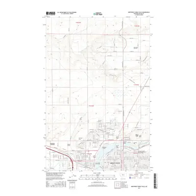
 2024 Northwest Great Falls2024 Print · USGSGreat Falls and the surrounding Cascade County plains come into sharp focus in this recent survey. Researchers can trace the modern development of Great Falls alongside legacy landmarks like Smelter Hill, Emerson Junction, and Black Eagle Falls.
End of results
Showing maps 1-12 of 12
Frequently asked questions
- What are the different types of historical maps available for Downtown?
- What is the oldest map of Downtown?
- Where can I purchase historical maps of Downtown for my home or office?
- Where can I download high-res historical maps of Downtown?
- Are there historical topographic maps available for Downtown?
- Is there historical aerial imagery available for Downtown?
- Where are historical maps of Downtown sourced from?