2000s (21st Century) Maps of Grayling, Montana
Explore 6 historic maps of Grayling from the 2000s (21st Century). These maps offer a rare glimpse into what life looked like during the 2000s — showing old roads, neighborhoods, homes, and landmarks that have changed or disappeared over time.
Whether you're researching your family's past, planning a metal detecting trip, or studying how Grayling's landscape evolved across the 2000s, these high-resolution maps are a powerful tool for exploring the history of this region.
- Focus on a specific era: All maps on this page are from the 2000s, giving you a focused view of this time period.
- See what’s changed: Compare century-old streets, trails, and buildings to today's modern landscape using overlays and satellite layers.
- Research with precision: Use these maps for genealogy, historical research, land use analysis, or educational projects.
- View, download, or print: Maps are fully viewable online in high resolution, and can be downloaded or printed for your own records.
Start exploring Grayling's history through authentic maps from the 2000s. This is your window into the past.
Grayling, MT maps
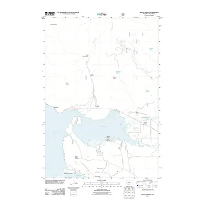
(6)- 2000 Map of Mount Hebgen, 2005 Print
 2000 Mount Hebgen2005 Print · USGSGallatin County during the late twentieth century reveals a landscape defined by seismic history and lakeside recreation. Researchers can trace the shoreline settlements of Grayling and Lakeview or locate the geologic scars of the Red Canyon Fault.
 - 2011 Map of Mount Hebgen, 2011 Print
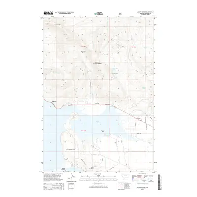
 2011 Mount Hebgen2011 Print · USGSCovers Grayling, including Horse Butte Acres Trailer Court, Lakeview, and other nearby areas
 - 2014 Map of Mount Hebgen, 2014 Print
 2014 Mount Hebgen2014 Print · USGSCovers Grayling, including Horse Butte Acres Trailer Court, Lakeview, and other nearby areas
 - 2017 Map of Mount Hebgen, 2017 Print
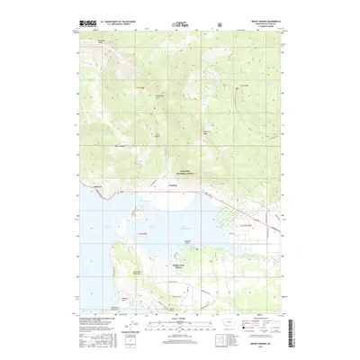 2017 Mount Hebgen2017 Print · USGSCovers Grayling, including Horse Butte Acres Trailer Court, Lakeview, and other nearby areas
 - 2020 Map of Mount Hebgen, 2020 Print
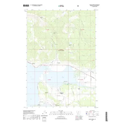 2020 Mount Hebgen2020 Print · USGSCovers Grayling, including Horse Butte Acres Trailer Court, Lakeview, and other nearby areas
 - 2024 Map of Mount Hebgen, 2024 Print
 2024 Mount Hebgen2024 Print · USGSGallatin County at the edge of the Madison Valley is shown here in detail during the early twenty-first century. Researchers can trace the development of Hebgen Lake Estates or explore the wilderness trails around Mt Hebgen and Johnson Lake.
End of results
Showing maps 1-6 of 6
Top cities near Grayling
Frequently asked questions
- What are the different types of historical maps available for Grayling?
- What is the oldest map of Grayling?
- Where can I purchase historical maps of Grayling for my home or office?
- Where can I download high-res historical maps of Grayling?
- Are there historical topographic maps available for Grayling?
- Is there historical aerial imagery available for Grayling?
- Where are historical maps of Grayling sourced from?