2000s (21st Century) Maps of Lonesome Hurst Summer Home Area, Montana
Explore 6 historic maps of Lonesome Hurst Summer Home Area from the 2000s (21st Century). These maps offer a rare glimpse into what life looked like during the 2000s — showing old roads, neighborhoods, homes, and landmarks that have changed or disappeared over time.
Whether you're researching your family's past, planning a metal detecting trip, or studying how Lonesome Hurst Summer Home Area's landscape evolved across the 2000s, these high-resolution maps are a powerful tool for exploring the history of this region.
- Focus on a specific era: All maps on this page are from the 2000s, giving you a focused view of this time period.
- See what’s changed: Compare century-old streets, trails, and buildings to today's modern landscape using overlays and satellite layers.
- Research with precision: Use these maps for genealogy, historical research, land use analysis, or educational projects.
- View, download, or print: Maps are fully viewable online in high resolution, and can be downloaded or printed for your own records.
Start exploring Lonesome Hurst Summer Home Area's history through authentic maps from the 2000s. This is your window into the past.
Lonesome Hurst Summer Home Area, MT maps
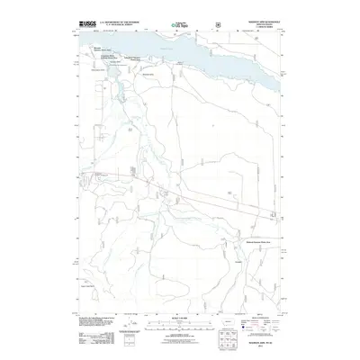
(6)- 2000 Map of Madison Arm, 2005 Print
 2000 Madison Arm2005 Print · USGSThe Montana-Idaho borderland near West Yellowstone is captured here at the turn of the century, showing a landscape shaped by forest recreation and water. Researchers can trace the development of seasonal communities like Madison Arm Resort and Bar N Ranch near Hebgen Lake.
 - 2011 Map of Madison Arm, 2011 Print
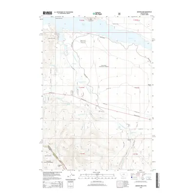
 2011 Madison Arm2011 Print · USGSCovers Lonesome Hurst Summer Home Area, including Romsett Summer Home Area, Lakeshore Summer Home Area, and other nearby areas
 - 2014 Map of Madison Arm, 2014 Print
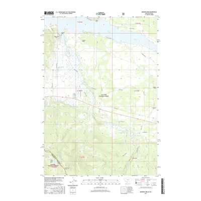
 2014 Madison Arm2014 Print · USGSCovers Lonesome Hurst Summer Home Area, including Romsett Summer Home Area, Lakeshore Summer Home Area, and other nearby areas
 - 2017 Map of Madison Arm, 2017 Print
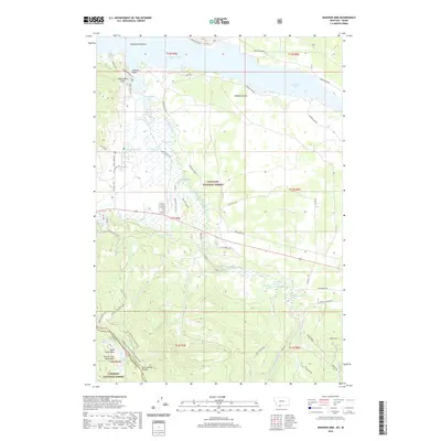
 2017 Madison Arm2017 Print · USGSCovers Lonesome Hurst Summer Home Area, including Romsett Summer Home Area, Lakeshore Summer Home Area, and other nearby areas
 - 2020 Map of Madison Arm, 2020 Print
 2020 Madison Arm2020 Print · USGSCovers Lonesome Hurst Summer Home Area, including Romsett Summer Home Area, Lakeshore Summer Home Area, and other nearby areas
 - 2024 Map of Madison Arm, 2024 Print
 2024 Madison Arm2024 Print · USGSThe Montana-Idaho border comes alive in this contemporary survey of the high mountain drainages around Hebgen Lake. Researchers can trace the Continental Divide and explore historical access routes like Old Stage Road and family-named landmarks such as Slushers Point.
End of results
Showing maps 1-6 of 6
Top cities near Lonesome Hurst Summer Home Area
Frequently asked questions
- What are the different types of historical maps available for Lonesome Hurst Summer Home Area?
- What is the oldest map of Lonesome Hurst Summer Home Area?
- Where can I purchase historical maps of Lonesome Hurst Summer Home Area for my home or office?
- Where can I download high-res historical maps of Lonesome Hurst Summer Home Area?
- Are there historical topographic maps available for Lonesome Hurst Summer Home Area?
- Is there historical aerial imagery available for Lonesome Hurst Summer Home Area?
- Where are historical maps of Lonesome Hurst Summer Home Area sourced from?