Old Maps of Railroad Summer Home Area, Montana for Academic Research
Study the evolution of Railroad Summer Home Area with 12 high-resolution historic maps. Whether you're teaching, researching, or modeling changes in land use, these maps provide essential visual documentation of urban, environmental, and geographic change.
- Analyze long-term change: Track patterns in development, transportation, and natural features.
- Ideal for environmental or urban studies: Support academic projects with primary historical map data.
- Use in the classroom or lab: Educators and researchers rely on these maps to bring historical context to life.
These maps are a powerful tool for teaching, research, and visualizing how Railroad Summer Home Area has changed over the decades.
Railroad Summer Home Area, MT maps
(12)- 1955 Map of Ashton, 1967 Print
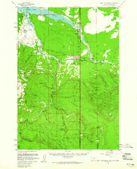
 1955 Ashton1967 Print · USGSThe Greater Yellowstone ecosystem is captured here during the mid-1950s, showing the high plateaus and remote gateway towns of Idaho and Montana. Researchers can trace the Union Pacific line to Ashton or locate small settlements like Squirrel and Grainville.4 unique versions available
 - 1958 Map of Ashton
 1958 Ashton1958 Print · USGSGreater Yellowstone and the eastern Idaho borderlands appear here in the mid-1950s as rail and road networks connected remote mountain basins. Trace the Union Pacific route through Ashton or locate early outposts like Last Chance, Squirrel, and West Yellowstone.
 - 1958 Map of West Yellowstone, 1960 Print
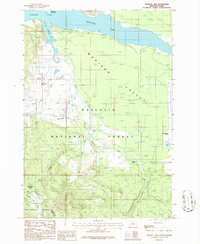
 1958 West Yellowstone1960 Print · USGSWest Yellowstone and the surrounding national forests are captured here in the late fifties, just before a major earthquake altered the region. Researchers can trace early park access via the Union Pacific and locate remote outposts like Whitmans Cabin and the Basin Ranger Sta.3 unique versions available
 - 1960 Map of Ashton
 1960 Ashton1960 Print · USGSThe Idaho-Montana-Wyoming borderlands at the dawn of the sixties show a landscape defined by the Continental Divide and early wilderness tourism. Genealogists and historians can trace rail-stop settlements like Trude Siding, old outposts like Warm River, and early lodging at Snowball Inn.
 - 1986 Map of Madison Arm
 1986 Madison Arm1986 Print · USGSThe high mountain basins of the Montana-Idaho border are captured here in the mid-1980s, centered on the expansive waters of Hebgen Lake. Researchers can trace the Old Railroad Grade, locate the remote Basin Cabin, and map the rugged line of the Continental Divide.2 unique versions available
 - 1993 Map of Hebgen Lake
 1993 Hebgen Lake1993 Print · USGSThe high mountain passes and vast river basins of the Montana-Idaho border come into focus in the early nineties. Genealogists and historians can trace the remote settlement of Lakeview and the development of West Yellowstone near the Red Rock Lakes National Wildlife Refuge.2 unique versions available
 - 2000 Map of Madison Arm, 2005 Print
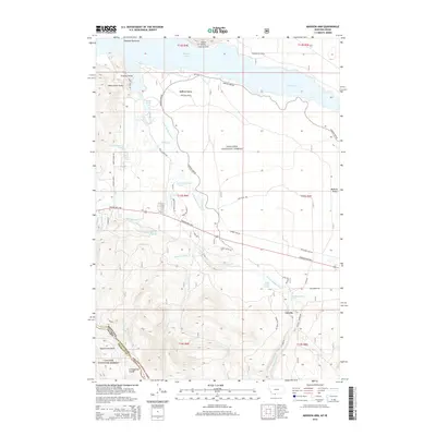
 2000 Madison Arm2005 Print · USGSThe Montana-Idaho borderland near West Yellowstone is captured here at the turn of the century, showing a landscape shaped by forest recreation and water. Researchers can trace the development of seasonal communities like Madison Arm Resort and Bar N Ranch near Hebgen Lake.
 - 2011 Map of Madison Arm, 2011 Print
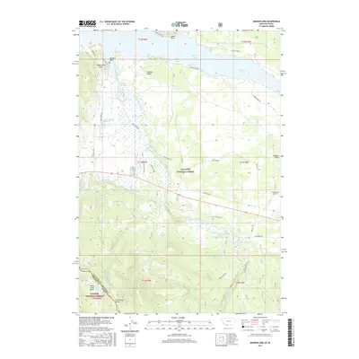
 2011 Madison Arm2011 Print · USGSCovers Railroad Summer Home Area, including Romsett Summer Home Area, Lakeshore Summer Home Area, and other nearby areas
 - 2014 Map of Madison Arm, 2014 Print
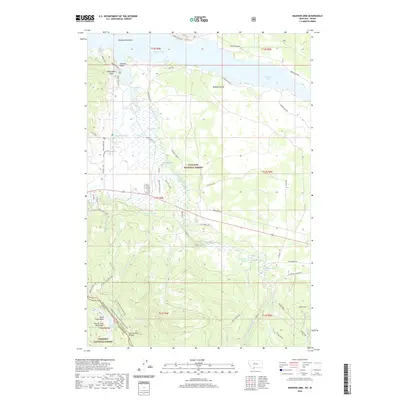
 2014 Madison Arm2014 Print · USGSCovers Railroad Summer Home Area, including Romsett Summer Home Area, Lakeshore Summer Home Area, and other nearby areas
 - 2017 Map of Madison Arm, 2017 Print
 2017 Madison Arm2017 Print · USGSCovers Railroad Summer Home Area, including Romsett Summer Home Area, Lakeshore Summer Home Area, and other nearby areas
 - 2020 Map of Madison Arm, 2020 Print
 2020 Madison Arm2020 Print · USGSCovers Railroad Summer Home Area, including Romsett Summer Home Area, Lakeshore Summer Home Area, and other nearby areas
 - 2024 Map of Madison Arm, 2024 Print
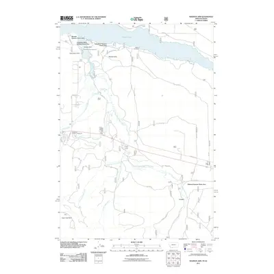
 2024 Madison Arm2024 Print · USGSThe Montana-Idaho border comes alive in this contemporary survey of the high mountain drainages around Hebgen Lake. Researchers can trace the Continental Divide and explore historical access routes like Old Stage Road and family-named landmarks such as Slushers Point.
End of results
Showing maps 1-12 of 12
Top cities near Railroad Summer Home Area
Frequently asked questions
- What are the different types of historical maps available for Railroad Summer Home Area?
- What is the oldest map of Railroad Summer Home Area?
- Where can I purchase historical maps of Railroad Summer Home Area for my home or office?
- Where can I download high-res historical maps of Railroad Summer Home Area?
- Are there historical topographic maps available for Railroad Summer Home Area?
- Is there historical aerial imagery available for Railroad Summer Home Area?
- Where are historical maps of Railroad Summer Home Area sourced from?