1900s (20th Century) Maps of Libby, Montana
Explore 11 historic maps of Libby from the 1900s (20th Century). These maps offer a rare glimpse into what life looked like during the 1900s — showing old roads, neighborhoods, homes, and landmarks that have changed or disappeared over time.
Whether you're researching your family's past, planning a metal detecting trip, or studying how Libby's landscape evolved across the 1900s, these high-resolution maps are a powerful tool for exploring the history of this region.
- Focus on a specific era: All maps on this page are from the 1900s, giving you a focused view of this time period.
- See what’s changed: Compare century-old streets, trails, and buildings to today's modern landscape using overlays and satellite layers.
- Research with precision: Use these maps for genealogy, historical research, land use analysis, or educational projects.
- View, download, or print: Maps are fully viewable online in high resolution, and can be downloaded or printed for your own records.
Start exploring Libby's history through authentic maps from the 1900s. This is your window into the past.
Libby, MT maps
(11)- 1920 Map of Libby
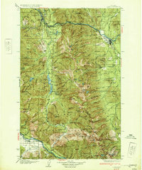
 1920 Libby1920 Print · USGSNorthwest Montana in the early twentieth century shows a landscape shaped by the Great Northern RR and industrial mining. You can locate family landmarks like Morrow Ranch, the Snowstorm Mines, and early post offices at Troy and Heron.
 - 1930 Map of Libby, 1960 Print
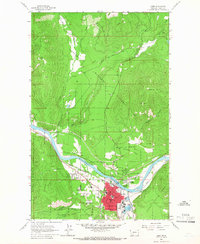
 1930 Libby1960 Print · USGSNorthwestern Montana at the opening of the 1930s is a rugged domain of mountain mining and timber camps. Genealogists and researchers can trace early settlers through labels like Old Town, Bull Lake Sch, and high-country operations such as the Snowshoe Mine.
 - 1932 Map of Libby
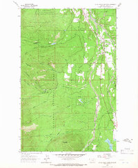
 1932 Libby1932 Print · USGSThe Kootenai River valley and surrounding mountain ranges are captured here in the early 1930s during the height of the region's mining and timber era. Genealogists and historians can locate remote landmarks like Old Town, the Snowshoe Mine, and early rural schools including Bull Lake Sch.3 unique versions available
 - 1957 Map of Kalispell, 1967 Print
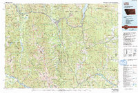
 1957 Kalispell1967 Print · USGSNorthwest Montana in the late fifties showcases a mountain landscape transitioning between wilderness and industry. Genealogists and researchers can trace the Great Northern rail corridor through Kalispell and Whitefish, or locate landmarks like the Montana Soldiers Home and Hungry Horse Reservoir.3 unique versions available
 - 1960 Map of Kalispell
 1960 Kalispell1960 Print · USGSNorthwest Montana in the late fifties is defined by the mountain corridors of the Great Northern Railway and the vast reaches of Glacier National Park. Researchers can trace the legacy of timber and mining towns like Libby, Rexford, and Whitefish, or locate landmarks such as the Snowshoe Mine.
 - 1961 Map of Kalispell
 1961 Kalispell1961 Print · USGSNorthwestern Montana at the start of the 1960s shows a landscape of timber-driven rail towns and the sprawling wild lands of Glacier National Park. Genealogists and historians can trace the route of the Great Northern through mountain passes or locate old settlements like Fortine, Trego, and Warland.
 - 1963 Map of Libby, 1966 Print
 1963 Libby1966 Print · USGSLibby sits along the Kootenai River in the early sixties, a mountain town anchored by rail and forest industry. Researchers can locate family landmarks like Asa Wood Jr HS, the local Cem, and the Drive-in Theater west of town.2 unique versions available
 - 1963 Map of Little Hoodoo Mountain, 1968 Print
 1963 Little Hoodoo Mountain1968 Print · USGSLincoln County, Montana, was a center for mining and timber when this survey was conducted in the early 1960s. Genealogists and historians can trace old claims like the Lukens Hazel Mine or locate early landmarks such as the Mc Grade Sch and White Haven.2 unique versions available
 - 1978 Map of Libby, 1993 Print
 1978 Libby1993 Print · USGSNorthwestern Montana in the late seventies and early eighties shows the impact of the newly formed Koocanusa Lake on the river economy. Genealogists and historians can trace local mining claims like the Snowstorm Mine or find smaller communities such as Happys Inn and White Haven.
 - 1997 Map of Libby, 2000 Print
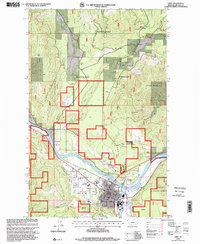 1997 Libby2000 Print · USGSThe mountain town of Libby is documented here in the late nineties, positioned at the junction of the Kootenai River and the national forest. Researchers can trace the local landscape from the Drive-in Theater and Plummer Sch to the high elevations of Sheldon Mountain.
 - 1997 Map of Little Hoodoo Mountain, 2000 Print
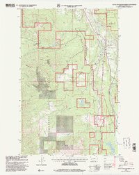 1997 Little Hoodoo Mountain2000 Print · USGSLincoln County as it appeared in the late nineties showcases a landscape of mountain mining and quiet forest settlements. Trace family roots and local industry at White Haven, the Mc Grade Sch, and the Herbert Mine.
End of results
Showing maps 1-11 of 11
Frequently asked questions
- What are the different types of historical maps available for Libby?
- What is the oldest map of Libby?
- Where can I purchase historical maps of Libby for my home or office?
- Where can I download high-res historical maps of Libby?
- Are there historical topographic maps available for Libby?
- Is there historical aerial imagery available for Libby?
- Where are historical maps of Libby sourced from?