Old Maps of Sheridan, Montana
Explore 14 old maps of Sheridan, spanning from 1893 to today. These high-resolution historic maps reveal how streets, neighborhoods, landmarks, and natural features evolved over time — perfect for genealogy, metal detecting, research, and local history exploration.
What you can do with these maps:
- See how Sheridan changed over time: Compare historical maps to modern-day views to trace roads, homesites, rail lines & more.
- View detailed metadata: Each map includes creators, publishers, year, scale, and archive source.
- Overlay maps with satellite & LiDAR: Visualize the past alongside modern tools to explore terrain & human change.
- Trusted historical sources: Maps sourced from the USGS, Library of Congress, and other archives.
- Access maps your way: View online, download high-res files, or order prints for personal or research use.
Start exploring old maps of Sheridan to uncover forgotten places, hidden landmarks, and the deep history beneath your feet.
Sheridan, MT maps
(14)- 1893 Map of Dillon
 1893 Dillon1893 Print · USGSSouthwestern Montana’s mountain ranges and river basins were being reshaped by the mining and rail boom in the late nineteenth century. Genealogists and historians can trace the early layout of Dillon and vanished camps like Hecla, Rochester, and Argenta.5 unique versions available
 - 1955 Map of Dillon, 1978 Print
 1955 Dillon1978 Print · USGSSouthwest Montana at the dawn of the interstate era reveals a landscape of high-mountain ranching and historic mining camps. Trace the routes of the Union Pacific through Dillon and Armstead, or locate early settlements like Bannack and Wisdom.2 unique versions available
 - 1957 Map of Dillon
 1957 Dillon1957 Print · USGSSouthwest Montana and Idaho in the mid-fifties reveal a high-country landscape of mountain ranges and ranching valleys. Genealogists can trace family holdings and rail stops along the Union Pacific Railroad, from Dillon to historic Virginia City and Twin Bridges.
 - 1958 Map of Dillon
 1958 Dillon1958 Print · USGSSouthwestern Montana during the late fifties reveals a high-country landscape defined by the Continental Divide and a legacy of mountain mining. Genealogists and historians can trace rail lines like the Union Pacific or locate early industrial sites including the Hecla Mine and Ermont Mine.
 - 1962 Map of Dillon
 1962 Dillon1962 Print · USGSSouthwest Montana in the early sixties is defined by its high mountain ranges and the winding rivers that carved its settlement patterns. Trace the rail routes of the Union Pacific through Dillon or locate mining activity near Butte and Argenta.
 - 1963 Map of Sheridan, 1964 Print
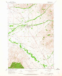 1963 Sheridan1964 Print · USGSThe Ruby River valley comes alive in this early 1960s survey, showing a landscape defined by ranching and the Northern Pacific railroad. Trace the network of historic irrigation ditches and find landmarks like Robbers Roost Sch and the Tamarack Mine.2 unique versions available
 - 1965 Map of Dillon
 1965 Dillon1965 Print · USGSSouthwest Montana in the mid-1960s is defined by its rugged river valleys and high mountain passes along the Continental Divide. Researchers can trace the path of the Union Pacific through Dillon and Armstead, or locate early mining activity near Melrose and Wise River.
 - 1983 Map of Dillon
 1983 Dillon1983 Print · USGSSouthwestern Montana’s ranching and mining heritage is recorded here in the early eighties, centered on the growing hub of Dillon. Researchers can trace the legacy of early gold strikes at Bannack or locate legacy claims like the Silver Bell Mine and Legal Tender Mine.
 - 1997 Map of Sheridan, 2002 Print
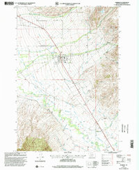 1997 Sheridan2002 Print · USGSSheridan and the surrounding Ruby Valley are captured here in the late nineties as a thriving agricultural and mining corridor. Researchers can trace the extensive irrigation network through the West Bench Canal and locate sites like the Robbers Roost Sch or the Tamarack Mine.
 - 2011 Map of Sheridan, 2011 Print
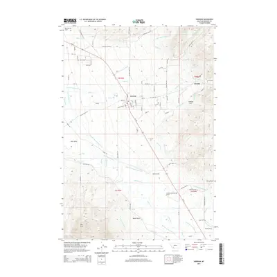
 2011 Sheridan2011 Print · USGSCovers Sheridan, including Brandon, Sheridan Trailer Court, and other nearby areas
 - 2014 Map of Sheridan, 2014 Print
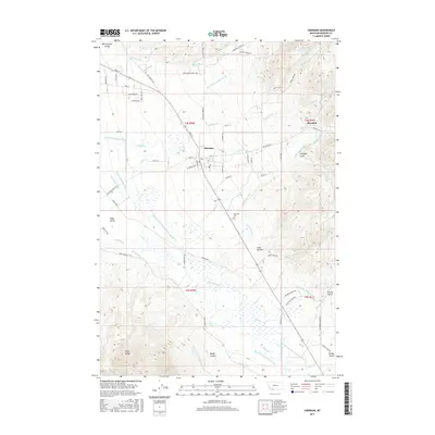
 2014 Sheridan2014 Print · USGSCovers Sheridan, including Brandon, Sheridan Trailer Court, and other nearby areas
 - 2017 Map of Sheridan, 2017 Print
 2017 Sheridan2017 Print · USGSCovers Sheridan, including Brandon, Sheridan Trailer Court, and other nearby areas
 - 2020 Map of Sheridan, 2020 Print
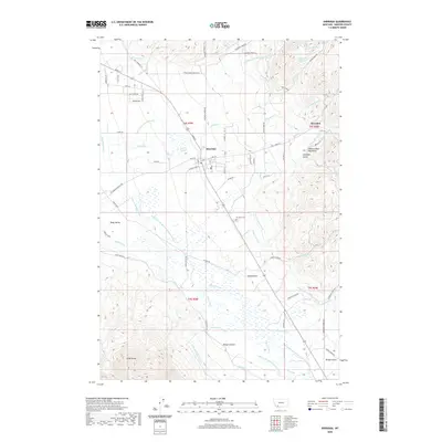 2020 Sheridan2020 Print · USGSCovers Sheridan, including Brandon, Sheridan Trailer Court, and other nearby areas
 - 2024 Map of Sheridan, 2024 Print
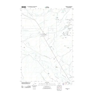
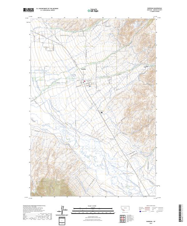 2024 Sheridan2024 Print · USGSThe Madison County town of Sheridan is captured in the modern era, positioned between the Tobacco Root Mountains and the Ruby River. Genealogists and historians can trace family lands near Oxbow Ranch or explore the complex network of early irrigation like the Vigilante Canal and Duncan Edelman Ditch.
End of results
Showing maps 1-14 of 14
Top cities near Sheridan
Top neighborhoods of Sheridan
Frequently asked questions
- What are the different types of historical maps available for Sheridan?
- What is the oldest map of Sheridan?
- Where can I purchase historical maps of Sheridan for my home or office?
- Where can I download high-res historical maps of Sheridan?
- Are there historical topographic maps available for Sheridan?
- Is there historical aerial imagery available for Sheridan?
- Where are historical maps of Sheridan sourced from?