Old Maps of Butte, Montana
Explore 226 old maps of Butte, spanning from 1889 to today. These high-resolution historic maps reveal how streets, neighborhoods, landmarks, and natural features evolved over time — perfect for genealogy, metal detecting, research, and local history exploration.
What you can do with these maps:
- See how Butte changed over time: Compare historical maps to modern-day views to trace roads, homesites, rail lines & more.
- View detailed metadata: Each map includes creators, publishers, year, scale, and archive source.
- Overlay maps with satellite & LiDAR: Visualize the past alongside modern tools to explore terrain & human change.
- Trusted historical sources: Maps sourced from the USGS, Library of Congress, and other archives.
- Access maps your way: View online, download high-res files, or order prints for personal or research use.
Start exploring old maps of Butte to uncover forgotten places, hidden landmarks, and the deep history beneath your feet.
Butte, MT maps
(226)- 1889 Map of Helena
 1889 Helena1889 Print · USGSThe Montana territory is caught in a moment of feverish railroad and mining expansion just before the close of the century. Genealogists and historians can trace early mountain routes and rail stations through settlements like Marysville, Wickes, and the bustling territorial hub of Helena.
 - 1893 Map of Helena
 1893 Helena1893 Print · USGSMontana's gold and silver boom is captured here in the late nineteenth century, showing the rail lines and mining camps radiating from the territorial capital. Genealogists and historians can trace the early layout of Helena or locate vanished sites like Blackfoot City and Gloster.2 unique versions available
 - 1893 Map of Dillon
 1893 Dillon1893 Print · USGSSouthwestern Montana’s mountain ranges and river basins were being reshaped by the mining and rail boom in the late nineteenth century. Genealogists and historians can trace the early layout of Dillon and vanished camps like Hecla, Rochester, and Argenta.5 unique versions available
 - 1899 Map of Boulder
 1899 Boulder1899 Print · USGSJefferson County was at the peak of its mining and railroad boom when this survey was conducted. Genealogists and historians can trace the foundations of Boulder and Wickes, as well as numerous hard-rock sites like the Hidden Treasure Mine and Amazon Mill.4 unique versions available
 - 1899 Map of Helena, 1956 Print
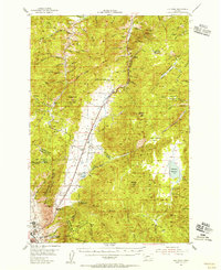
 1899 Helena1956 Print · USGSThe Montana gold country and the Continental Divide appear here at the close of the nineteenth century. Genealogists and historians can trace the mining and rail networks connecting Helena and Butte, including Pikes Peak Mill, Marysville, and Ft. Harrison.
 - 1903 Map of Helena
 1903 Helena1903 Print · USGSMontana's mining heartland comes alive at the dawn of the new century, from the state capital to the copper-rich summits above the Silver Bow. Trace the early rail lines serving Marysville, locate the historic barracks of Ft. Harrison, and follow the mountain trails through Mullan Pass.4 unique versions available
 - 1947 Map of Butte, 1949 Print
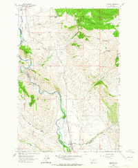
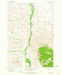
 1947 Butte1949 Print · USGSWestern Montana at the peak of its rail-and-river era shows the vital connections between the mining and industrial centers of Butte and Helena. Researchers can trace the three major railroad lines serving mountain settlements like Garrison, Philipsburg, and Warm Springs.2 unique versions available
 - 1954 Map of Elk Park, 1956 Print
 1954 Elk Park1956 Print · USGSThe high country of the Continental Divide near Butte comes into focus during the mid-fifties, showing the transition from industrial mining to the Deerlodge National Forest. Researchers can trace the Northern Pacific rail line past the Ruby Mine and old settlements at Woodville and McQueen.3 unique versions available
 - 1955 Map of Dillon, 1978 Print
 1955 Dillon1978 Print · USGSSouthwest Montana at the dawn of the interstate era reveals a landscape of high-mountain ranching and historic mining camps. Trace the routes of the Union Pacific through Dillon and Armstead, or locate early settlements like Bannack and Wisdom.2 unique versions available
 - 1957 Map of Dillon
 1957 Dillon1957 Print · USGSSouthwest Montana and Idaho in the mid-fifties reveal a high-country landscape of mountain ranges and ranching valleys. Genealogists can trace family holdings and rail stops along the Union Pacific Railroad, from Dillon to historic Virginia City and Twin Bridges.
 - 1958 Map of Butte
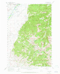
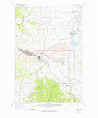
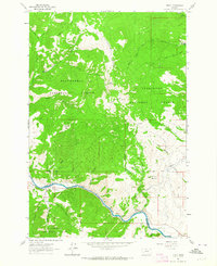
 1958 Butte1958 Print · USGSWestern Montana's mining and rail corridors are captured in the late fifties, from the urban bustle of the Copper King cities to high mountain passes. Researchers can trace the path of the Milwaukee St Paul and Pacific through Deer Lodge and locate remote outposts like Potomac Post Office.5 unique versions available
 - 1958 Map of Dillon
 1958 Dillon1958 Print · USGSSouthwestern Montana during the late fifties reveals a high-country landscape defined by the Continental Divide and a legacy of mountain mining. Genealogists and historians can trace rail lines like the Union Pacific or locate early industrial sites including the Hecla Mine and Ermont Mine.
 - 1958 Map of Vipond Park, 1959 Print
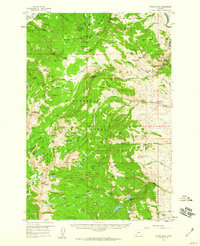 1958 Vipond Park1959 Print · USGSThe Pioneer Mountains in the late fifties reveal a high-country landscape shaped by silver and lead mining. Local historians can trace the foundations of Glendale or locate historic diggings at the Hecla Mines and Old Faithful Mine.3 unique versions available
 - 1959 Map of Butte North, 1961 Print
 1959 Butte North1961 Print · USGSSilver Bow County in the late fifties was the heart of the American copper industry, dominated by the massive mining operations around Butte. Researchers can trace the rail lines of the Northern Pacific and locate historic mining sites like the Butte Pacific Mine or the emerging Berkeley Pit.3 unique versions available
 - 1960 Map of Butte
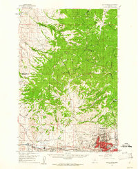
 1960 Butte1960 Print · USGSWestern Montana at the dawn of the sixties is defined by its industrial mining hubs and the railroads that connect them. Genealogists and historians can trace the routes of the Milwaukee Road through Butte or locate smaller settlements like Southern Cross and Bearmouth.
 - 1960 Map of Twin Bridges, 1963 Print
 1960 Twin Bridges1963 Print · USGSMadison County in the early sixties shows a landscape defined by the meeting of four major rivers and the legacy of the mining boom. Genealogists and historians can trace family-named sites like Pogliano Ranch, the Pageville Sch, and dozens of lode mines including the Shamrock Mine.3 unique versions available
 - 1960 Map of Waterloo, 1964 Print
 1960 Waterloo1964 Print · USGSMadison and Silver Bow counties in the early sixties reveal a landscape shaped by high-country ranching and mining. Researchers can trace the water rights and early settlements of the Jefferson valley, including Waterloo, Mammoth, and the Silver Bow Ranch.2 unique versions available
 - 1961 Map of Melrose, 1964 Print
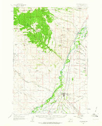
 1961 Melrose1964 Print · USGSSilver Bow County during the early sixties centers on the railroad-dependent settlement of Melrose and its rugged mining outskirts. Researchers can trace the industrial footprint of the Old Glory Mine or follow water rights along the McCauley Ditch.4 unique versions available
 - 1961 Map of Burnt Mountain, 1964 Print
 1961 Burnt Mountain1964 Print · USGSThe Montana high country along the Continental Divide is captured here in the early sixties, showing the intersection of two national forests. Genealogists and historians can locate isolated homesteads like Scuichetti Place, the Ajax Cabin, and the High Rye Guard Station.
 - 1961 Map of Dickie Peak, 1964 Print
 1961 Dickie Peak1964 Print · USGSSilver Bow County high country is shown here in the early sixties, split by the Continental Divide and county boundaries. Genealogists and historians can trace remote activity at French Town, the Hungry Hill Mine, and Johnson Park.2 unique versions available
 - 1961 Map of Earls Gulch, 1964 Print
 1961 Earls Gulch1964 Print · USGSThe ranching and mining landscapes of Beaverhead and Madison Counties are captured here in the early sixties as the river-and-rail economy thrived. Genealogists can locate family holdings like Kalsta Ranch and McCullough Ranch or trace industrial sites like the Tungsten Mill.5 unique versions available
 - 1961 Map of Anaconda, 1964 Print
 1961 Anaconda1964 Print · USGSThe Deer Lodge Valley in the early 1960s was a hub of smelting industry and state institutions. Trace the industrial footprint of the Anaconda Smelter and find local landmarks like Gregson Hot Springs and the State Hospital at Warm Springs.
 - 1961 Map of Wickiup Creek, 1964 Print
 1961 Wickiup Creek1964 Print · USGSThe Silver Bow and Madison County line was a landscape of high-altitude mineral exploration in the early sixties. Researchers can trace historic extraction efforts through numerous Mines and Prospects near King and Queen Hill and Moffet Mountain.2 unique versions available
 - 1961 Map of Butte South, 1964 Print
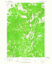
 1961 Butte South1964 Print · USGSThe industrial outskirts of Butte meet the high timber of the Continental Divide in the early 1960s. Genealogists can locate several major cemeteries like Holy Cross Cem and Mountain View Cem, while researchers can trace rail lines to Feeley and the old Moose Town (Site).2 unique versions available
 - 1961 Map of Dewey, 1964 Print
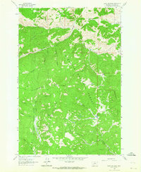
 1961 Dewey1964 Print · USGSThe Big Hole River valley comes alive in the early sixties, showing the vital infrastructure of Dewey and its mountain surroundings. Trace the remnants of the Old Grade Railroad or locate family sites like Dewey Cem and Mitchell Park.3 unique versions available
Showing maps 1-25 of 226
Top cities near Butte
Top neighborhoods of Butte
- Rocker historical maps
- Sciuchetti Place historical maps
- Williamsburg historical maps
- Grace historical maps
- Nine-mile historical maps
- Janney historical maps
See more
Frequently asked questions
- What are the different types of historical maps available for Butte?
- What is the oldest map of Butte?
- Where can I purchase historical maps of Butte for my home or office?
- Where can I download high-res historical maps of Butte?
- Are there historical topographic maps available for Butte?
- Is there historical aerial imagery available for Butte?
- Where are historical maps of Butte sourced from?