1990s Maps of Butte, Montana
Explore 29 historic maps of Butte from the 1990s. These maps offer a rare glimpse into what life looked like during the 1990s — showing old roads, neighborhoods, homes, and landmarks that have changed or disappeared over time.
Whether you're researching your family's past, planning a metal detecting trip, or studying how Butte's landscape evolved across the 1990s, these high-resolution maps are a powerful tool for exploring the history of this region.
- Focus on a specific era: All maps on this page are from the 1990s, giving you a focused view of this time period.
- See what’s changed: Compare century-old streets, trails, and buildings to today's modern landscape using overlays and satellite layers.
- Research with precision: Use these maps for genealogy, historical research, land use analysis, or educational projects.
- View, download, or print: Maps are fully viewable online in high resolution, and can be downloaded or printed for your own records.
Start exploring Butte's history through authentic maps from the 1990s. This is your window into the past.
Butte, MT maps
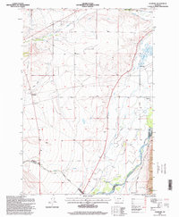
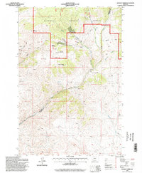
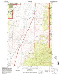
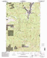
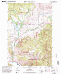
(29)- 1994 Map of Butte North
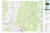 1994 Butte North1994 Print · USGSWestern Montana in the nineties was a landscape defined by ranching legacy and high-altitude mining. Genealogists and historians can trace institutional history at the Deer Lodge Prison Farm or locate old claims like the Saratoga Mine and Morning Glory Mine.
 - 1994 Map of Wisdom
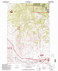
 1994 Wisdom1994 Print · USGSThe high mountain valleys of Southwest Montana and East Idaho come alive in the mid-1990s as the Big Hole River meanders toward the Continental Divide. Trace the grounds of the Big Hole National Battlefield or locate remote settlements like Wisdom and Gibbonsville.2 unique versions available
 - 1996 Map of Grace, 1998 Print
 1996 Grace1998 Print · USGSJefferson and Silver Bow Counties come together in the late nineties amidst the high peaks of the Deerlodge National Forest. Researchers can trace the small settlements at Grace and Cedric or locate several Quarry and Prospect sites near Little Pipestone Creek.
 - 1996 Map of Mount Humbug, 1998 Print
 1996 Mount Humbug1998 Print · USGSThe Silver Bow and Madison county line crosses the Continental Divide during the mid-1990s, revealing a landscape shaped by mining and water management. Trace local history through the mining sites near Moose Town and landmarks like Mount Humbug and Gold Hill.
 - 1996 Map of Orofino Mountain, 1998 Print
 1996 Orofino Mountain1998 Print · USGSDeer Lodge and Silver Bow counties meet along this mountainous divide during the late twentieth century, showing a landscape defined by industry and elevation. Miners and genealogists can trace decades of exploration through the Butte Pacific Mine and numerous prospects near Orofino Mountain.
 - 1996 Map of Anaconda South, 1998 Print
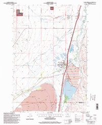
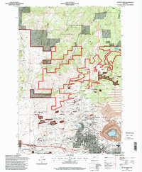
 1996 Anaconda South1998 Print · USGSAnaconda sits at the edge of Montana's high country in the mid-1990s, where smelting history meets the Continental Divide. Trace the transition from town landmarks like the Lincoln School to the wild terrain of the Mount Haggin State Wildlife Management Area and Sugarloaf Mountain.
 - 1996 Map of Burnt Mountain, 1998 Print
 1996 Burnt Mountain1998 Print · USGSThe Continental Divide and the high-elevation forests of Silver Bow County are captured here in the mid-1990s. Trace the boundaries of the High Rye Work Center and follow the ridgelines from Burnt Mountain through the DEERLODGE NATIONAL FOREST.
 - 1996 Map of Warm Springs, 1998 Print
 1996 Warm Springs1998 Print · USGSDeer Lodge County in the mid-1990s showcases a transition between industrial processing and state-run institutional campuses. Researchers can trace the grounds of the Montana State Hospital Warm Springs Campus and identify land features like the Anaconda Airport and the waters of Modesty Creek.
 - 1996 Map of Vendome, 1998 Print
 1996 Vendome1998 Print · USGSThe Jefferson River valley in the mid-1990s reveals a landscape of ranching and complex irrigation. Genealogists and local historians can trace the irrigation networks of Parrot Ditch or locate the Fish Creek Cem and settlements like Piedmont and Vendome.
 - 1996 Map of Homestake, 1998 Print
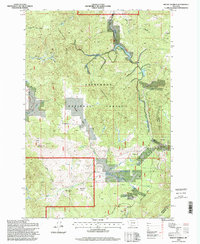
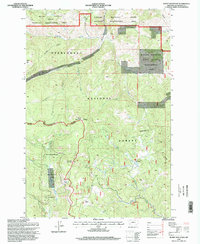
 1996 Homestake1998 Print · USGSThe high mountain passes above Butte come into focus in the mid-nineties as urban neighborhoods met the wilderness of the Deerlodge National Forest. Genealogists and local historians can locate the Holy Cross Cemetery, the remote Mc Allister Ranch, and the mountain settlement of Homestake.
 - 1996 Map of Opportunity, 1998 Print
 1996 Opportunity1998 Print · USGSNear the boundary of Silver Bow and Deer Lodge counties in the 1990s, this area reflects a mix of mountain wilderness and roadside settlements. Researchers can trace the layout of Fairmont Hot Springs Resort and the tracks through Crackerville, Stuart, and Gregson.
 - 1996 Map of Table Mountain, 1998 Print
 1996 Table Mountain1998 Print · USGSThe Highland Mountains of Madison County are mapped here in the late twentieth century, showing a landscape defined by mining history and forest management. Researchers can locate the Big Bonanza Mine, trace the remote Hell Canyon Ranger Cabin, or find family-named points like Dougherty Butte.
 - 1996 Map of Wickiup Creek, 1998 Print
 1996 Wickiup Creek1998 Print · USGSThe high Montana backcountry along the Silver Bow and Madison county line appears in the mid-1990s as a landscape of active and historic mining. Mineral seekers can trace dozens of prospects and mines near Negro Mountain and Soap Gulch.
 - 1996 Map of Waterloo, 1998 Print
 1996 Waterloo1998 Print · USGSThe Waterloo area of Madison County appears here in the 1990s, where the river valley meets the forest edge. Researchers can trace irrigation networks like Parrot Ditch and mining sites such as Strawn Mine or Silver Bow Ranch.
 - 1996 Map of Elk Park Pass, 1998 Print
 1996 Elk Park Pass1998 Print · USGSThe Continental Divide and the high slopes of Rampart Mountain overlook the mining and forest lands of Jefferson County in the late nineties. Researchers can trace the industrial footprint of numerous Mine Dumps and Prospects near the Our Lady of the Rockies monument.
 - 1996 Map of Butte North, 1998 Print
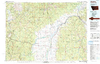
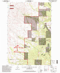
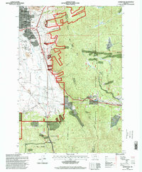
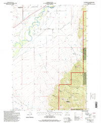
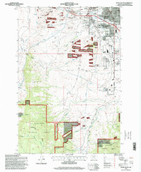
 1996 Butte North1998 Print · USGSThe mining landscape of Butte is shown in the late twentieth century as the massive Berkeley Pit and Strip Mine reshape the area. Genealogists and historians can locate heritage sites like Walkerville, Centerville, and the tragic Granite Mountain Mine.
 - 1996 Map of Tucker Creek, 1998 Print
 1996 Tucker Creek1998 Print · USGSThe Silver Bow high country is shown here in the mid-1990s, where public lands and wildlife management zones converge. You can locate remote outposts like the Fleecer Guard Station, trace old mining prospects in Curly Gulch, and follow the path of an early aqueduct.
 - 1996 Map of Butte South, 1998 Print
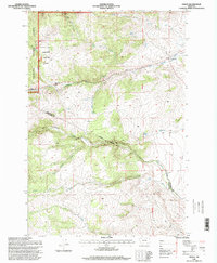
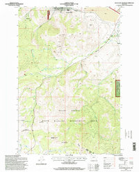
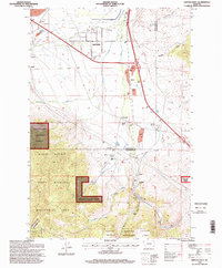
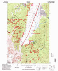
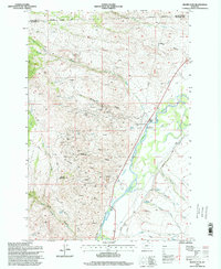
 1996 Butte South1998 Print · USGSSilver Bow County in the late nineties shows the enduring urban and industrial character of Butte as it stretches toward the Deerlodge National Forest. Genealogists can locate family sites across several memorial grounds like Holy Cross Cemetery or trace the development around the Bert Mooney Airport.
 - 1996 Map of Silver Star, 1998 Print
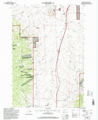
 1996 Silver Star1998 Print · USGSSilver Star and the Jefferson River valley are shown in the late twentieth century, when high-altitude mining still shaped the Madison County landscape. Metal detectorists and local historians can trace numerous workings like the Keystone and Stella mines or locate the old Cemetery and Ironrod Bridge.
 - 1996 Map of Pipestone Pass, 1998 Print
 1996 Pipestone Pass1998 Print · USGSThe high country of the Continental Divide in the late twentieth century reveals a transition from mining to recreation. Researchers can trace historic industrial footprints at Donald, various prospect pits, and the Highland Lookout atop the mountains.
 - 1996 Map of Lockhart Meadows, 1998 Print
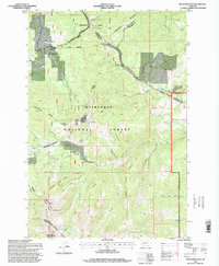
 1996 Lockhart Meadows1998 Print · USGSThe high peaks of the Continental Divide dominate this mid-nineties survey of the Deer Lodge National Forest. Researchers can trace old mining sites like the Champion Mine or follow the path of the Continental Divide National Scenic Trail through the backcountry.
 - 1996 Map of Ramsay, 1998 Print
 1996 Ramsay1998 Print · USGSSilver Bow County in the late 1990s displays a rugged intersection of mountain wilderness and industrial activity. Genealogists and historians can trace the footprint of mining operations at the Butte and Zenith Mine or locate early community hubs like Ramsay and Nissler.
 - 1996 Map of Buxton, 1998 Print
 1996 Buxton1998 Print · USGSThe high country of Silver Bow County meets industrial history in the late nineties, showcasing the rugged terrain of Deer Lodge National Forest. Trace family roots and old land ties near Buxton and Feely, or locate historic Prospect sites and mining Tailings.
 - 1997 Map of Melrose, 2002 Print
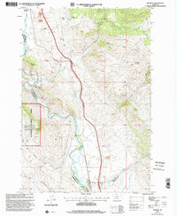 1997 Melrose2002 Print · USGSThe high country surrounding Melrose in the late nineties was a landscape shaped by river irrigation and hard-rock mining. Genealogists and researchers can trace local landmarks like the Melrose Cem and historic workings at the Old Glory Mine or Maiden Rock Mine.
 - 1997 Map of Lincoln Gulch, 2002 Print
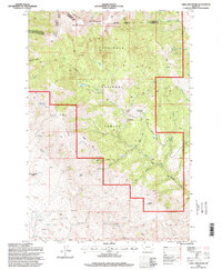
 1997 Lincoln Gulch2002 Print · USGSThe high mountain ranches of Deer Lodge County remained active in the late nineties, positioned where the forest meets the valley floor. Genealogists and historians can locate legacy properties like Rousch Ranch or Johnson Ranch and trace drainages from Lincoln Gulch to the Big Hole River.
Showing maps 1-25 of 29
Top cities near Butte
Top neighborhoods of Butte
- Rocker historical maps
- Sciuchetti Place historical maps
- Williamsburg historical maps
- Grace historical maps
- Nine-mile historical maps
- Janney historical maps
See more
Frequently asked questions
- What are the different types of historical maps available for Butte?
- What is the oldest map of Butte?
- Where can I purchase historical maps of Butte for my home or office?
- Where can I download high-res historical maps of Butte?
- Are there historical topographic maps available for Butte?
- Is there historical aerial imagery available for Butte?
- Where are historical maps of Butte sourced from?