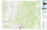
1994 Map of Butte North
USGS Topo · Published 1994About this map
The Grant-Kohrs Ranch National Historical Site and the extensive Deer Lodge Prison Farm anchor the northern reaches of this Montana landscape. In the mid-1990s, the region demonstrates a dense overlay of institutional and industrial activity, from the Warm Springs State Hospital complex in the west to the numerous mining claims dotting the Helena National Forest. The map traces the corridor of the Burlington Northern railroad as it connects major centers like Butte and Deer Lodge, passing through smaller settlements such as Opportunity, Galen, and Rocker. High-elevation mining remains a defining characteristic of the terrain, with names like the Saratoga Mine, Free Enterprise Mine, and Morning Glory Mine appearing across the slopes of Bison Mountain and Sugarloaf Mountain. This detailed survey also captures specialized land uses, including the Warm Springs State Wildlife Management Area and Boulder Hot Springs.
Find a feature on this map
205 named features on this map. Tap any name to fly to it.
Don’t see what you’re looking for? This feature index may not catch every label — zoom into the map to look around manually.
Map Details
Editions of this 1994 Butte North Map
This is the sole edition of this map. No revisions or reprints were ever made.
Other maps of this area

1886 · Fort Logan
USGS Topo · 1:250,000

1888 · Three Forks
USGS Topo · 1:250,000

1889 · Helena
USGS Topo · 1:250,000

1893 · Helena
USGS Topo · 1:250,000

1893 · Dillon
USGS Topo · 1:250,000

1894 · Three Forks
USGS Topo · 1:250,000

1895 · Three Forks
USGS Topo · 1:250,000

1899 · Boulder
USGS Topo · 1:125,000

1899 · Helena
USGS Topo · 1:62,500

1899 · Helena
USGS Topo · 1:250,000