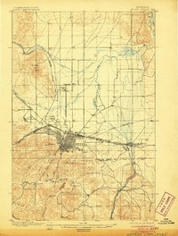
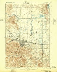
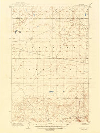
1899 Map of Helena
USGS Topo · Published 1899About this map
Helena stands at a pivotal intersection of early Montana industry and transit, where the Northern Pacific R. R. and the Montana Central R. R. meet at the foot of Mt Helena. This late-19th-century landscape is defined by its mining heritage, from the Sapphire Placers in the north to the Winscott Mine and Bonanza Chief Mine tucked into the southern gulches. While the urban grid of the capital is firmly established, nearby outposts like Broadwater, Kenwood, and Unionville maintain distinct identities tied to local springs and mineral wealth. To the west, Fort Harrison anchors the military presence, while the northern reaches transition into the sprawling drainage of Prickly Pear Creek. The map meticulously details the rugged transition between the valley floor and the surrounding peaks, including Mt Ascension and Skihi Pk.
Find a feature on this map
43 named features on this map. Tap any name to fly to it.
Don’t see what you’re looking for? This feature index may not catch every label — zoom into the map to look around manually.
Map Details
Editions of this 1899 Helena Map
3 editions found