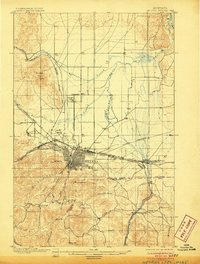
1899 Map of Helena Special
USGS Topo · Published 1906About this map
Helena stands as the primary hub of this late-Victorian era survey, showing a dense urban grid surrounded by a landscape defined by mining and early education. To the north, the University and a nearby Cemetery mark the edge of the city, while the southern terrain is carved by gold and silver exploration. Placer mining is evident along the Missouri River at the Sapphire Placers, and lode mining is represented by the Winscott Mine and Bonanza Chief Mine.
Find a feature on this map
45 named features on this map. Tap any name to fly to it.
Don’t see what you’re looking for? This feature index may not catch every label — zoom into the map to look around manually.
Map Details
Editions of this 1899 Helena Special Map
3 editions found
Other maps of this area

1886 · Fort Logan
USGS Topo · 1:250,000

1889 · Helena
USGS Topo · 1:250,000

1893 · Helena
USGS Topo · 1:250,000

1899 · Boulder
USGS Topo · 1:125,000

1899 · Helena
USGS Topo · 1:62,500

1899 · Helena
USGS Topo · 1:250,000

1903 · Helena
USGS Topo · 1:250,000

1947 · Butte
USGS Topo · 1:250,000

1948 · White Sulphur Springs
USGS Topo · 1:250,000

1950 · Jefferson City
USGS Topo · 1:62,500