
1950 Map of East Helena
USGS Topo · Published 1954About this map
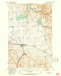
Prickly Pear Creek winds through a valley defined by the early industrial and agricultural development of central Montana. The landscape is marked by the presence of the Northern Pacific and Great Northern railroads, which facilitated the growth of settlements like East Helena and Montana City. The area's mining history is evident in the foothills of the Helena National Forest, where the Economy Mine and Chicago Mine are located alongside numerous gulches such as Mitchell Gulch and Spokane Creek. Water management for the Missouri River Basin is a central theme, shown through the expansive Hauser Lake and Lake Helena, as well as the McClellan Creek Reservoir. Local community life is documented through scattered rural schools like Harmony School and the Spokane Creek School, as well as the St Anns Cem and the prominent Masonic Home.
Find a feature on this map
55 named features on this map. Tap any name to fly to it.
Don’t see what you’re looking for? This feature index may not catch every label — zoom into the map to look around manually.
Map Details
Editions of this 1950 East Helena Map
4 editions found
Other maps of this area

1886 · Fort Logan
USGS Topo · 1:250,000

1889 · Helena
USGS Topo · 1:250,000

1893 · Helena
USGS Topo · 1:250,000

1899 · Boulder
USGS Topo · 1:125,000

1899 · Helena
USGS Topo · 1:62,500

1899 · Helena
USGS Topo · 1:250,000

1903 · Helena
USGS Topo · 1:250,000

1947 · Butte
USGS Topo · 1:250,000

1948 · White Sulphur Springs
USGS Topo · 1:250,000

1950 · Jefferson City
USGS Topo · 1:62,500