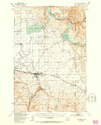
1950 Map of East Helena
USGS Topo · Published 1954About this map
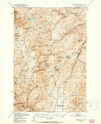
East Helena serves as the industrial and transportation hub of this mid-century landscape, where the Northern Pacific and Great Northern railroads converge. The map documents a complex irrigation and water management network, featuring a system of flumes and ditches alongside the Prickly Pear Creek valley. To the north, the waters of Lake Helena and Hauser Lake dominate the terrain, with the Missouri River cutting through Eldorado Bar.
Find a feature on this map
45 named features on this map. Tap any name to fly to it.
Don’t see what you’re looking for? This feature index may not catch every label — zoom into the map to look around manually.
Map Details
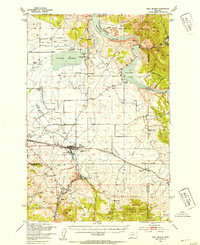
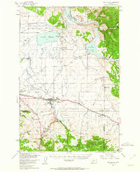
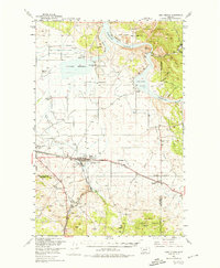
Editions of this 1950 East Helena Map
4 editions found
Other maps of this area

1886 · Fort Logan
USGS Topo · 1:250,000

1889 · Helena
USGS Topo · 1:250,000

1893 · Helena
USGS Topo · 1:250,000

1899 · Boulder
USGS Topo · 1:125,000

1899 · Helena
USGS Topo · 1:62,500

1899 · Helena
USGS Topo · 1:250,000

1903 · Helena
USGS Topo · 1:250,000

1947 · Butte
USGS Topo · 1:250,000

1948 · White Sulphur Springs
USGS Topo · 1:250,000
1950 · Jefferson City
USGS Topo · 1:62,500