Old Maps of Target Range, Missoula County for Genealogy
Trace your family roots with 13 historic maps of Target Range. These high-res maps reveal old neighborhoods, homesites, landmarks, and streets — helping you uncover where your ancestors lived and how the area evolved over time.
- Explore historic neighborhoods: Identify where your relatives may have lived in the 1800s or 1900s.
- Compare maps over time: Trace the changes in streets, buildings, and landmarks for multi-generational research.
- Perfect for genealogy & ancestry research: Used by family historians and researchers to map out lineage and migration.
These maps are an incredible resource for exploring your personal connection to Target Range's past.
Target Range, Missoula County maps
(13)- 1912 Map of Missoula
 1912 Missoula1912 Print · USGSWestern Montana at the end of the frontier era shows a landscape of growing rail hubs and remote mountain outposts. Researchers can trace early river crossings like Alberts Ferry, the grounds of Ft Missoula, and vanished schools such as Big Flat School.4 unique versions available
 - 1956 Map of Hamilton, 1970 Print
 1956 Hamilton1970 Print · USGSThe Bitterroot Valley and surrounding high country are captured here during the mid-fifties, showing the region's transition into a modern forest-and-rail hub. Genealogists and historians can trace family-named sites and early infrastructure from Fort Missoula to towns like Stevensville and Darby along the Northern Pacific line.2 unique versions available
 - 1959 Map of Hamilton
 1959 Hamilton1959 Print · USGSThe Bitterroot Valley and surrounding wilderness are captured in the late fifties, showing a landscape defined by forestry and river-based settlement. Researchers can trace the Lolo Trail or locate historical points like Fort Missoula and the Fred Burr Reservoir.
 - 1960 Map of Hamilton
 1960 Hamilton1960 Print · USGSThe Bitterroot Valley and surrounding high country are captured here during the late fifties, showing the region's transition into a modern forest and rail corridor. Researchers can trace the path of the Northern Pacific through Missoula or locate landmarks like Fort Missoula and Lake Como.
 - 1964 Map of Hamilton
 1964 Hamilton1964 Print · USGSThe Bitterroot Valley and its surrounding peaks are captured in detail during the mid-1960s, showing the early infrastructure of the Northern Rockies. Genealogists and historians can trace family roots in Hamilton and Stevensville or follow the historic Lolo Trail and Nez Perce Trail.
 - 1964 Map of Southwest Missoula, 1967 Print
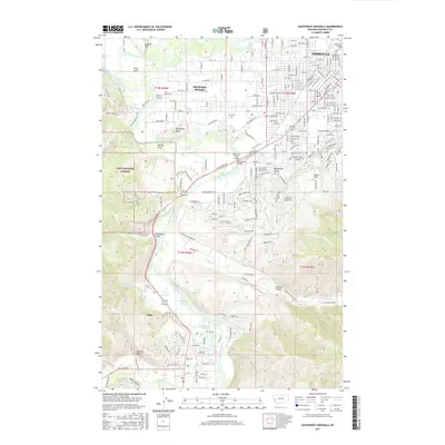
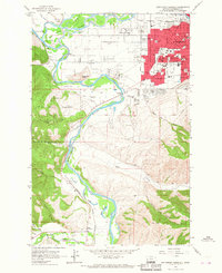 1964 Southwest Missoula1967 Print · USGSMissoula and the Bitterroot Valley are captured here in the mid-sixties, showing a city expanding into its orchard lands and river flats. Researchers can trace the grounds of Fort Missoula, numerous neighborhood schools, and local landmarks like the Maclay Bridge.2 unique versions available
 - 1981 Map of Missoula West
 1981 Missoula West1981 Print · USGSThe Bitterroot Valley and the rugged Bitterroot Range are captured here in the early 1980s, documenting the expansion of Missoula and its outlying timber and river towns. Researchers can trace the Burlington Northern rail corridors or locate remote landmarks like Lolo Hot Springs and Lolo Pass.2 unique versions available
 - 1999 Map of Southwest Missoula, 2003 Print
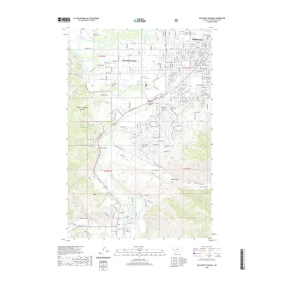
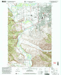 1999 Southwest Missoula2003 Print · USGSMissoula and the Bitterroot Valley are shown here in the late 1990s as the city expanded toward its forested western slopes. Researchers can trace historic routes like the Lewis and Clark Historic Trail or locate landmarks such as Fort Missoula and Maclay Bridge.
 - 2011 Map of Southwest Missoula, 2011 Print
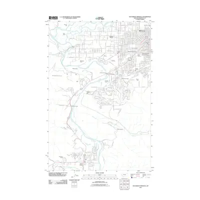 2011 Southwest Missoula2011 Print · USGSCovers Target Range, including Missoula, Lolo, and other nearby areas
 - 2014 Map of Southwest Missoula, 2014 Print
 2014 Southwest Missoula2014 Print · USGSCovers Target Range, including Missoula, Lolo, and other nearby areas
 - 2017 Map of Southwest Missoula, 2017 Print
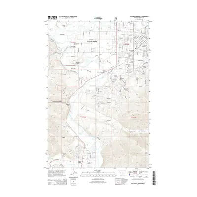
 2017 Southwest Missoula2017 Print · USGSCovers Target Range, including Missoula, Lolo, and other nearby areas
 - 2020 Map of Southwest Missoula, 2020 Print
 2020 Southwest Missoula2020 Print · USGSCovers Target Range, including Missoula, Lolo, and other nearby areas
 - 2024 Map of Southwest Missoula, 2024 Print
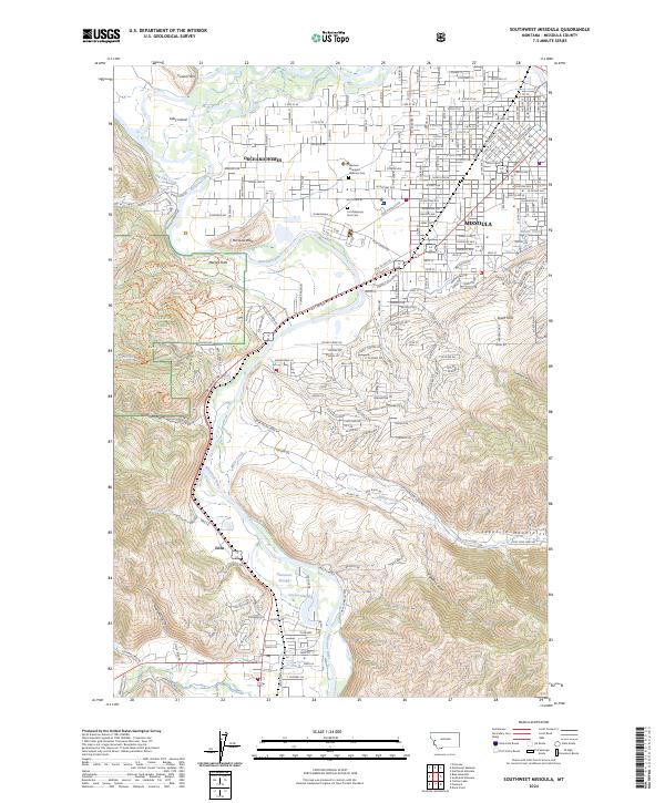 2024 Southwest Missoula2024 Print · USGSMissoula and the Bitterroot Valley are shown in the 2020s as the urban edge meets the timberlands of the Lolo National Forest. Researchers can trace the development of the South Hills and Lolo or locate civic landmarks like the Western Montana Veterans Cem.
End of results
Showing maps 1-13 of 13
Frequently asked questions
- What are the different types of historical maps available for Target Range?
- What is the oldest map of Target Range?
- Where can I purchase historical maps of Target Range for my home or office?
- Where can I download high-res historical maps of Target Range?
- Are there historical topographic maps available for Target Range?
- Is there historical aerial imagery available for Target Range?
- Where are historical maps of Target Range sourced from?