Old Maps of McCloud, Montana for Genealogy
Trace your family roots with 10 historic maps of McCloud. These high-res maps reveal old neighborhoods, homesites, landmarks, and streets — helping you uncover where your ancestors lived and how the area evolved over time.
- Explore historic neighborhoods: Identify where your relatives may have lived in the 1800s or 1900s.
- Compare maps over time: Trace the changes in streets, buildings, and landmarks for multi-generational research.
- Perfect for genealogy & ancestry research: Used by family historians and researchers to map out lineage and migration.
These maps are an incredible resource for exploring your personal connection to McCloud's past.
McCloud, MT maps
(10)- 1953 Map of Miles City, 1966 Print
 1953 Miles City1966 Print · USGSEastern Montana and the North Dakota borderlands come alive in this mid-century survey of the Yellowstone River valley. Genealogists and historians can trace the rural network of the era through sites like Fertile Prairie School, St Johns Church, and the rail lines serving Ismay and Plevna.4 unique versions available
 - 1957 Map of Miles City
 1957 Miles City1957 Print · USGSEastern Montana and the North Dakota borderlands come alive in the mid-fifties as the rail and ranching economy peaks along the Yellowstone River. Genealogists and historians can trace numerous rural landmarks like St Phillips Church, Fertile Prairie School, and the Ostendorf Ranch.
 - 1958 Map of Miles City
 1958 Miles City1958 Print · USGSEastern Montana ranching and rail life are documented here during the late fifties, centered on the confluence of the Yellowstone River and Powder River. Researchers can trace rural school locations like St Phillips Church and Chimney Creek School alongside dozens of named family ranches.
 - 1972 Map of Mc Cloud, 1975 Print
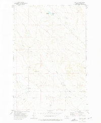 1972 Mc Cloud1975 Print · USGSPrairie County ranching country is captured in the early 1970s, showing a landscape defined by intermittent water and high-plains landmarks. Researchers can trace the drainage of Plenty Creek and locate sites like the Homestead Reservoir and Mc Cloud.
 - 1980 Map of Terry, 1981 Print
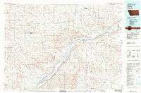 1980 Terry1981 Print · USGSEastern Montana's rail and river networks are preserved here as they appeared in the early eighties. Genealogists and historians can trace the paths of two major railroads through Terry and Kinsey or locate family landmarks near Broadview Bench and Eagle Butte.
 - 2011 Map of McCloud, 2011 Print
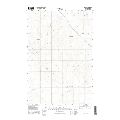
 2011 McCloud2011 Print · USGSCovers McCloud, including Prairie County, United States, and other nearby areas
 - 2014 Map of McCloud, 2014 Print
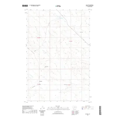
 2014 McCloud2014 Print · USGSCovers McCloud, including Prairie County, United States, and other nearby areas
 - 2017 Map of McCloud, 2017 Print
 2017 McCloud2017 Print · USGSCovers McCloud, including Prairie County, United States, and other nearby areas
 - 2020 Map of McCloud, 2020 Print
 2020 McCloud2020 Print · USGSCovers McCloud, including Prairie County, United States, and other nearby areas
 - 2024 Map of McCloud, 2024 Print
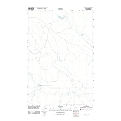
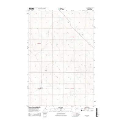
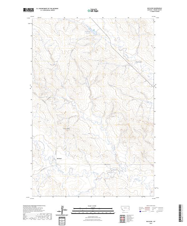 2024 McCloud2024 Print · USGSPrairie County ranching country is mapped here in the early twenty-first century. Researchers can trace the junction of Bowgun Rd and Cherry Creek Rd near the McCloud settlement or locate family landmarks like Bowgun Butte and Smith Coulee.
End of results
Showing maps 1-10 of 10
Frequently asked questions
- What are the different types of historical maps available for McCloud?
- What is the oldest map of McCloud?
- Where can I purchase historical maps of McCloud for my home or office?
- Where can I download high-res historical maps of McCloud?
- Are there historical topographic maps available for McCloud?
- Is there historical aerial imagery available for McCloud?
- Where are historical maps of McCloud sourced from?