Old Maps of Noxon, Montana
Explore 13 old maps of Noxon, spanning from 1932 to today. These high-resolution historic maps reveal how streets, neighborhoods, landmarks, and natural features evolved over time — perfect for genealogy, metal detecting, research, and local history exploration.
What you can do with these maps:
- See how Noxon changed over time: Compare historical maps to modern-day views to trace roads, homesites, rail lines & more.
- View detailed metadata: Each map includes creators, publishers, year, scale, and archive source.
- Overlay maps with satellite & LiDAR: Visualize the past alongside modern tools to explore terrain & human change.
- Trusted historical sources: Maps sourced from the USGS, Library of Congress, and other archives.
- Access maps your way: View online, download high-res files, or order prints for personal or research use.
Start exploring old maps of Noxon to uncover forgotten places, hidden landmarks, and the deep history beneath your feet.
Noxon, MT maps
(13)- 1932 Map of Trout Creek, 1955 Print
 1932 Trout Creek1955 Print · USGSThe Clark Fork River corridor in the 1930s shows a landscape of mountain rail travel and early forest management. Genealogists and historians can locate rural schools like Ayers School, local industry at Tuscor Mill, and old mining sites such as the Jack White Mine.
 - 1935 Map of Trout Creek, 1949 Print
 1935 Trout Creek1949 Print · USGSThe Clark Fork valley and the mining districts of Shoshone County are caught in high detail in the 1930s. Genealogists and historians can trace rail-side schools like Tuscor Sch, the operations at Jack Waite Mine, and old settlements from Noxon to Mace.
 - 1936 Map of Trout Creek
 1936 Trout Creek1936 Print · USGSThe Clark Fork valley and the Bitterroot mountains are captured here in the mid-1930s, showing a landscape defined by timber and mining. Researchers can trace the industrial footprint of the Tuscor Mill, remote operations like the Jack Waite Mine, and old mountain schools such as Flat Sch.2 unique versions available
 - 1956 Map of Wallace, 1966 Print
 1956 Wallace1966 Print · USGSWestern Montana and the Idaho panhandle meet in this mid-century survey of the Bitterroot and Cabinet Mountains. Genealogists and historians can trace the rail-and-river economy through the Northern Pacific line and settlements like Thompson Falls or St. Ignatius.3 unique versions available
 - 1960 Map of Wallace
 1960 Wallace1960 Print · USGSNorthwestern Montana and the Idaho panhandle are captured in the late fifties, showing the vast Flathead Indian Reservation and the mining districts of the Bitterroot Range. Researchers can trace the rail lines of the Northern Pacific or locate early sites like the Morning Mine and the National Bison Range.
 - 1966 Map of Noxon, 1971 Print
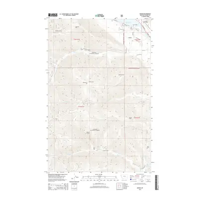
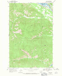 1966 Noxon1971 Print · USGSThe riverfront settlement of Noxon is captured in the mid-1960s, just as the Cabinet Gorge Reservoir had reshaped the local valley. Researchers can trace historic mountain routes including the (Pack) Trail and prominent landmarks like Hole-in-the-Wall and Stevens Peak.2 unique versions available
 - 1992 Map of Thompson Falls, 1993 Print
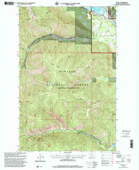
 1992 Thompson Falls1993 Print · USGSNorthwest Montana in the early nineties is defined here by the winding Clark Fork and its major impoundments. Researchers can trace the river-valley settlements of Noxon, Trout Creek, and Thompson Falls or locate mining sites like the Copper King Mine.
 - 1997 Map of Noxon, 2000 Print
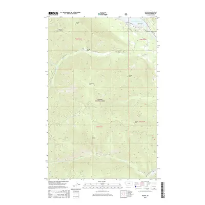
 1997 Noxon2000 Print · USGSNoxon and the Clark Fork valley are documented here in the late twentieth century, showing the intersection of river management and mountain wilderness. Researchers can trace the banks of the Cabinet Gorge Reservoir or locate high-elevation landmarks like Hole in the Wall and Loveland Peak.
 - 2011 Map of Noxon, 2011 Print
 2011 Noxon2011 Print · USGSCovers Noxon, including Sanders County, United States, and other nearby areas
 - 2014 Map of Noxon, 2014 Print
 2014 Noxon2014 Print · USGSCovers Noxon, including Sanders County, United States, and other nearby areas
 - 2017 Map of Noxon, 2017 Print
 2017 Noxon2017 Print · USGSCovers Noxon, including Sanders County, United States, and other nearby areas
 - 2020 Map of Noxon, 2020 Print
 2020 Noxon2020 Print · USGSCovers Noxon, including Sanders County, United States, and other nearby areas
 - 2024 Map of Noxon, 2024 Print
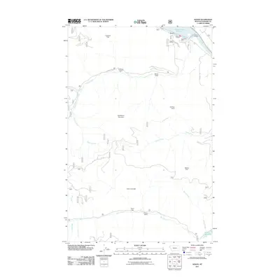
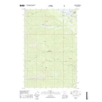
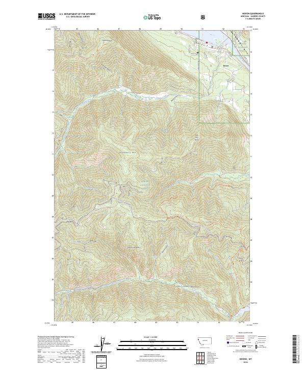 2024 Noxon2024 Print · USGSNoxon and the surrounding Kaniksu National Forest appear in fine detail in this contemporary topographic survey. Researchers can locate family sites near Noxon Cem or trace the high ridges of the Coeur d'Alene Mountains through Devil Gap and Hole-in-the-Wall.
End of results
Showing maps 1-13 of 13
Top cities near Noxon
Frequently asked questions
- What are the different types of historical maps available for Noxon?
- What is the oldest map of Noxon?
- Where can I purchase historical maps of Noxon for my home or office?
- Where can I download high-res historical maps of Noxon?
- Are there historical topographic maps available for Noxon?
- Is there historical aerial imagery available for Noxon?
- Where are historical maps of Noxon sourced from?