Old Maps of Sanders County, Montana
Explore 648 old maps of Sanders County, spanning from 1901 to today. These high-resolution historic maps reveal how streets, neighborhoods, landmarks, and natural features evolved over time — perfect for genealogy, metal detecting, research, and local history exploration.
What you can do with these maps:
- See how Sanders County changed over time: Compare historical maps to modern-day views to trace roads, homesites, rail lines & more.
- View detailed metadata: Each map includes creators, publishers, year, scale, and archive source.
- Overlay maps with satellite & LiDAR: Visualize the past alongside modern tools to explore terrain & human change.
- Trusted historical sources: Maps sourced from the USGS, Library of Congress, and other archives.
- Access maps your way: View online, download high-res files, or order prints for personal or research use.
Start exploring old maps of Sanders County to uncover forgotten places, hidden landmarks, and the deep history beneath your feet.
Sanders County, MT maps
(648)- 1901 Map of Coeur D'Alene District, 1954 Print
 1901 Coeur D'Alene District1954 Print · USGSIdaho's Silver Valley hums with industrial activity at the turn of the century as silver and lead mining reach their peak. Genealogists and historians can trace the deep-vein claims of the Bunker Hill and Sullivan Mine or the narrow-canyon settlements of Burke and Mace.
 - 1903 Map of Coeur D'Alene District
 1903 Coeur D'Alene District1903 Print · USGSThe Silver Valley was at its industrial peak at the start of the century, defined by a dense network of silver and lead operations. Genealogists and historians can trace early rail lines and major works like the Standard Mines, Gem Mine, and the town of Wardner.
 - 1906 Map of Coeur D'Alene District
 1906 Coeur D'Alene District1906 Print · USGSIdaho’s Silver Valley is shown at its industrial peak in the early twentieth century, when mines and railroads saturated these steep canyons. Genealogists and researchers can trace the rail lines to remote mining camps and famous works like the Hecla Mine, Bunker Hill and Sullivan Mines, and Burke.3 unique versions available
 - 1909 Map of Cataldo, 1954 Print
 1909 Cataldo1954 Print · USGSShoshone County was at its mining peak during the first decade of the 1900s, defined by the river-and-rail economy of the Idaho Panhandle. Genealogists can trace family roots through the silver and lead districts at Kellogg and Wardner, or find remote landmarks like Magee Ranch and the Old Mission.
 - 1911 Map of Cataldo
 1911 Cataldo1911 Print · USGSThe Idaho Panhandle's mining and timber country is documented here in the early twentieth century, showing the rail-linked settlements of the Coeur d'Alene River valley. Genealogists can trace family sites at Old Mission, Kellogg, and Magee Ranch.2 unique versions available
 - 1911 Map of Priest Lake, 1954 Print
 1911 Priest Lake1954 Print · USGSThe Idaho Panhandle during the early 1900s was a landscape of deep lakes and high-altitude mining operations connected by new rail lines. Genealogists and historians can trace pioneer settlements like Port Hill and Coolin, or locate remote industrial sites such as the Queen Mine and Mountain Chief Mine.
 - 1913 Map of Priest Lake
 1913 Priest Lake1913 Print · USGSThe Idaho Panhandle was a rugged network of rail sidings and mining camps in the years before the Great War. Genealogists and historians can trace old homesteads and depots from Sandpoint up to the Continental Mine and the remote border crossing at Addie.3 unique versions available
 - 1914 Map of Avery, 1954 Print
 1914 Avery1954 Print · USGSThe Bitterroot Range was a hive of mining and rail activity when this survey was conducted. You can trace the Chicago Milwaukee and St Paul Railway route or locate early mining operations like the Snowstorm Mine and Mastodon Mine.
 - 1917 Map of Avery, 1949 Print
 1917 Avery1949 Print · USGSThe mining camps and mountain passes of the Idaho-Montana border are documented here just after the peak of the regional silver and lead boom. You can trace the path of the Milwaukee St Paul and Pacific RR or locate historic claims like the Snowstorm Mine and Monitor Mine.
 - 1918 Map of St Regis, 1946 Print
 1918 St Regis1946 Print · USGSMineral County, Montana, was a bustling corridor for mining and rail traffic during the early twentieth century. Researchers can trace the path of the Northern Pacific through St Regis or locate remote sites like the Gold Crown Mine and Gold Nugget Cabin.
 - 1919 Map of St. Regis
 1919 St. Regis1919 Print · USGSThe Montana-Idaho borderlands were a hub of mountain mining and transcontinental railroading during the early twentieth century. Genealogists and historians can locate remote settlements like DeBorgia and Henderson or trace old mining operations such as the Saltese Consolidated Mine and Gold Crown Mine.
 - 1920 Map of Flathead Lake
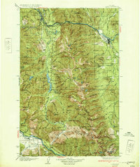
 1920 Flathead Lake1920 Print · USGSWestern Montana at the dawn of the twenties reveals a landscape being transformed by irrigation and rail. Genealogists can trace family roots in early settlements like Polson, Ronan, and Dayton, or locate landmarks such as Wild Horse I. and the Pablo Reservoir.
 - 1920 Map of Libby
 1920 Libby1920 Print · USGSNorthwest Montana in the early twentieth century shows a landscape shaped by the Great Northern RR and industrial mining. You can locate family landmarks like Morrow Ranch, the Snowstorm Mines, and early post offices at Troy and Heron.
 - 1920 Map of Jennings
 1920 Jennings1920 Print · USGSNorthwest Montana in the early twenties is captured here as a landscape of timber, rail, and isolated homesteads. Genealogists can trace family-named locations such as Corries Ranch and Deegan Ranch, or locate the site of the Mamicke P.O. near the Fisher River.
 - 1930 Map of Libby, 1960 Print
 1930 Libby1960 Print · USGSNorthwestern Montana at the opening of the 1930s is a rugged domain of mountain mining and timber camps. Genealogists and researchers can trace early settlers through labels like Old Town, Bull Lake Sch, and high-country operations such as the Snowshoe Mine.
 - 1932 Map of Libby
 1932 Libby1932 Print · USGSThe Kootenai River valley and surrounding mountain ranges are captured here in the early 1930s during the height of the region's mining and timber era. Genealogists and historians can locate remote landmarks like Old Town, the Snowshoe Mine, and early rural schools including Bull Lake Sch.3 unique versions available
 - 1932 Map of Trout Creek, 1955 Print
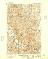
 1932 Trout Creek1955 Print · USGSThe Clark Fork River corridor in the 1930s shows a landscape of mountain rail travel and early forest management. Genealogists and historians can locate rural schools like Ayers School, local industry at Tuscor Mill, and old mining sites such as the Jack White Mine.
 - 1935 Map of Thompson Lakes
 1935 Thompson Lakes1935 Print · USGSNorthwestern Montana in the mid-thirties was a rugged domain of timber management and rail-line outposts. Researchers can trace the Great Northern Ry through Jennings or locate remote schools like the Thompson River Sch and Manicke Sch.3 unique versions available
 - 1935 Map of Trout Creek, 1949 Print
 1935 Trout Creek1949 Print · USGSThe Clark Fork valley and the mining districts of Shoshone County are caught in high detail in the 1930s. Genealogists and historians can trace rail-side schools like Tuscor Sch, the operations at Jack Waite Mine, and old settlements from Noxon to Mace.
 - 1936 Map of Trout Creek
 1936 Trout Creek1936 Print · USGSThe Clark Fork valley and the Bitterroot mountains are captured here in the mid-1930s, showing a landscape defined by timber and mining. Researchers can trace the industrial footprint of the Tuscor Mill, remote operations like the Jack Waite Mine, and old mountain schools such as Flat Sch.2 unique versions available
 - 1937 Map of Thompson Falls
 1937 Thompson Falls1937 Print · USGSThe Clark Fork river valley and the high Cabinet Mountains are documented here in the mid-1930s. Genealogists and researchers can trace the early railroad communities of Thompson Falls and Belknap or locate the Silver Butte Fisher Sch and Bend Ranger Sta.2 unique versions available
 - 1937 Map of Thompson Falls, 1949 Print
 1937 Thompson Falls1949 Print · USGSThe Clark Fork valley in the 1930s was a vital corridor defined by the Northern Pacific Line and riverside settlements. Researchers can trace early infrastructure and mountain life through the locations of the Silver Butte Fisher Sch, the Bend Ranger Sta, and the ferry at Eddy.
 - 1942 Map of Thompson Lakes
 1942 Thompson Lakes1942 Print · USGSNorthwest Montana during the early 1940s remained a landscape of timber and rail, where the Great Northern Railway hugged the banks of the Kootenai River. Researchers can trace the network of forest lookouts like Warland Pk Lookout and find early rural sites including Pleasant Valley Sch.2 unique versions available
 - 1951 Map of Clark Fork, 1952 Print
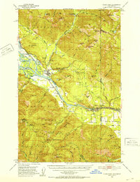 1951 Clark Fork1952 Print · USGSThe Idaho-Montana borderlands are captured here in the early 1950s just as the river valley was preparing for major hydroelectric changes. Researchers can trace the legacy of local mining at Whitedelf Mine or locate early school sites like the River Echo Sch (Aband).4 unique versions available
 - 1955 Map of Spokane, 1965 Print
 1955 Spokane1965 Print · USGSInland Empire life in the fifties and sixties centers on the growth of Spokane and the heavy mining industry of northern Idaho. Trace mid-century landmarks like Fairchild Air Force Base, the Bunker Hill Mine, and early campuses such as Gonzaga University.2 unique versions available
Showing maps 1-25 of 648
Top cities of Sanders County
- Thompson Falls historical maps
- Plains historical maps
- Hot Springs historical maps
- Trout Creek historical maps
- Noxon historical maps
- Paradise historical maps
Frequently asked questions
- What are the different types of historical maps available for Sanders County?
- What is the oldest map of Sanders County?
- Where can I purchase historical maps of Sanders County for my home or office?
- Where can I download high-res historical maps of Sanders County?
- Are there historical topographic maps available for Sanders County?
- Is there historical aerial imagery available for Sanders County?
- Where are historical maps of Sanders County sourced from?