1960s Maps of Sanders County, Montana
Explore 57 historic maps of Sanders County from the 1960s. These maps offer a rare glimpse into what life looked like during the 1960s — showing old roads, neighborhoods, homes, and landmarks that have changed or disappeared over time.
Whether you're researching your family's past, planning a metal detecting trip, or studying how Sanders County's landscape evolved across the 1960s, these high-resolution maps are a powerful tool for exploring the history of this region.
- Focus on a specific era: All maps on this page are from the 1960s, giving you a focused view of this time period.
- See what’s changed: Compare century-old streets, trails, and buildings to today's modern landscape using overlays and satellite layers.
- Research with precision: Use these maps for genealogy, historical research, land use analysis, or educational projects.
- View, download, or print: Maps are fully viewable online in high resolution, and can be downloaded or printed for your own records.
Start exploring Sanders County's history through authentic maps from the 1960s. This is your window into the past.
Sanders County, MT maps
(57)- 1960 Map of Kalispell
 1960 Kalispell1960 Print · USGSNorthwest Montana in the late fifties is defined by the mountain corridors of the Great Northern Railway and the vast reaches of Glacier National Park. Researchers can trace the legacy of timber and mining towns like Libby, Rexford, and Whitefish, or locate landmarks such as the Snowshoe Mine.
 - 1960 Map of Wallace
 1960 Wallace1960 Print · USGSNorthwestern Montana and the Idaho panhandle are captured in the late fifties, showing the vast Flathead Indian Reservation and the mining districts of the Bitterroot Range. Researchers can trace the rail lines of the Northern Pacific or locate early sites like the Morning Mine and the National Bison Range.
 - 1961 Map of Kalispell
 1961 Kalispell1961 Print · USGSNorthwestern Montana at the start of the 1960s shows a landscape of timber-driven rail towns and the sprawling wild lands of Glacier National Park. Genealogists and historians can trace the route of the Great Northern through mountain passes or locate old settlements like Fortine, Trego, and Warland.
 - 1963 Map of Sandpoint
 1963 Sandpoint1963 Print · USGSNorthern Idaho and eastern Washington are shown in the early sixties as a high-country network of timber, mining, and rail. Genealogists and historians can trace the Great Northern line through Metaline Falls, Bonners Ferry, and past the Finch Mine.
 - 1963 Map of Treasure Mountain, 1966 Print
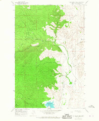
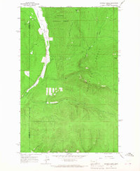
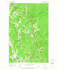 1963 Treasure Mountain1966 Print · USGSThe high alpine basins of the Cabinet Range are captured in the early sixties before modern forest management changed. Researchers can trace historic access routes like the Flower Creek Trail and locate remote landmarks such as Hanging Valley and Sky Lakes.2 unique versions available
 - 1963 Map of Crowell Mountain, 1966 Print
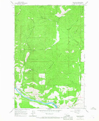
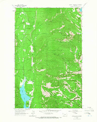 1963 Crowell Mountain1966 Print · USGSThe Cabinet Mountains wilderness of the early sixties is shown here in high detail, from the Idaho border to the shores of Bull Lake. You can locate old recreational sites like Dorr Skeels Campground and remote peaks including Doonan Peak and Crowell Mountain.3 unique versions available
 - 1964 Map of Dixon, 1966 Print
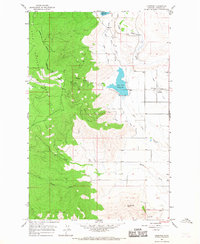
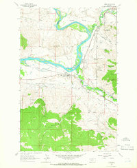 1964 Dixon1966 Print · USGSThe Flathead and Jocko rivers meet in this 1960s survey of the Sanders and Lake County line. Researchers can trace the mid-century rail-and-water economy through features like the Northern Pacific railroad, Dixon Indian Chapel, and the National Bison Range.
 - 1964 Map of Mc Donald, 1966 Print
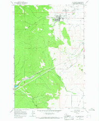
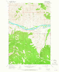 1964 Mc Donald1966 Print · USGSSanders County in the mid-1960s reveals a landscape shaped by river transport and mountain industry. Genealogists and historians can trace the Northern Pacific rail line and local industrial sites like the Green Mountain Mine and the Revais Canal.
 - 1964 Map of Melton Ranch, 1966 Print
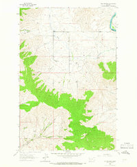 1964 Melton Ranch1966 Print · USGSSanders County ranching country comes to life in the 1960s as a network of family homesteads and valley streams. Genealogists and researchers can trace the locations of Melton Ranch, Jennings Ranch, and the winding path of the Little Bitterroot River.2 unique versions available
 - 1964 Map of Ravalli, 1966 Print
 1964 Ravalli1966 Print · USGSThe Flathead Indian Reservation in the mid-1960s showcases a landscape dedicated to conservation and early infrastructure. Researchers can trace the rail-and-water network of the Northern Pacific and Lower Jocko Canal or locate local landmarks like the Cem and Ravalli Potholes.2 unique versions available
 - 1964 Map of Meadow Peak, 1967 Print
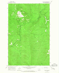
 1964 Meadow Peak1967 Print · USGSThe high timber country of Northwest Montana during the mid-sixties is captured here along the Flathead and Sanders county line. Researchers can trace historic access routes like the Bar Z Trail and locate the Lookout Tower atop Meadow Peak.2 unique versions available
 - 1964 Map of Mill Pocket Creek, 1967 Print
 1964 Mill Pocket Creek1967 Print · USGSSanders County in the mid-1960s shows a transition from the protected timber of the National Forest to the irrigated ranching lands of the Bitterroot Valley. Genealogists and researchers can locate the McKay Cem and trace the paths of the Camas Canal and Alder Creek Ditch.
 - 1964 Map of Calico Creek, 1967 Print
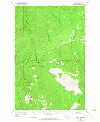
 1964 Calico Creek1967 Print · USGSThe Thompson River valley in the mid-sixties is shown here as a wilderness of timber and water. You can trace the Pack Trail through the Lolo National Forest and locate specific landmarks like Deerhorn Mountain and Big Spr.
 - 1964 Map of Eddy Mountain, 1967 Print
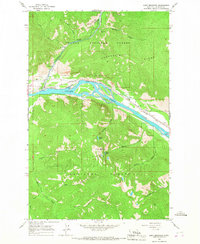 1964 Eddy Mountain1967 Print · USGSThe Clark Fork valley in Sanders County during the mid-1960s was a corridor of rail travel and mountain mining. Trace the Northern Pacific line through the settlement of Eddy or explore the mining sites near Buckeye Canyon.2 unique versions available
 - 1964 Map of Big Hole Peak, 1967 Print
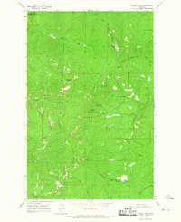
 1964 Big Hole Peak1967 Print · USGSSanders County mountains are shown in the mid-1960s as a high-elevation landscape defined by the winding corridor of the Clark Fork river. Researchers can trace the path of the Northern Pacific railroad and the remote routes of a Pack Trail leading toward Big Hole Peak.
 - 1964 Map of Priscilla Peak, 1967 Print
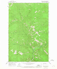 1964 Priscilla Peak1967 Print · USGSThe Lolo National Forest in the mid-1960s is shown here as a landscape of high summits and backcountry routes. Researchers can trace historic Pack Trail routes connecting Priscilla Peak to Honeymoon Lake and the West Fork Thompson River.
 - 1964 Map of Markle Pass, 1967 Print
 1964 Markle Pass1967 Print · USGSSanders County ranching and mountain terrain are captured in the mid-1960s as the landscape transitions into the Camas Prairie. Researchers can locate the Markle Cem, Oliver Gulch Sch, and the high waters of Schmitz Lakes.2 unique versions available
 - 1964 Map of Coney Peak, 1967 Print
 1964 Coney Peak1967 Print · USGSSanders County’s high timber country in the 1960s was a remote landscape defined by the Lolo National Forest and the Flathead Indian Reservation Boundary. Researchers can trace the primitive Pack Trail routes that linked water sources like Corona Lake and the Little Thompson River.
 - 1964 Map of Baldy Lake, 1967 Print
 1964 Baldy Lake1967 Print · USGSThe high forest country of Sanders County is captured in the mid-1960s, showing the intersection of federal lands and reservation boundaries. Locate the Lookout Tower on Baldy Mountain or trace the early roads near Blanchards Corner and Rainbow Lake.
 - 1964 Map of Cook Mountain, 1967 Print
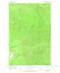 1964 Cook Mountain1967 Print · USGSThe high timberlands along the Sanders and Flathead county line were mapped in the 1960s, documenting a landscape tied to the Thompson River. Outdoorsmen and historians can trace an extensive Pack Trail network leading past Cook Mountain and through Broken Nose Gulch.
 - 1964 Map of Shroder Creek, 1967 Print
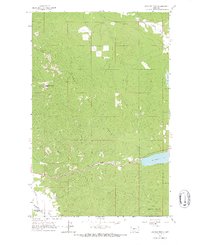
 1964 Shroder Creek1967 Print · USGSThe high timberland of Sanders and Flathead counties comes into focus in the mid-1960s, showing the meeting of two national forests. Trace the Thompson River valley and find high-elevation landmarks like Bar Z Peak and Pinehill reachable only by Pack Trail.
 - 1964 Map of Weeksville, 1967 Print
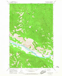
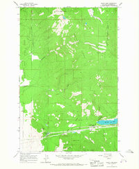
 1964 Weeksville1967 Print · USGSThe Clark Fork valley and the Thompson River confluence are captured in the mid-1960s, showing a critical Montana transit corridor. Researchers can trace the Northern Pacific rail line and locate old sites like Weeksville, The Pines, and the Gravel Pit.
 - 1964 Map of Lonepine, 1967 Print
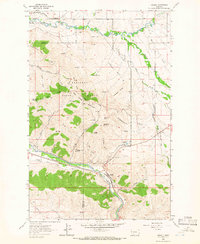
 1964 Lonepine1967 Print · USGSSanders County ranching and timber lands meet in the mid-1960s along the Flathead Indian Reservation Boundary. Researchers can locate family landmarks near Lonepine, including Murray Memorial Cem and the Community Hall.
 - 1964 Map of Hot Springs, 1967 Print
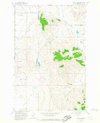
 1964 Hot Springs1967 Print · USGSHot Springs and the Camas Prairie Basin are shown in the 1960s, a period when the town's thermal character and irrigation systems were well-established. Genealogists and local historians can locate Maillet Cem, trace the length of the Camas Canal, and find early landmarks like the Hot Springs Substa.
 - 1964 Map of Bassoo Peak, 1967 Print
 1964 Bassoo Peak1967 Print · USGSThe wilderness boundary of the Flathead Indian Reservation meets two national forests in the mid-1960s. Researchers can trace remote mountain routes like the Pack Trail past Bassoo Peak, Snowstorm Mountain, and the engineered Alder Creek Ditch.
Showing maps 1-25 of 57
Top cities of Sanders County
- Thompson Falls historical maps
- Plains historical maps
- Hot Springs historical maps
- Trout Creek historical maps
- Noxon historical maps
- Paradise historical maps
Frequently asked questions
- What are the different types of historical maps available for Sanders County?
- What is the oldest map of Sanders County?
- Where can I purchase historical maps of Sanders County for my home or office?
- Where can I download high-res historical maps of Sanders County?
- Are there historical topographic maps available for Sanders County?
- Is there historical aerial imagery available for Sanders County?
- Where are historical maps of Sanders County sourced from?